Information complémentaire
| Marque | |
|---|---|
| Pays |
16.50$
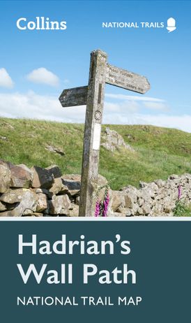
Hadrian’s Wall Path – Trail Map – Collins ISBN 9780008602987
Perfect guide and map for planning your adventure along Hadrian’s Wall.
Highlights of this Planning Map include:
Part of the National Trail network, this long-distance footpath covers 84 miles (135 km) along the line of Hadrian’s Wall from coast-to-coast. Starting in Wallsend in Newcastle and ending in Bowness-on-Solway, this path weaves through beautiful countryside, encountering historic remains of Roman forts and milecastles, and splendid bridges. A suggested walking itinerary makes it easy for users to plan their journey along this popular route.
Publication: 2023
Disponible sur commande
| Marque | |
|---|---|
| Pays |


![]() Nous sommes fermés le lundi de Pâques!
Nous sommes fermés le lundi de Pâques! ![]()