Information complémentaire
| Marque | |
|---|---|
| Pays | |
| Région |
19.95$
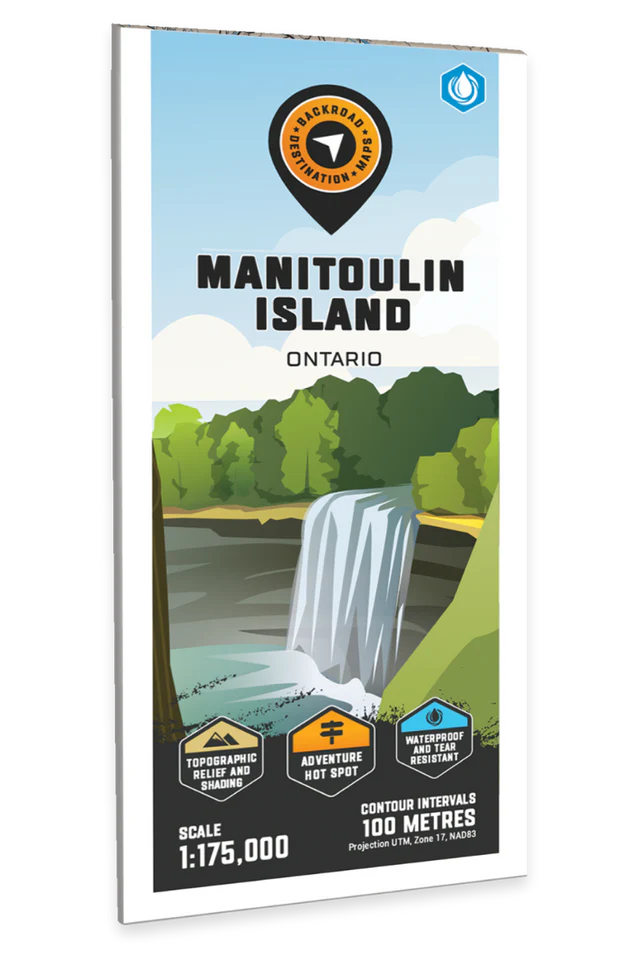
Manitoulin Island – Destination Map – BRMB Code: 622098111866
Covering all of Manitoulin Island in northern Ontario, this map features the roads, trails, biking routes, campsites, access points, fish species, hunting boundaries and lakes in the area. Use for canoeing, camping, exploring, fishing, hiking, hunting, kayaking, skiing, wildlife viewing and more. With 1:10,000 water and trail data, no other map for the area provides you with this level of recreational or topographic detail. This 1:175,000 scale printed map includes Manitoulin Island, Barrie Island, Blind River, Cockburn Island, Espanola, Gore Bay, Little Current, Manitowaning, Wikwemikong First Nations, Lake Huron, Lake Manitou, Little Current, Providence Bay and more!
The printed version of the map is displayed at 1:175,000 scale on 61 x 94 cm (24 x 37 in) paper on a durable waterproof synthetic material. The Wall Maps have been customized to display nicely and fit into common picture frame sizes so you can hang on the cabin, home or workshop wall. They are available in three different sizes and come printed on the waterproof synthetic material.
Map Scale: 1:175,000
Release: 2023
Dimensions: 61 x 94 cm (24 x 37 inches)
| Marque | |
|---|---|
| Pays | |
| Région |

![]() Nous sommes fermés le lundi de Pâques!
Nous sommes fermés le lundi de Pâques! ![]()