Canadian Charts
The Canadian Hydrographic Service (CHS) publishes over 900 paper charts which are described in a series of four free chart catalogues for the Pacific Coast, Central Canada, Atlantic Coast, and the Arctic. Visit the Chart Index to view our catalogues in an interactive format.
Showing 1–12 of 108 results
-

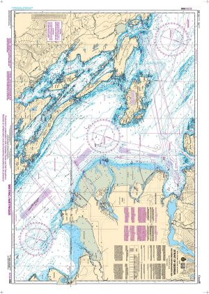
Chart 1350: Sorel-Tracy to Otterburn-Park
Price range: 28.00$ through 53.00$ Select options This product has multiple variants. The options may be chosen on the product page -

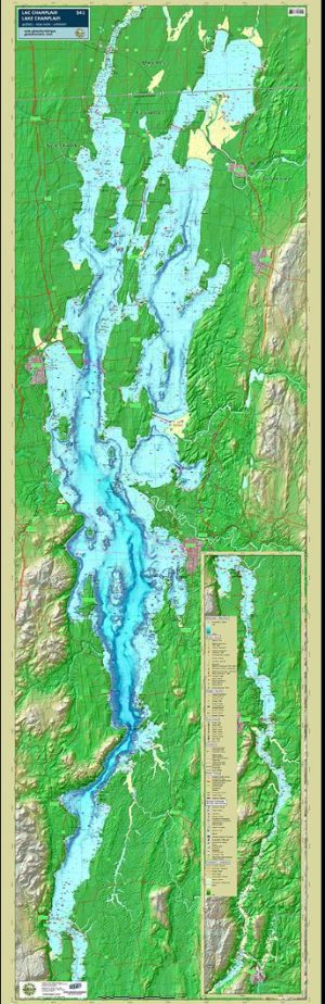
Lake Champlain Wall Map – TrakMaps #541
Read more -
Nautical Chart 1201: Saint-Fulgence to Saguenay
Price range: 20.00$ through 35.00$ Select options This product has multiple variants. The options may be chosen on the product page -
Nautical Chart 1202: Cap Éternité to Saint Fulgence
Price range: 20.00$ through 35.00$ Select options This product has multiple variants. The options may be chosen on the product page -
Nautical Chart 1203: Tadoussac to Cap Éternité
Price range: 20.00$ through 35.00$ Select options This product has multiple variants. The options may be chosen on the product page -
Nautical Chart 1220: Baie des Sept-Îles
Price range: 20.00$ through 35.00$ Select options This product has multiple variants. The options may be chosen on the product page -
Nautical Chart 1221: Pointe de Moisie to Île du Grand Caouis
Price range: 20.00$ through 35.00$ Select options This product has multiple variants. The options may be chosen on the product page -
Nautical Chart 1223: Chenal du Bic and approaches
Price range: 20.00$ through 35.00$ Select options This product has multiple variants. The options may be chosen on the product page -
Nautical Chart 1226: Anchorages and Harbour Installations – Haute Côte-Nord
Price range: 20.00$ through 35.00$ Select options This product has multiple variants. The options may be chosen on the product page -
Nautical Chart 1230: Plans-Péninsule de la Gaspésie
Price range: 20.00$ through 35.00$ Select options This product has multiple variants. The options may be chosen on the product page -
NAUTICAL CHART 1233: Cap aux Oies to Sault-au-Cochon
Price range: 20.00$ through 35.00$ Select options This product has multiple variants. The options may be chosen on the product page -
Nautical Chart 1234: Cap de la Tête au Chien to Cap aux Oies
Price range: 20.00$ through 35.00$ Select options This product has multiple variants. The options may be chosen on the product page