Additional information
| Dimensions | N/A |
|---|---|
| Dimension | Big, Small |
| Plastification | Flushmount, Foamcore, Paper, Plastic |
Price range: 30.00$ through 189.00$
Title:
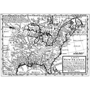
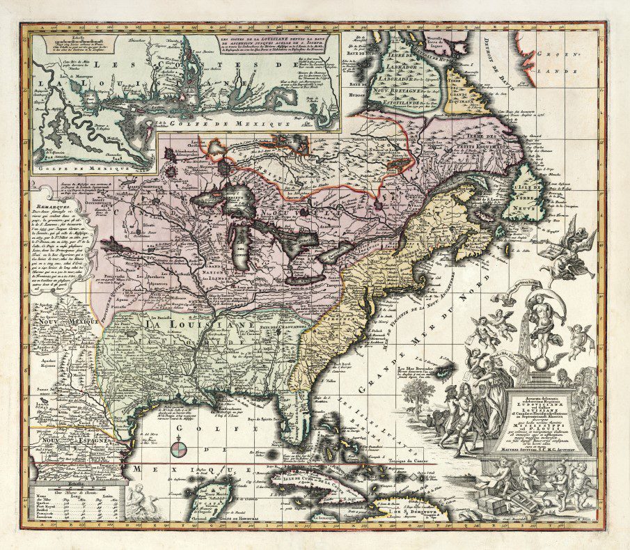
Accurata delineatio Regni Franciae et Provinciarum Americæ Septentrionalis
(in English: “Accurate Delineation of the Kingdom of France and the Provinces of North America”).
Date of Creation: 1715, created by Matthaeus Seutter, a German cartographer and map publisher active in the 18th century.
Dimensions:
Description:
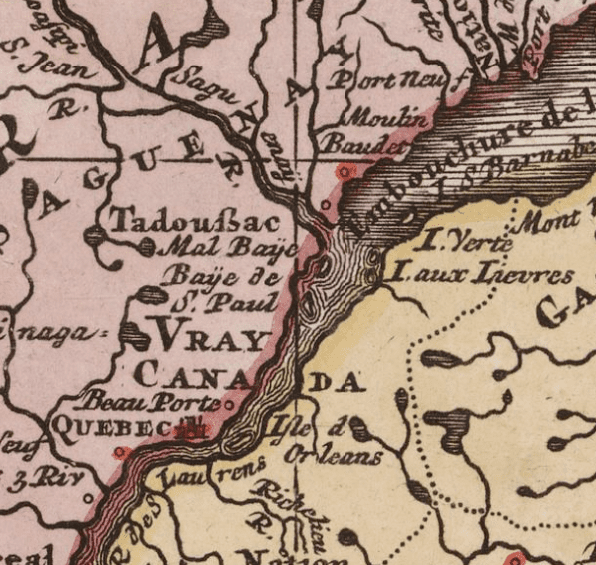
This map is a detailed representation of New France, including the territories of Louisiana, Canada (including the St. Lawrence Valley, Quebec, and Montreal), as well as large regions of what are now the United States, such as Michigan and the Great Lakes. It shows the main navigational routes, important strategic locations, forts, and early European settlements.
One of the interesting aspects of this map is its accuracy in depicting French colonies and their points of contact with Indigenous peoples. It also highlights the territories claimed by France in North America, well before the conflicts that marked the Seven Years’ War and the cession of New France to Britain in 1763.
Features:
Historical Context:
The map dates to the period of French colonial expansion in North America. By 1715, France had significant control over regions in New France, but the map also depicts areas disputed with the British and other colonial powers. It was a time of consolidation for French colonies and the development of the fur trade, especially with Indigenous peoples.
Purpose and Use:
The primary purpose of this map was to provide an accurate representation of the territories controlled or claimed by France in the New World. It was likely used by French authorities, merchants, explorers, and military officials. It illustrates not only geography but also France’s imperial ambitions in the Americas.
Importance:
Please note:
Foamcores and flushmount laminations are not available for shipping.
Expect a two-week lead time for foamcore or flushmount option.
| Dimensions | N/A |
|---|---|
| Dimension | Big, Small |
| Plastification | Flushmount, Foamcore, Paper, Plastic |