Additional information
| Language | English |
|---|---|
| Region |
7.95$
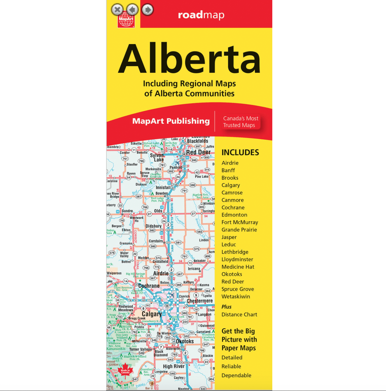
Alberta – Mapart Paper Road Map
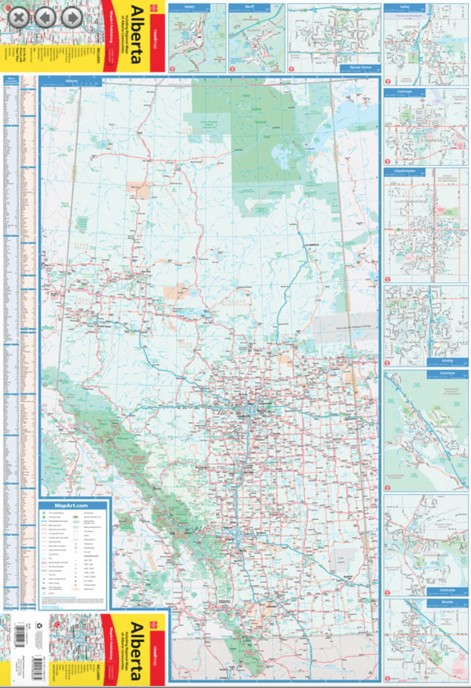
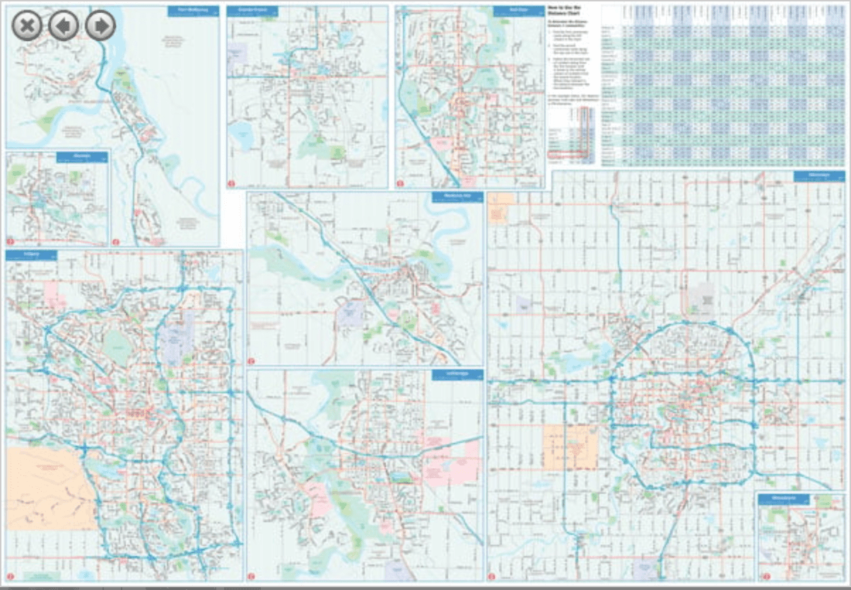
The folded map of the province of Alberta includes a detailed provincial map of Alberta at a scale of 1:1,500,000. Includes regional maps at a scale of 1:50,000 of Airdrie, Banff, Brooks, Camrose, Canmore, Cochrane, Fort McMurray, Grande Prairie, Jasper, Leduc, Lethbridge, Lloydminster, Medicine Hat, Okotoks, Red Deer, Spruce Grove, Wetaskiwin, as well as Calgary (1:100,000) and Edmonton (1:125,000), a distance table, a community index, and a map legend.
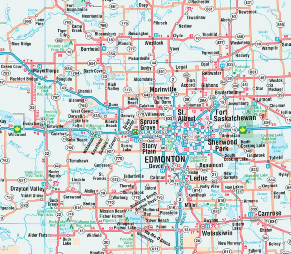
The provincial map shows the following features: the Trans-Canada Highway, the Yellowhead Highway, divided highways/interchanges, paved and unpaved primary roads, paved and unpaved secondary roads, other paved and unpaved roads, forestry and undeveloped roads, seasonal roads, ferries, distance between points (km), international borders, provincial borders, time zones, airports, border crossings, tourist information centres, hospitals, point elevations, national parks/historic sites, provincial parks/recreational areas, wilderness areas/protected areas, forest reserves, icefields, national defence, campgrounds, downhill skiing, picnic areas, populated places, the provincial capital, and Indian reserves.
Dimensions:
Folded: 10.2 x 23.5 cm (4 x 9.25 inches)
Unfolded: 68.6 x 99.7 cm (27 x 39.25 inches)
Proudly made in Canada!
2025
| Language | English |
|---|---|
| Region |