Additional information
| Language | English |
|---|---|
| Map Type | Paper, Road |
| Region |
6.95$
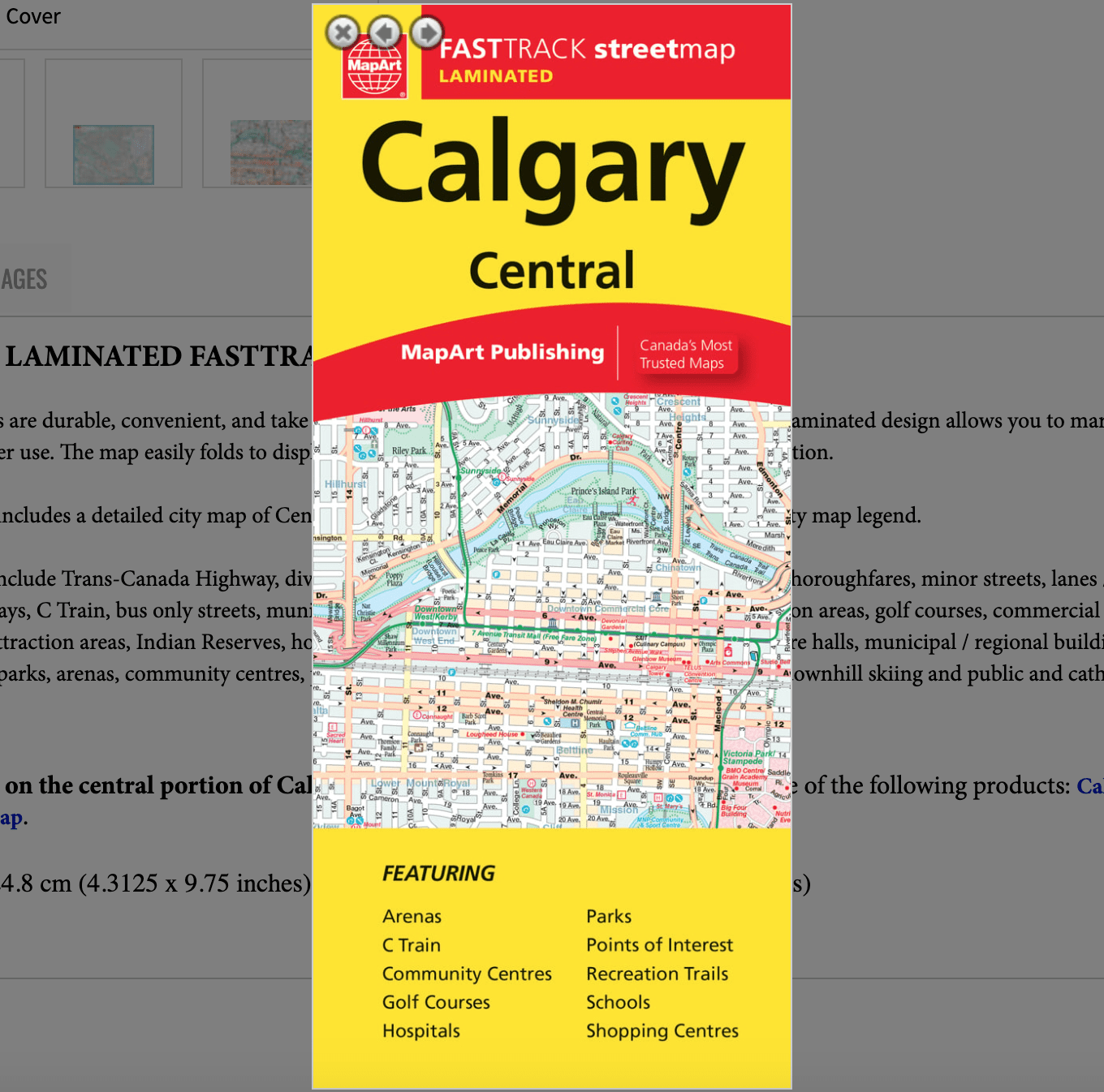
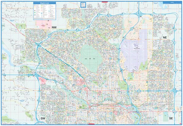
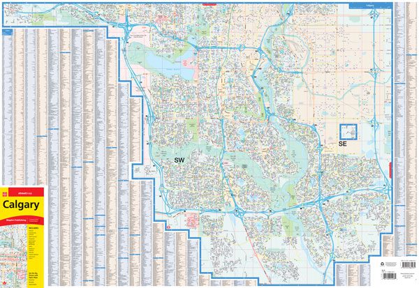
Calgary paper road map – Mapart
Folded maps have been the trusted standard for years, offering unbeatable accuracy and reliability at a great price. Detailed indices make for quick and easy location of destinations. It’s a must-have for anyone travelling, working or living in Calgary, Alberta.
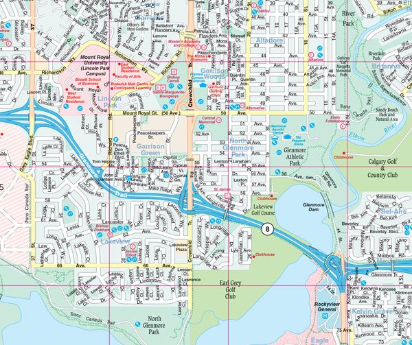
This folded map of Calgary includes detailed city mapping at 1:29,000. Includes a street index and legend.
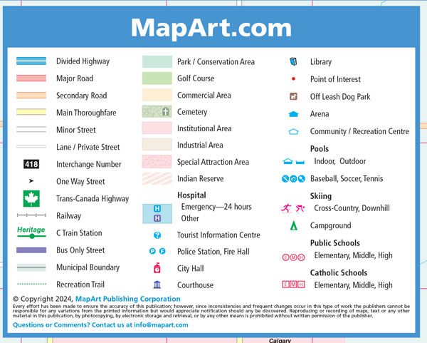
The detailed city mapping has many features including divided highways, major roads, secondary roads, main thoroughfares, minor streets, lanes / private streets, interchange numbers, one way streets, Trans-Canada highway, railways, C Train stations, bus only streets, municipal boundaries, recreation trails, parks / conservation areas, golf courses, commercial areas, cemeteries, institutional areas, industrial areas, special attraction areas, Indian reserves, hospitals, tourist information centres, police stations, fire halls, city hall, courthouses, libraries, points of interest, off leash dog parks, arenas, community / recreation centres, pools, baseball, soccer, tennis, skiing, campgrounds, public and catholic schools.
Edition: 2024
English only.
Proudly made in Canada!
| Language | English |
|---|---|
| Map Type | Paper, Road |
| Region |