Additional information
| Brand | |
|---|---|
| Map Type | Paper, Road |
7.95$
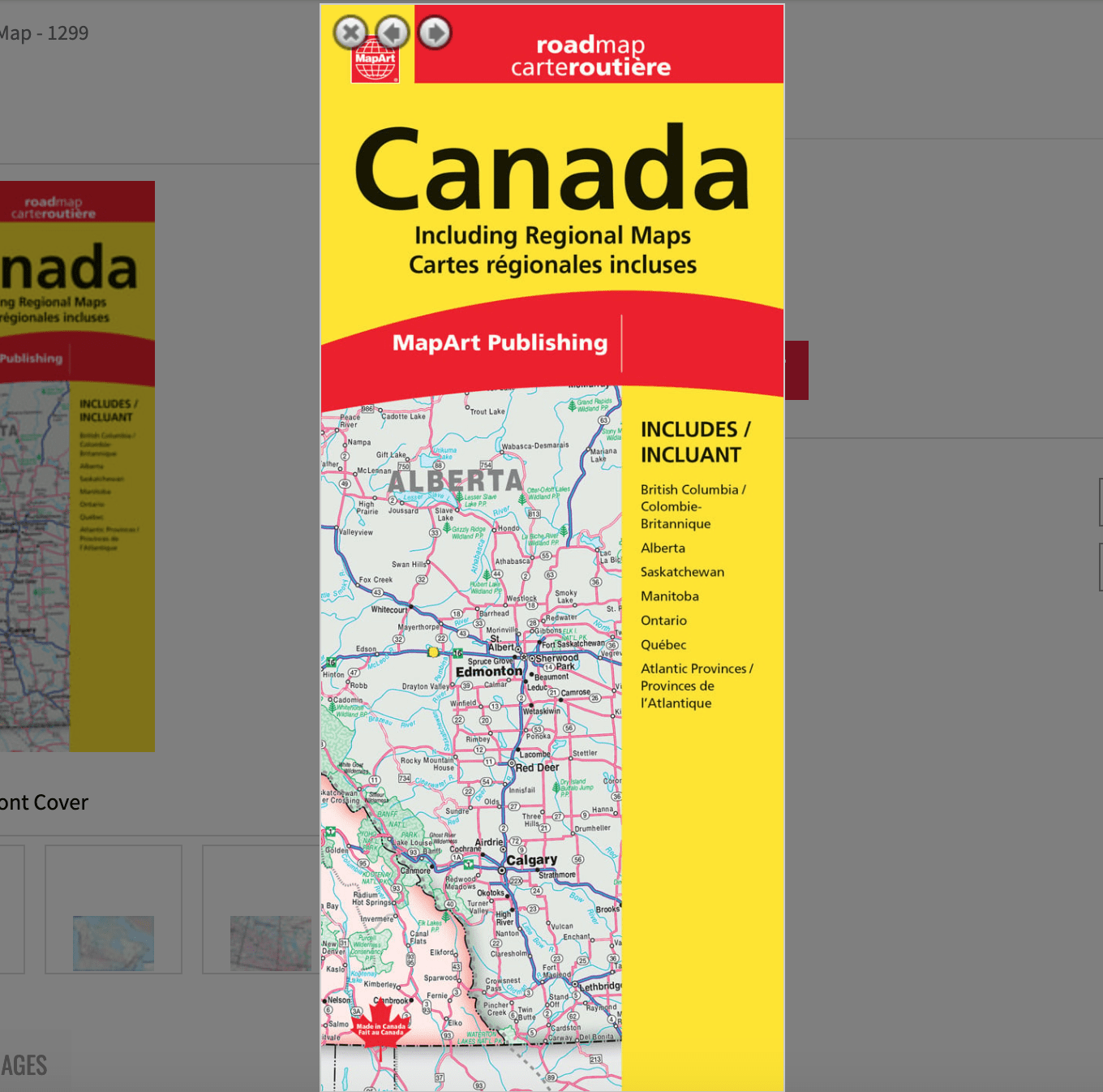
Canada paper folded Map -MapArt
061158012994
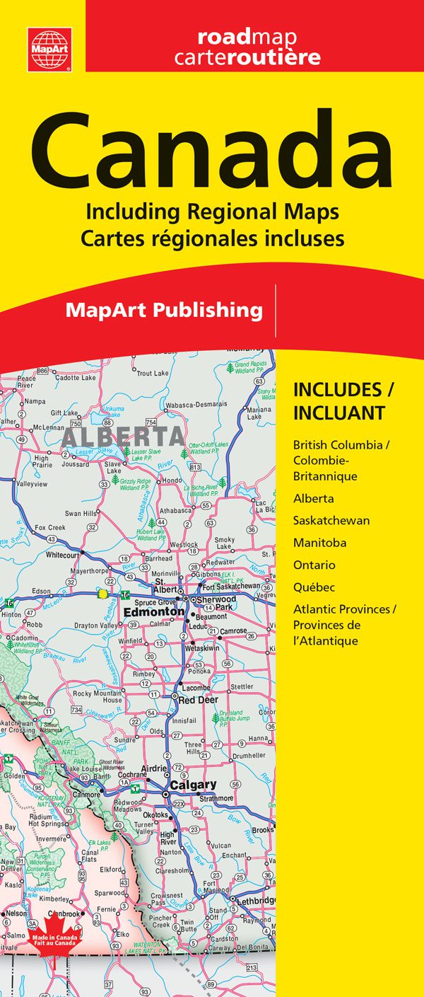
Are you looking to explore Canada? Make sure you have the perfect companion on your journey: our Canada Road Map! Our detailed map is designed to help you navigate your way through Canada’s vast landscape. With our easy-to-read maps, you’ll be able to find your way around the country in no time. Whether you’re planning a road trip or just need to know the best route to take, our Canada Road Map has you covered! Get your map today and start your adventure.
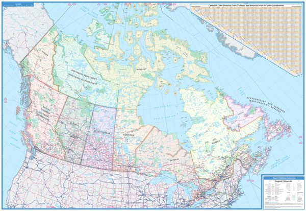
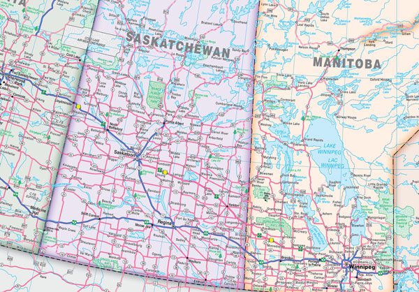
Includes a national map of Canada at a scale of 1:6,000,000, and regional maps of areas of British Columbia, Alberta, Saskatchewan and Manitoba at 1:1,875,000, Ontario at 1:1,000,000, Québec at 1:1,250,000 and the Atlantic Provinces at 1:900,000. Plus a Canadian Cities Distance Chart.
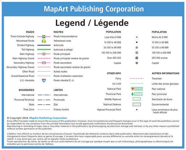
Features on the national map of Canada include Trans-Canada highway, Yellowhead Route, divided highways, toll highways, main highways, main highways gravel, secondary highways, secondary highways gravel, other roads, gravel/seasonal roads, U.S. interstates, international boundaries, provincial/territorial boundaries, state boundaries, time zones, populations, over 250 000, capitals, ferry, ice limits, national parks, provincial parks, wildlife reserves, National Defence and highest provincial points.
Edition: 2024
Proudly made in Canada!
| Brand | |
|---|---|
| Map Type | Paper, Road |