Additional information
| Brand | |
|---|---|
| Plastification | Paper, Plastic |
| Format | Folded, Rolled |
Price range: 17.95$ through 29.95$
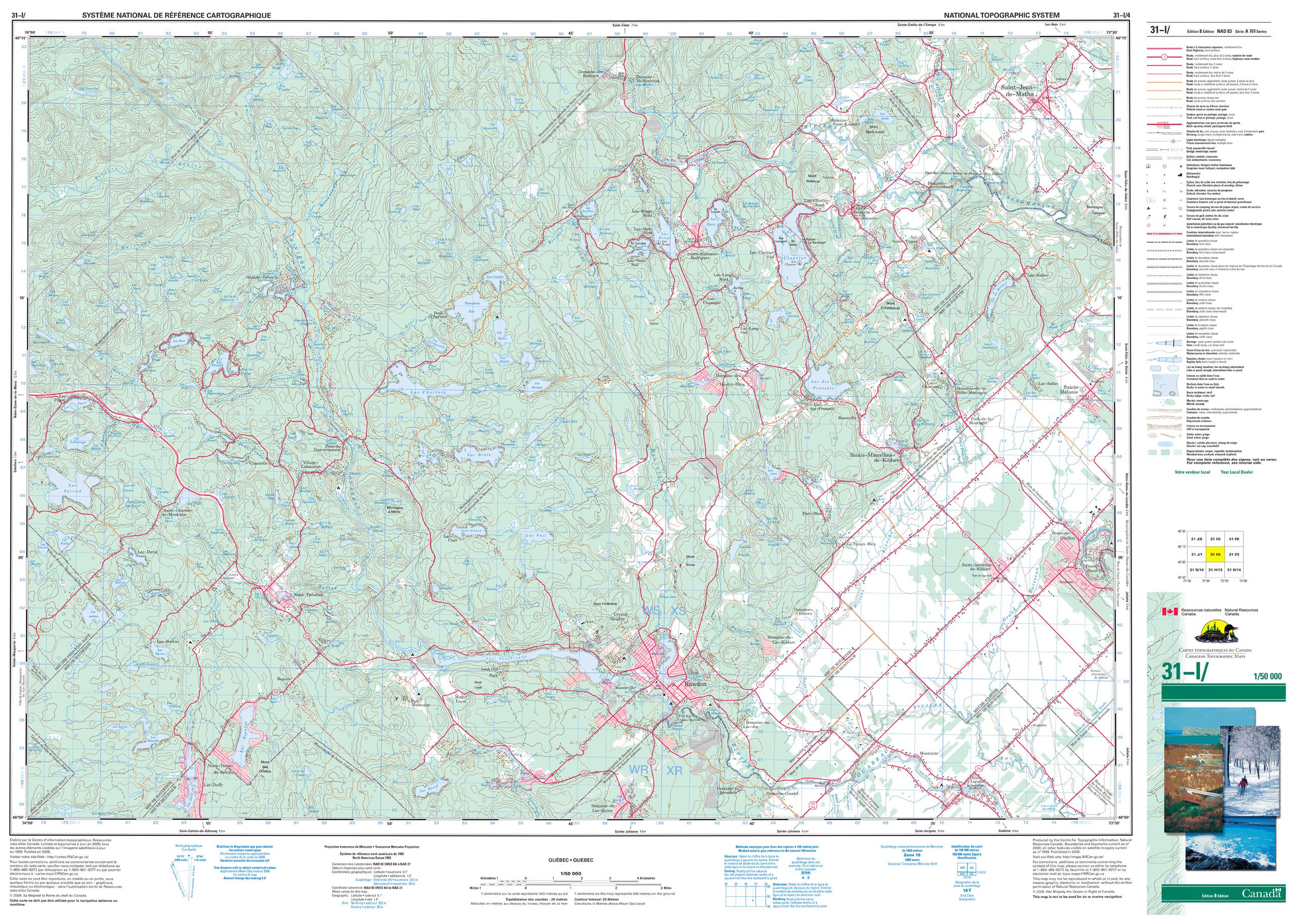
Topographic Maps Scale 1: 50 000 are suitable for a wide variety of applications, from emergency management, urban planning, surveying, resource development, to camping, canoeing, hunting and fishing to name a few. Why? Because they represent the earth’s features accurately and to scale, on a two-dimensional surface. This section provides information to facilitate the use of topographic maps, and also how to obtain paper and digital maps.
To see our topo map collection, click here.
The size of topographic maps scale 1:50,000 – Government of Canada may vary depending on the edition of the map because the covering of the map, what is found in the margin, outside the map, varies depending on its edition .
| Brand | |
|---|---|
| Plastification | Paper, Plastic |
| Format | Folded, Rolled |