Scale:1:80,000, providing detailed coverage of the Cape Verde Islands. This scale offers a clear view of the roads, cities, and key points of interest throughout the archipelago.
Dimensions:
Folded: 13 x 25.5 cm (compact and easy to carry).
Unfolded: 125 x 96 cm (full map view for complete use).
Content:
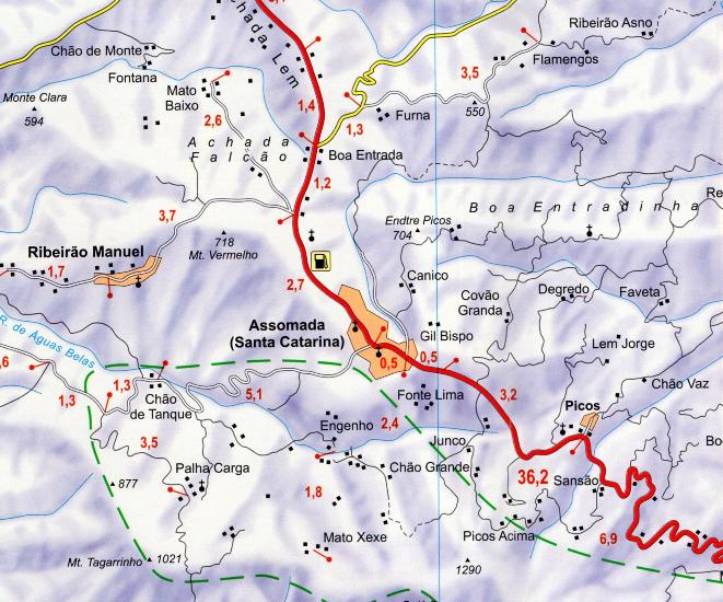
Detailed road map of Cape Verde, including main roads, secondary roads, and smaller routes on the major islands.
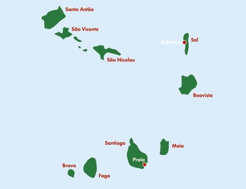
Highlights key points of interest such as Praia (the capital), Mindelo, Santiago (the main island), São Vicente, and Fogo, including cultural, tourist, and historical landmarks.
Topographic relief to better understand the geography of the archipelago, including mountains and active volcanoes, such as the Fogo volcano.
City index for quick location, ideal for exploring both urban and rural areas on each island.
Multilingual legend, including French, English, German, Italian, and Spanish for easy understanding.
Specifically designed for travelers and drivers, offering detailed information for smooth navigation.
Weight:Approximately 201 g, lightweight and easy to carry in a bag or suitcase, ideal for travel.
Ideal Use:
Perfect for travelers, hikers, and drivers looking to explore Cape Verde’s diverse landscapes, from beaches to volcanic mountains.
A valuable tool for those wanting to explore the culture and natural sites of the archipelago in detail.
This map is essential for anyone planning to travel in Cape Verde, with detailed information on topography, roads, and local points of interest.