Additional information
| Region | |
|---|---|
| Map Type | Paper, Road |
| Brand |
5.95$
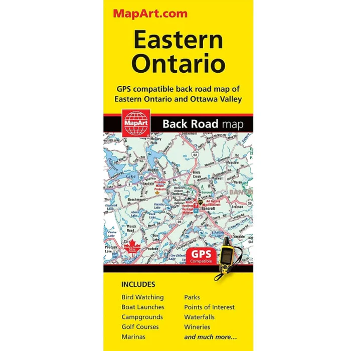
Eastern Ontario Folded Map – 1300
667702022228
Folded maps have been the trusted standard for years, offering unbeatable accuracy and reliability at a great price. Detailed indices make for quick and easy location of destinations. It’s a must-have for anyone travelling, working or living in Eastern Ontario.
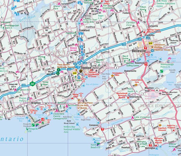
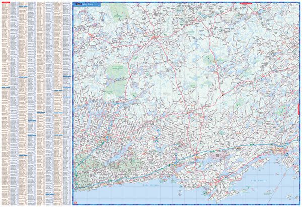
The Eastern Ontario folded map includes detailed regional mapping of Eastern Ontario at 1:250,000, community index, road index as well as a map legend.
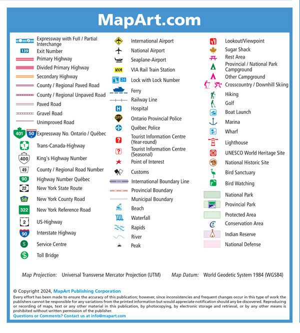
The detailed regional road map includes expressways, interchanges, exit numbers, primary highways, secondary highways, paved and unpaved county/regional roads, paved and unpaved roads, unimproved roads, airports, VIA Rail stations, locks and lock numbers, ferries, railways, hospitals, OPP, Québec Police, tourist information centres, points of interest, customs, boundaries, beaches, waterfalls, rapids, peaks, lookouts/viewpoints, sugar shacks, rest areas, campgrounds, skiing, hiking, golf, boat launches, marinas, wharfs, lighthouses, UNESCO World Heritage sites, National Historic sites, bird sanctuaries, bird watching, national parks, provincial parks, protected areas, conservation areas, Indian reserves, National Defence, and more.
Edition: 2024
Proudly made in Canada!