Additional information
| Brand | |
|---|---|
| Country | |
| Region |
19.95$
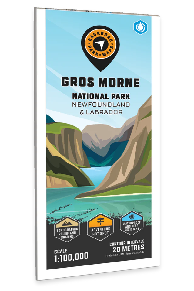
Gros Morne National Park – Destination Map – BRMB Code: 622098111620
Covering all of Gros Morne National Park, this Newfoundland topographic recreation map highlights all the access roads and trails for hikers, anglers, paddlers, skiers, and backcountry enthusiasts. Showcasing frontcountry and wilderness campsites, boat launches, huts and cabins, picnic sites, snowmobile routes, viewpoints, waterfalls, and fishing hotspots, there is a lifetime of outdoor adventures to be found here. Shown at a 1:100,000 scale, this map features our industry-leading topographic contours and relief shading, as well as roads, padding routes and trails, and snowmobile areas. Included on the map are Bakers Brook, Cow Head, Lobster Cove, Norris Point, Rocky Harbour, Trout River, Witondale, Woody Point, Bonne Bay, Lomond River, Long Range Mountains, Western Brook Pond, and more! No other map covers all of Gros Morne National Park with this level of recreation detail.
The printed version of the map is displayed at 1:100,000 scale on 61 x 94 cm (24 x 37 in) paper on a durable waterproof synthetic material. The Wall Maps have been customized to display nicely and fit into common picture frame sizes so you can hang on the cabin, home or workshop wall. They are available in three different sizes and come printed on the waterproof synthetic material.
Map Scale: 1:100.000 Scale
Release: 2023
Dimensions: 61 x 94 cm (24 x 37 inches)
| Brand | |
|---|---|
| Country | |
| Region |