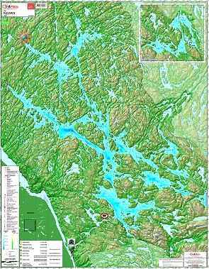
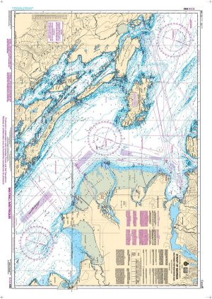
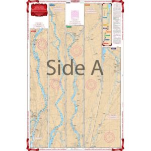
Kipawa Lake #291 – TrakMaps Nautical Chart
29.99$
Kipawa Lake #291 – TrakMaps Nautical Chart – TrakMaps Nautical Chart
Description:
Kipawa Lake #291 – TrakMaps Nautical Chart – TrakMaps Nautical Chart
Includes:
- Marshes
- Diving sites
- Marinas
- Launch ramps
- Camping sites
- Picnic sites
- Topography in 3D
- Printed on waterproof and tear-proof synthetic paper
Sources:
- Canadian Hydrographic Service
- Quebec Ministry of Energy and Natural Resources
- National Oceanic and Atmospheric Administration
- Natural Resources Canada
- Ontario Ministry of Natural Resources and Forestry
- National Geospatial-Intelligence Agency
- TrakMaps
This product does not contain data from all sources listed above. Other sources may also be used.
Dimensions:
- 28 x 36 in
For the electronic version of this map, shop Marine Quebec – TrakMaps. SD card compatible with our Garmin GPS units. PC/MAC version does not need a GPS to work.
Related products
-
Instruments

One-hand brass divider
Price range: 49.95$ through 59.95$ Select options This product has multiple variants. The options may be chosen on the product page -
Canadian Charts
Nautical Chart 1312: Lac Saint-Pierre
Price range: 20.00$ through 35.00$ Select options This product has multiple variants. The options may be chosen on the product page -
US Charts
Champlain Canal and lake Champlain
49.95$ Add to cart -
Guides

Lake Champlain, Hudson and St. Lawrence River Cruising Guide
67.95$ Add to cart