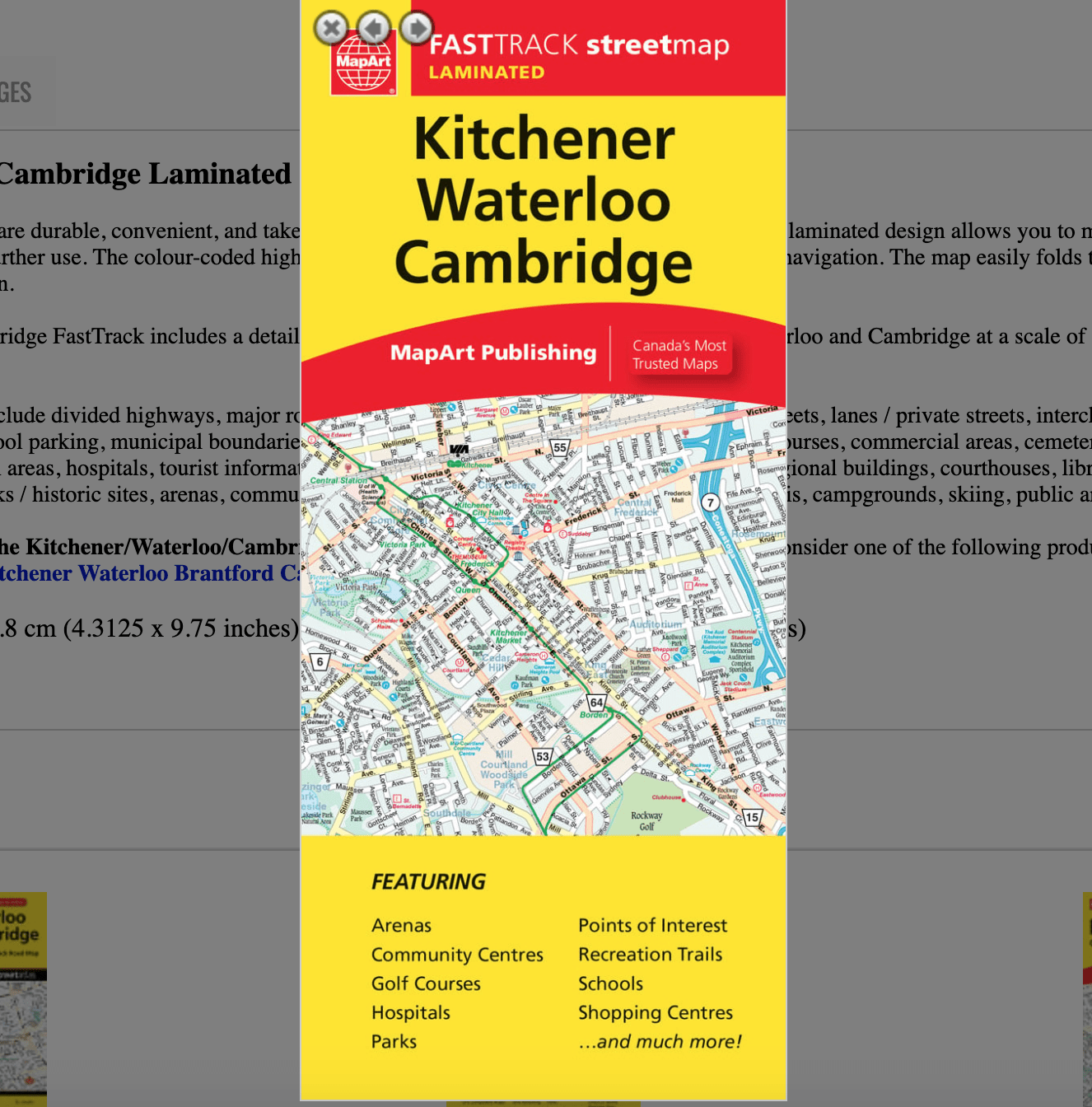
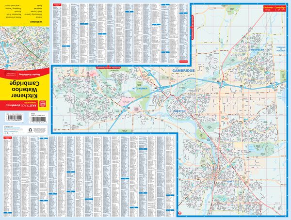
Kitchener, Waterloo & Cambridge – MapArt laminated road map
9.95$
Kitchener / Waterloo / Cambridge Laminated FastTrack Map
0-61158-01242-0
Laminated Map FastTrack maps are durable, convenient, and take all the wear and tear your journey can dish out. The laminated design allows you to mark your route, make notes, then wipe the surface clean for further use. The colour-coded highways and clear exit names make for quick and easy navigation. The map easily folds to display individual sections. This is a must-have for navigation.
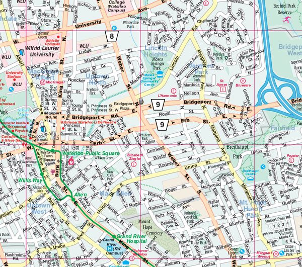
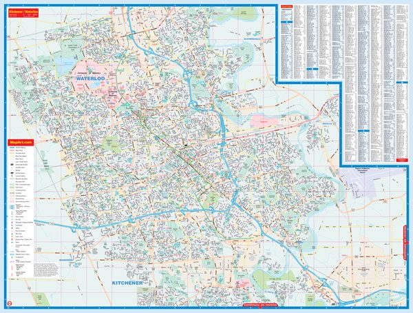
The Kitchener / Waterloo / Cambridge FastTrack includes a detailed city map of the central portion of Kitchener, Waterloo and Cambridge at a scale of 1:31,250, a detailed street index and a map legend.
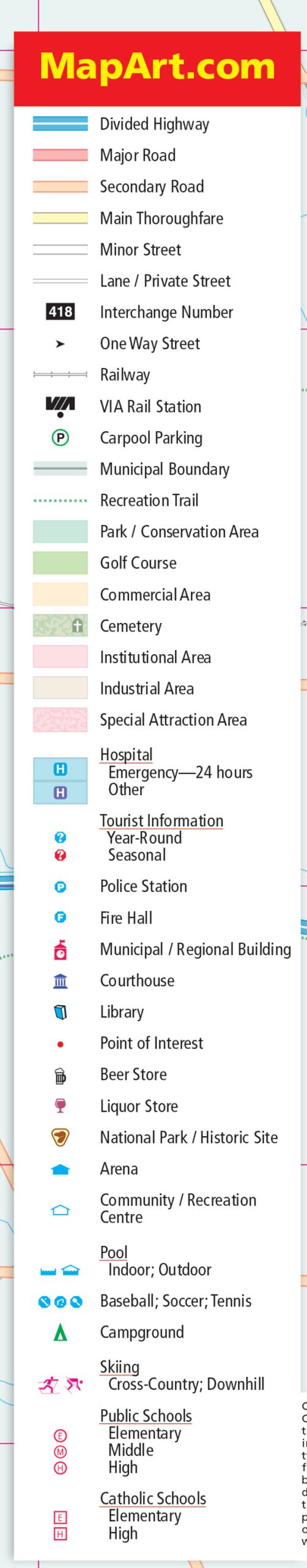
The detailed city map features include divided highways, major roads, secondary roads, main thoroughfares, minor streets, lanes / private streets, interchange numbers, one way streets, railways, VIA Rail stations, carpool parking, municipal boundaries, recreation trails, parks / conservation areas, golf courses, commercial areas, cemeteries, institutional areas, industrial areas, special attraction areas, hospitals, tourist information centres, police stations, fire halls, municipal / regional buildings, courthouses, libraries, points of interest, beer stores, liquor stores, national parks / historic sites, arenas, community / recreation centres, pools, baseball, soccer, tennis, campgrounds, skiing, public and catholic schools.
Note: This product focuses on the Kitchener/Waterloo/Cambridge central areas. For full coverage of Kitchener consider one of the following products: Kitchener Cambridge Waterloo Folded Map or the Kitchener Waterloo Brantford Cambridge Street Atlas.
Dimensions: Folded: 11 x 24.8 cm (4.3125 x 9.75 inches) Unfolded: 65.4 x 49.5 cm (25.75 x 19.5 inches)
Edition: 2023
Proudly made in Canada!
Available on order.
Available on backorder
Related products
-
Scratch Maps

Scratch map artist edition
54.99$ Add to cart -
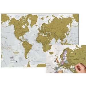
Scratch Maps
Scratch map of the World – french – Craenen
48.95$ Add to cart -
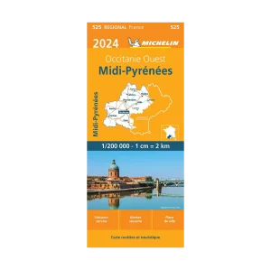
Road Maps

Midi-Pyrénées road map Michelin #525
16.95$ Add to cart -
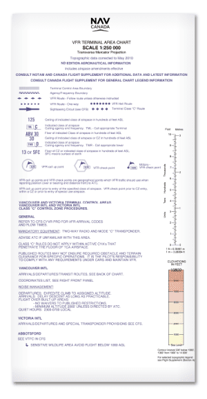
Aviation

Terminal Area Chart (VTA) – NAV Canada
Price range: 19.99$ through 29.99$ Select options This product has multiple variants. The options may be chosen on the product page