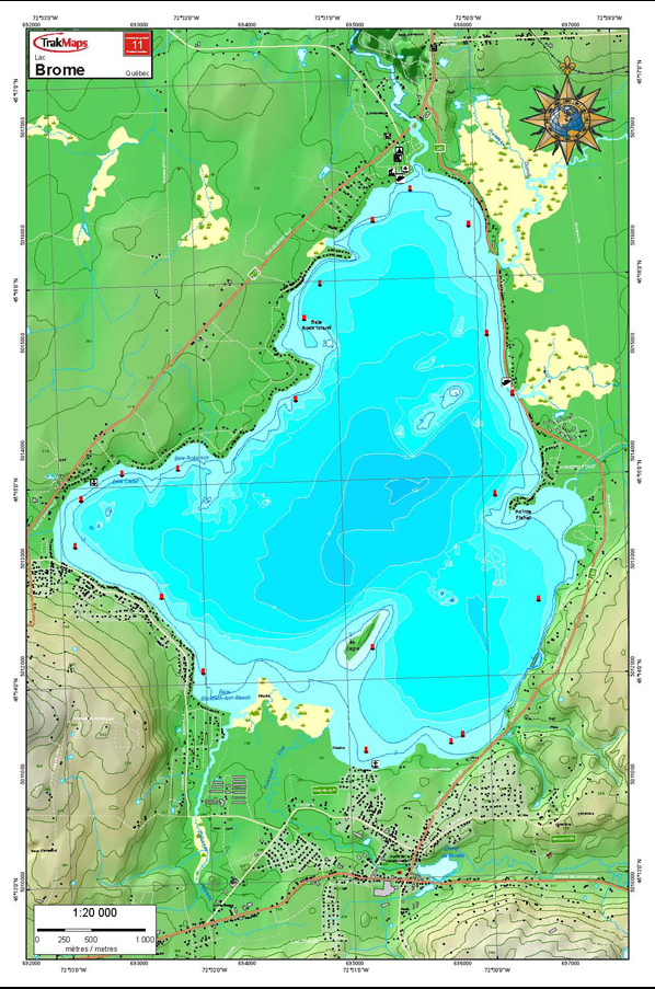
Lake Brome #11 – TrakMaps Lake Chart
15.99$
TrakMaps Lake Chart
Description
Individual Lake Chart. Printed on waterproof and tear-proof paper at a scale of 1:20,000. Perfect for fishing, boating and ice fishing.
Includes
- Bathymetry
- Navigation aids
- Main roads
- Launch ramps
- Printed on waterproof and tear-proof synthetic paper
Sources
- Canadian Hydrographic Service
- Quebec Ministry of Energy and Natural Resources
- National Oceanic and Atmospheric Administration
- Natural Resources Canada
- Ontario Ministry of Natural Resources and Forestry
- National Geospatial-Intelligence Agency
- TrakMaps
This product does not contain data from all sources listed above. Other sources may also be used.
Dimensions:
Buy the electronic version of TrakMaps Lake Chart. Install it on your computer. Also compatible with Garmin GPS.