Additional information
| Region | |
|---|---|
| Map Type | Laminated, Road |
| Brand |

7.95$
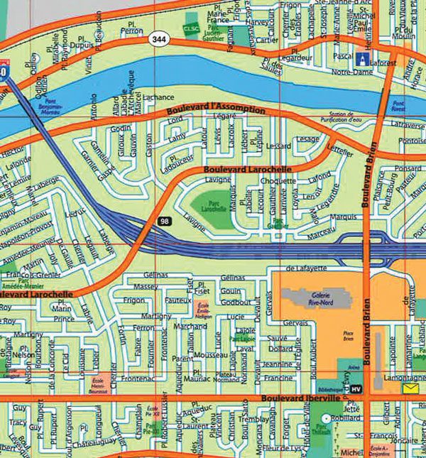
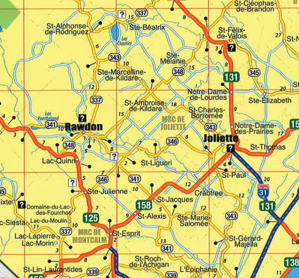
Lanaudière Repentigny Joliette FastTrack Map
8-23302-20954-0
Laminated maps are durable, convenient, and take all the wear and tear your journey can dish out. The laminated design allows you to mark your route, make notes, then wipe the surface clean for further use. The colour-coded highways and clear exit names make for quick and easy navigation. The map easily folds to display individual sections. This is a must-have for navigation.
The laminated folded map of Lanaudière, Repentigny and Joliette includes detailed city mapping of Charlemagne, Joliette, Lanaudière, Notre-Dame-des-Prairies, Rawdon, Repentigny, St-Charles-Borromée, St-Jean-de-Matha, St-Gabriel-de-Brandon and St-Michel-des-Saints, street indexes and a regional map of the area.
Dimensions: Folded: 10.8 x 27.9 cm (4.25 x 11 inches) Unfolded: 27.9 x 75.4 cm (11 x 29.6875 inches)
Edition: 2009
Proudly made in Canada!
| Region | |
|---|---|
| Map Type | Laminated, Road |
| Brand |