Additional information
| Region | |
|---|---|
| Brand |
5.95$
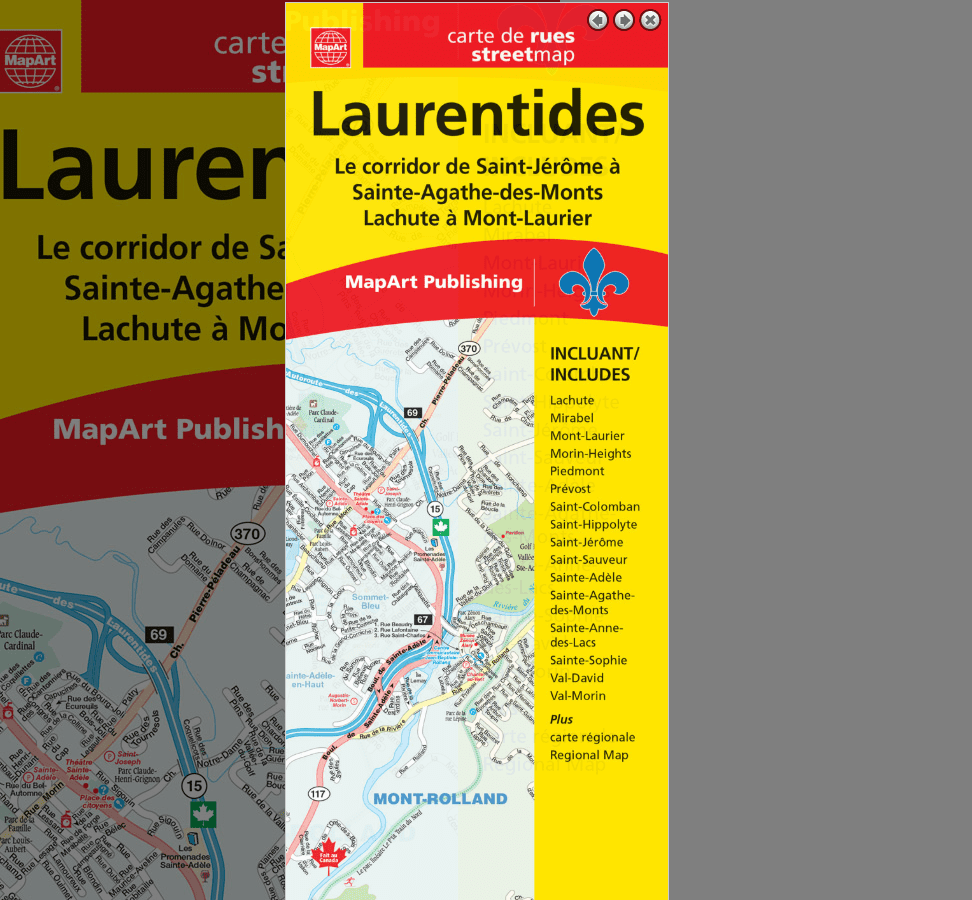
Laurentides Folded paper Map
0-61158-01116-4
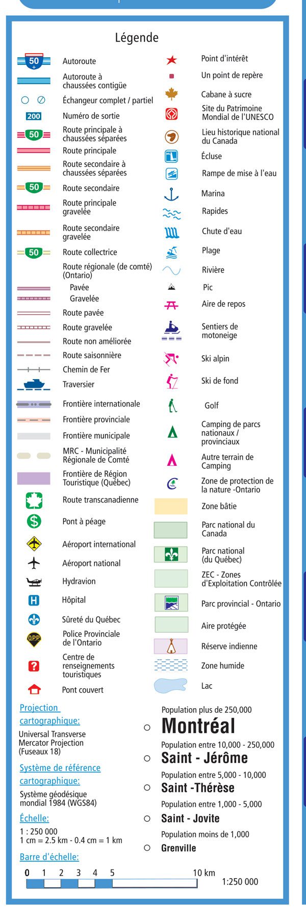
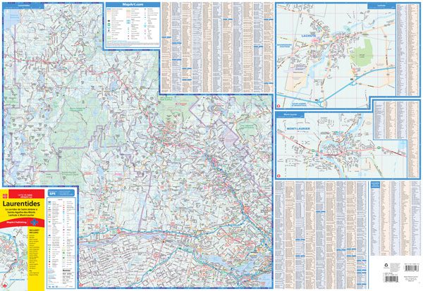
MapArt folded maps have been the trusted standard for years, offering unbeatable accuracy and reliability at a great price. Detailed indices make for quick and easy location of destinations. It’s a must-have for anyone travelling, working or living in the Laurentides area.
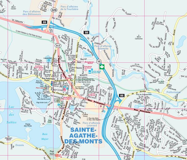
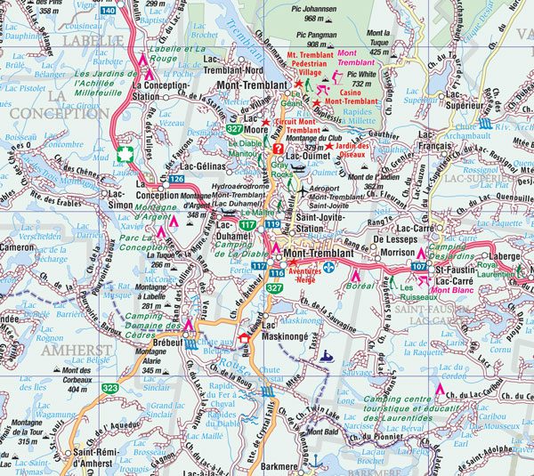
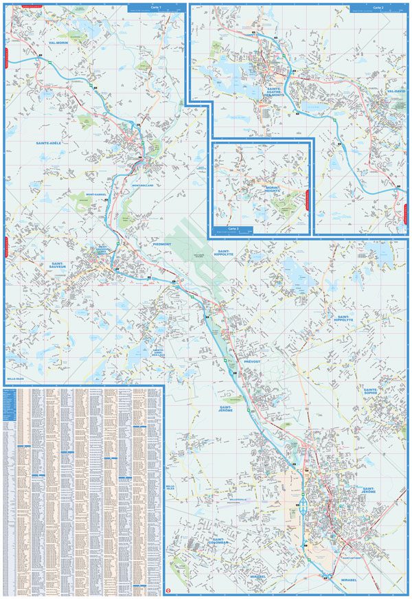
This folded map includes detailed city maps at 1:31,250 of Mirabel, Morin-Heights, Piedmont, Prévost, Saint-Colomban, Saint-Hippolyte, Saint-Jérôme, Saint-Sauveur, Sainte-Adèle, Sainte-Agathe-des-Monts, Sainte-Anne-des-Lacs, Sainte-Sophie, Val-David, Val-Morin as well as Lachute (1:25,000) and Mont-Laurier (1:25,000) including street indexes of each community and map legend. A regional back roads map at 1:250,000 includes a map legend and community name index.
Edition: 2025
Proudly made in Canada!
| Region | |
|---|---|
| Brand |