Additional information
| Region | |
|---|---|
| Map Type | Paper, Road |
| Brand |
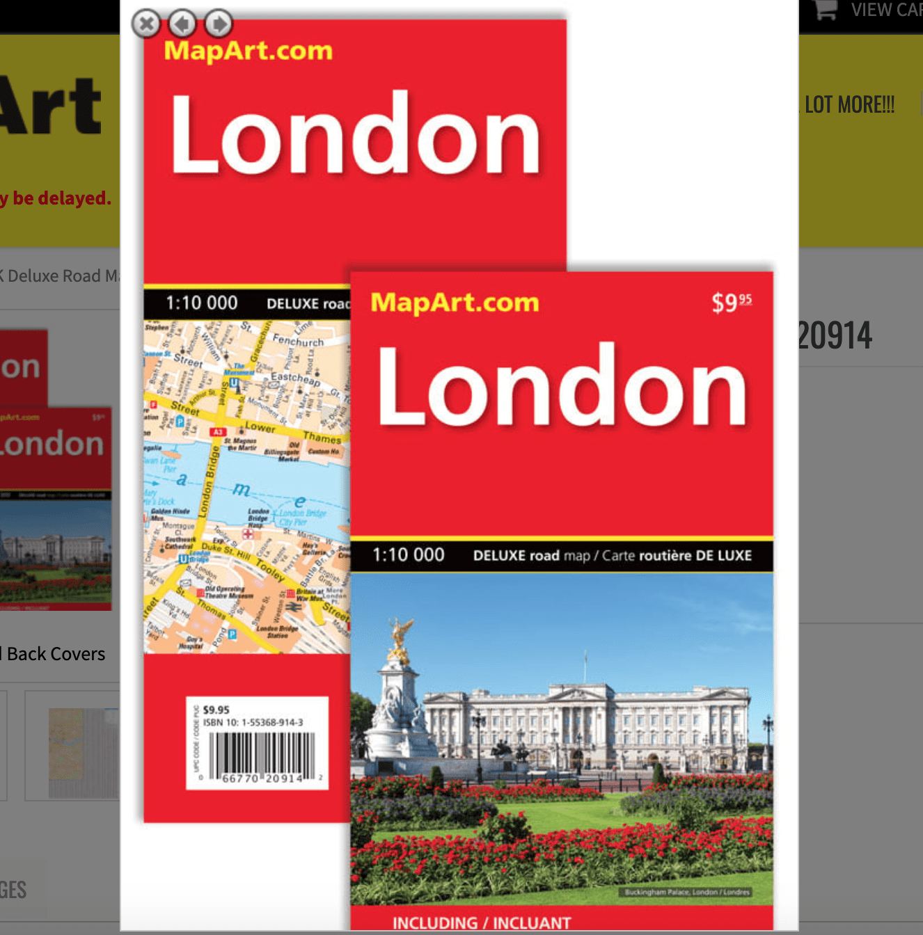
9.95$
London UK Deluxe Road Map
0-66770-20914-2
International MapArt maps are renowned for their up-to-date information and clear layout. A must-have travel item, this map is both easy-to-use and easy-to-read.
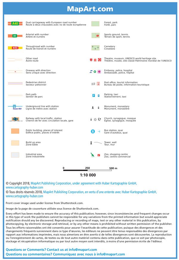
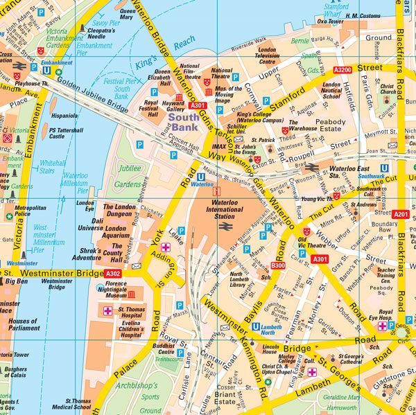
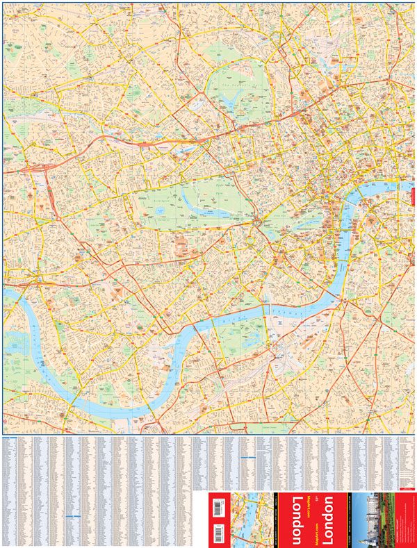
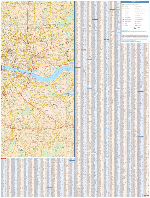
The folded map of London, UK includes a detailed city map of London at a scale of 1:10,000, a bilingual map legend and street index.
The detailed map features include dual carriageways with European road numbers, arterials with numbers, throughroads with numbers, other roads, oneways with direction, pedestrian districts, park paths, Underground lines with stations, railways with local traffic, stations, public buildings, places of interest, built up areas, industrial areas, forest/parks, sports grounds, tennis, cemeteries, theatres, museums, UNESCO world heritage sites, embassies, police, hospitals, post offices, tourist information, parking, taxi, monuments, monasteries, churches, synagogues, mosques, bus stations, quai, towers, walls, zoos, shopping centres.
Edition: 2018
Dimensions: Folded: 13 x 24.1 cm (5.125 x 9.5 inches) Unfolded: 127 x 96.5 cm (50 x 38 inches)
| Region | |
|---|---|
| Map Type | Paper, Road |
| Brand |