Additional information
| Region | |
|---|---|
| Map Type | Laminated, Road |
| Brand |
9.95$
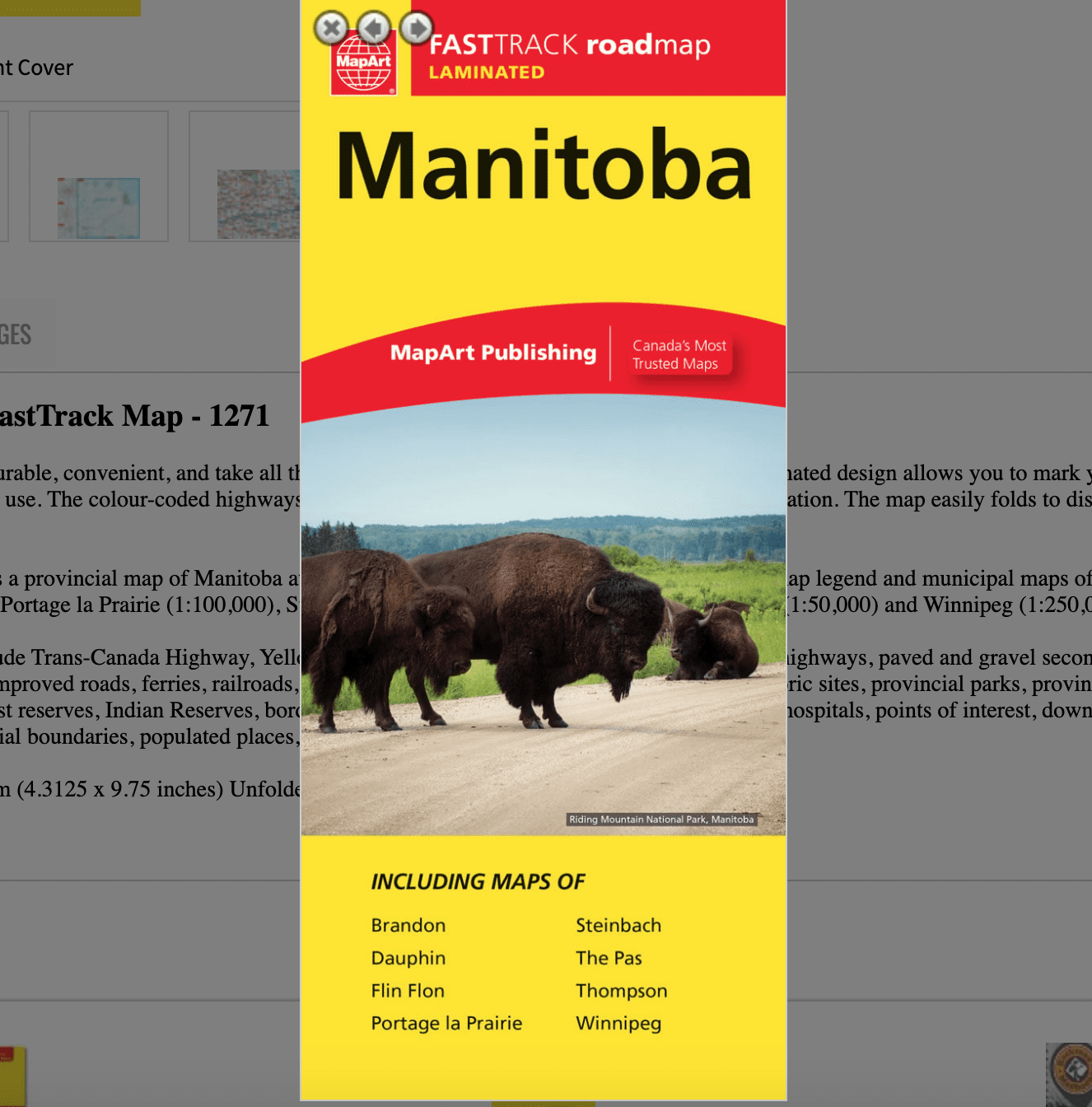
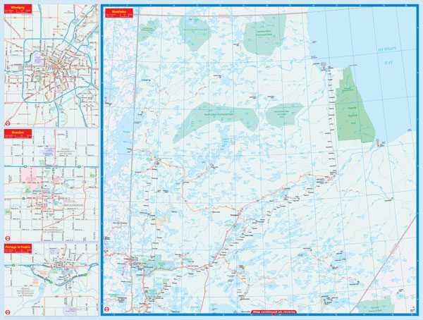
Manitoba Laminated FastTrack Map – MapArt
0-61158-01271-0
Laminated FastTrack maps are durable, convenient, and take all the wear and tear your journey can dish out. The laminated design allows you to mark your route, make notes, then wipe the surface clean for further use. The colour-coded highways and clear exit names make for quick and easy navigation. The map easily folds to display individual sections. This is a must-have for navigation.
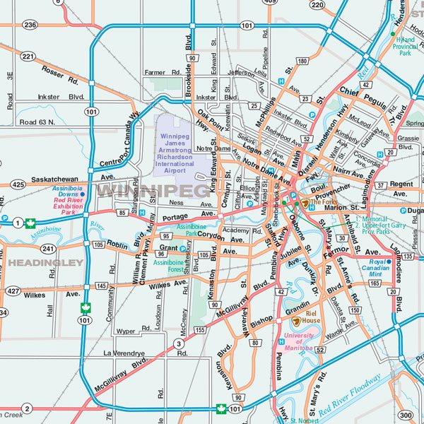
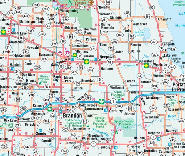
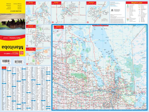
The Manitoba FastTrack includes a provincial map of Manitoba at a scale of 1:1,500,000, a community name index, map legend and municipal maps of Brandon (1:100,000), Dauphin (1:50,000), Flin Flon (1:50,000), Portage la Prairie (1:100,000), Steinbach (1:50,000), The Pas (1:50,000), Thompson (1:50,000) and Winnipeg (1:250,000).
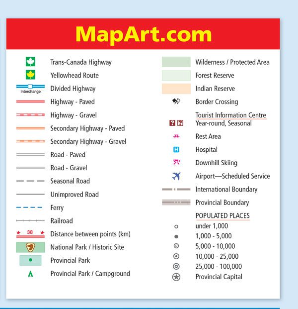
The provincial map features include Trans-Canada Highway, Yellowhead Route, divided highways, paved and gravel highways, paved and gravel secondary highways, paved and gravel roads, seasonal roads, unimproved roads, ferries, railroads, distances between points (km), national parks / historic sites, provincial parks, provincial parks / campgrounds, wilderness / protected areas, forest reserves, Indian Reserves, border crossings, tourist information centres, rest areas, hospitals, points of interest, downhill skiing, airports, mines, international boundaries, provincial boundaries, populated places, provincial capital.
Dimensions: Folded: 11 x 24.8 cm (4.3125 x 9.75 inches) Unfolded: 65.4 x 49.5 cm (25.75 x 19.5 inches)
Edition: 2024
Proudly made in Canada!