Additional information
| Region | |
|---|---|
| Map Type | Road atlas |
| Brand |
19.95$
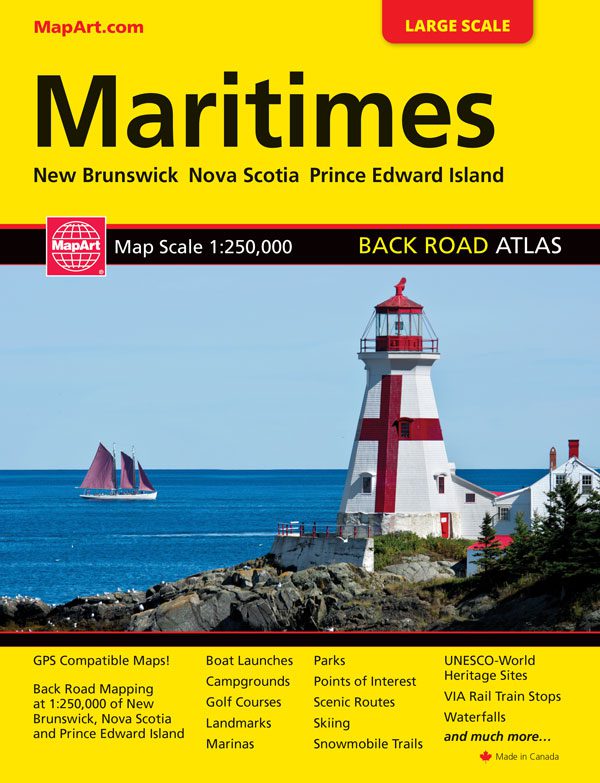
Maritimes Atlas
061158012192
It’s the definitive auto companion for travel in this area, whether you are a resident or short-term visitor. It’s got all the features to make even the unfamiliar areas easy to navigate.
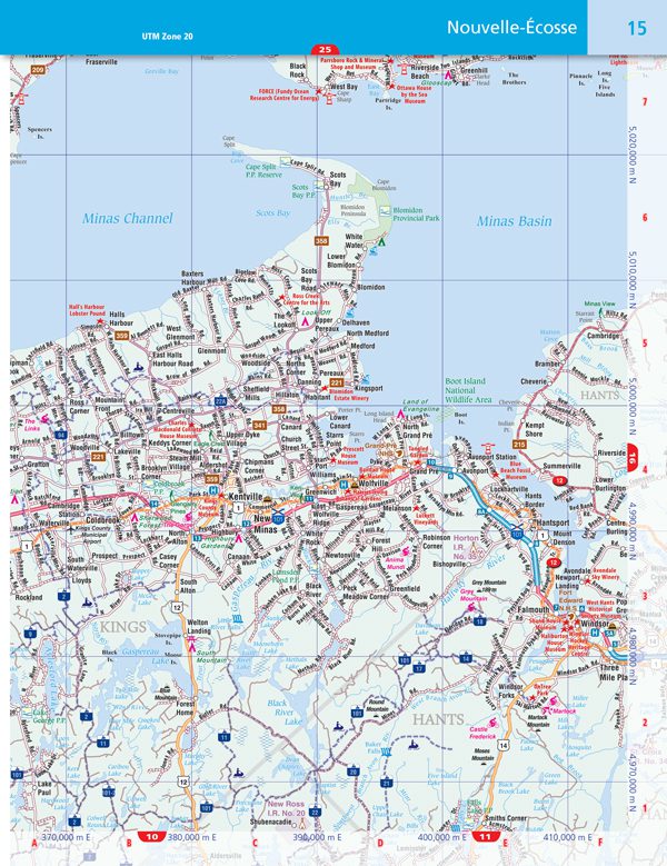
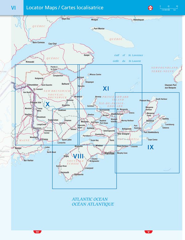
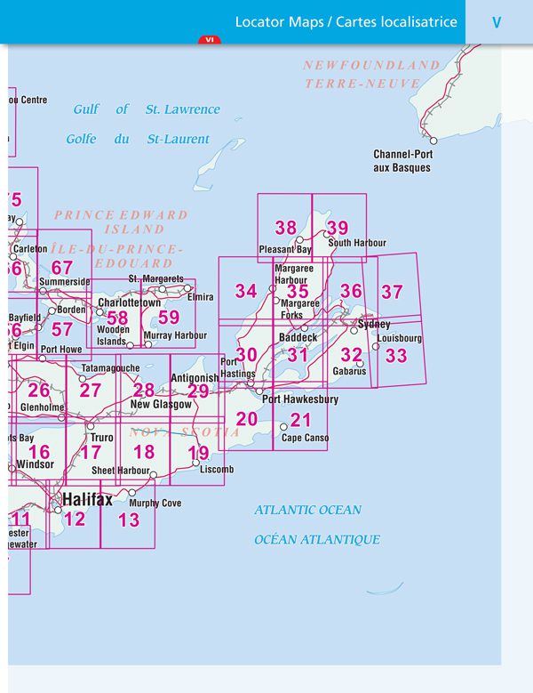
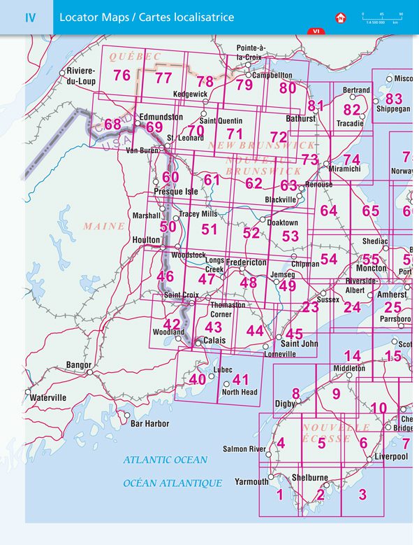
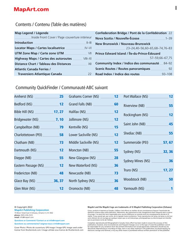
Inside this 120 page atlas you will find back road maps (1:250,000) of New Brunswick, Nova Scotia and Prince Edward Island, locator maps, UTM zone map, highway maps, distance chart, Atlantic Canada ferry information, Confederation bridge information, scenic routes, community index and road index.
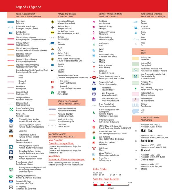
The regional maps features include expressways, interchanges, exit numbers, divided primary highways, primary highways, divided secondary highways, secondary highways, unpaved primary highways, unpaved secondary highways, county/regional/municipal roads, paved and unpaved roads, unimproved roads, seasonal roads, Trans-Canada highway, Interstate highways, airports, VIA Rail stations, railways, ferries, RCMP, Québec police, police stations, hospitals, customs, tourist information centres, toll bridges, boundaries, time zones, rest areas, skiing, mountain biking, golf courses, wharfs, boat launch ramps, marinas, points of interest, landmarks, scenic routes, snowmobile trails, Trans-Canada Trail, campgrounds, UNESCO World Heritage sites, National Historic sites, bird watching, viewpoints/lookouts, lighthouses, whale watching, sugar shacks, rapids, waterfalls, beaches, peaks, national and provincial parks, bird sanctuaries, National Defence, Indian reserves, populations and more.
Saddlestitch bound
Dimensions: 21 x 28 cm (8.375 x 10.875 inches)
Edition: 2023
Proudly made in Canada!
| Region | |
|---|---|
| Map Type | Road atlas |
| Brand |