Additional information
| Region | |
|---|---|
| Map Type | Paper, Road |
| Brand |
5.95$
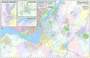
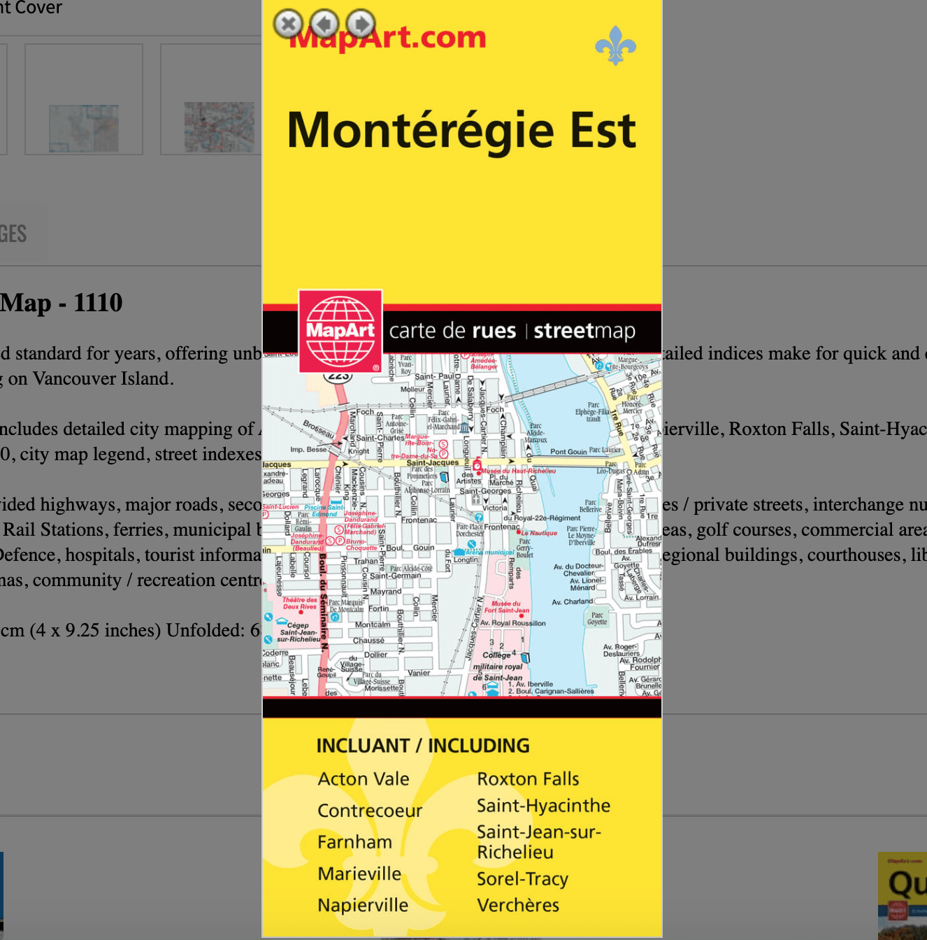
Montérégie Est Folded Map
061158011102
Folded maps have been the trusted standard for years, offering unbeatable accuracy and reliability at a great price. Detailed indices make for quick and easy location of destinations. It’s a must-have for anyone travelling on Vancouver Island.
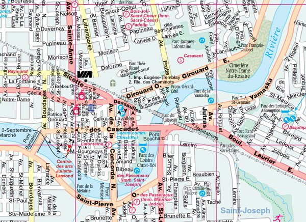
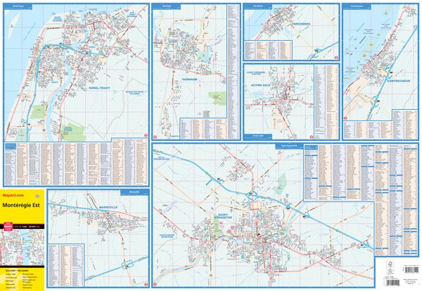
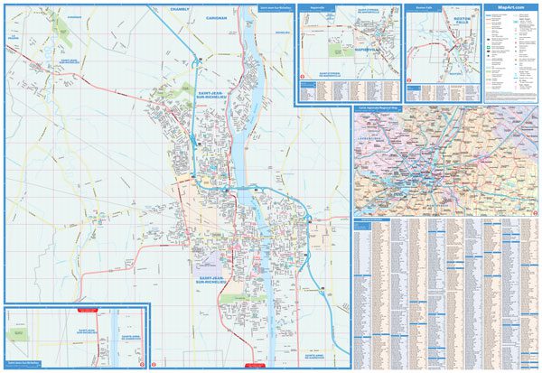
The Montérégie Est folded map includes detailed city mapping of Acton Vale, Contrecoeur, Farnham, Marieville, Napierville, Roxton Falls, Saint-Hyacinthe, Saint-Jean-sur-Richelieu, Sorel-Tracy, Verchères at 1:25,000, city map legend, street indexes and a regional map at 1:500,000.
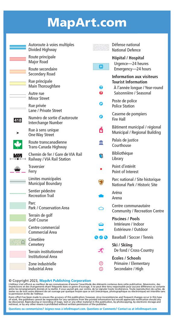
The city map features include divided highways, major roads, secondary roads, main thoroughfares, minor streets, lanes / private streets, interchange numbers, one way streets, Trans-Canada Highway, railways / VIA Rail Stations, ferries, municipal boundaries, recreation trails, parks / conservation areas, golf courses, commercial areas, cemeteries, institutional areas, industrial areas, National Defence, hospitals, tourist information centres, police stations, fire halls, municipal / regional buildings, courthouses, libraries, points of interest, national parks / historic sites, arenas, community / recreation centres, pools, baseball, soccer, tennis, skiing, schools.
Dimensions: Folded: 10.2 x 23.5 cm (4 x 9.25 inches) Unfolded: 68.6 x 99.7 cm (27 x 39.25 inches)
Edition: 2023
Proudly made in Canada!
Comprend une cartographie détaillée des villes d’Acton Vale, Contrecoeur, etc. et une carte régionale à l’échelle 1:500 000.
| Region | |
|---|---|
| Map Type | Paper, Road |
| Brand |