Additional information
| Region | |
|---|---|
| Map Type | Road atlas |
| Brand |
12.95$
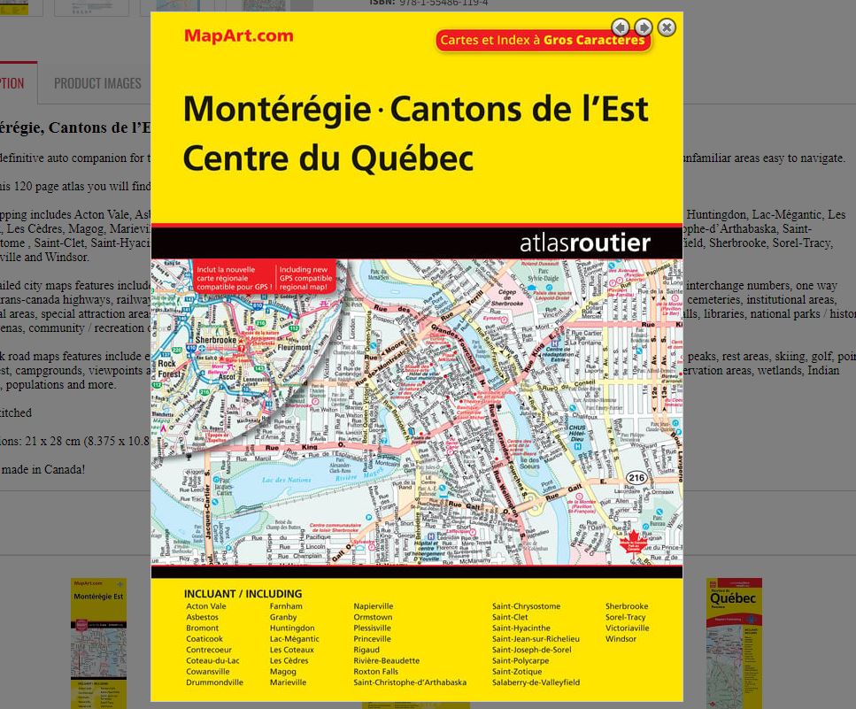
Montérégie, Cantons de l’Est, Centre du Québec
061158011195
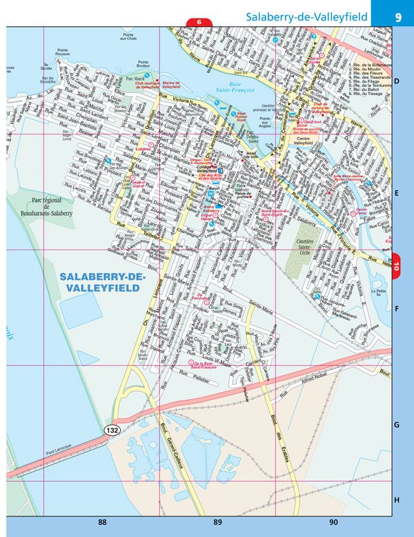
It’s the definitive auto companion for travel in this area, whether you are a resident or short-term visitor. It’s got all the features to make even the unfamiliar areas easy to navigate.
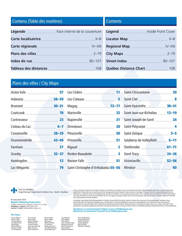
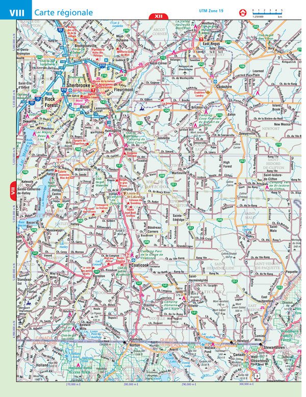
Inside this 120 page atlas you will find city maps (1:21,000), back road maps (1:250,000), locator maps, street index and a Québec distance chart.
City mapping includes Acton Vale, Asbestos, Bromont, Coaticook, Contrecoeur, Coteau-du-Lac, Cowansville, Drummondville, Farnham, Granby, Huntingdon, Lac-Mégantic, Les Coteaux, Les Cèdres, Magog, Marieville, Napierville, Ormstown, Plessisville, Princeville, Rigaud, Rivière-Beaudette, Roxton Falls , Saint-Christophe-d’Arthabaska, Saint-Chrysostome , Saint-Clet, Saint-Hyacinthe, Saint-Jean-sur-Richelieu, Saint-Joseph-de-Sorel, Saint-Polycarpe, Saint-Zotique, Salaberry-de-Valleyfield, Sherbrooke, Sorel-Tracy, Victoriaville and Windsor.
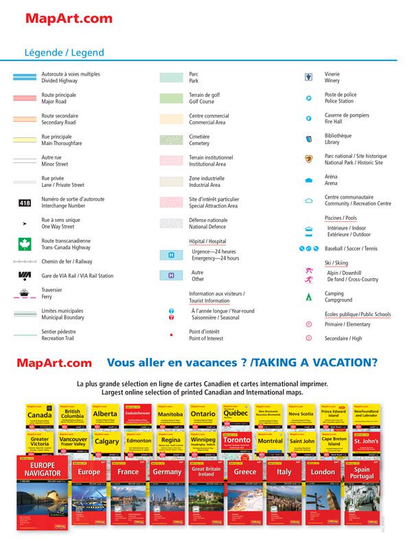
The detailed city maps features include divided highways, major roads, secondary roads, main thoroughfares, minor streets, lanes / private streets, interchange numbers, one way streets, trans-canada highways, railways, VIA Rail stations, ferries, municipal boundaries, recreation trails, parks, golf course s, commercial areas, cemeteries, institutional areas, industrial areas, special attraction areas, national defence, hospitals, tourist information centres, points of interest , wineries, police stations, fire halls, libraries, national parks / historic sites , arenas, community / recreation centres, pools, baseball, soccer, tennis, skiing, campgrounds and public schools
The back road maps features include expressways to unimproved roads, airports, hospitals, tourist information centres, rapids, waterfalls, beaches, peaks, rest areas, skiing, golf, points of interest, campgrounds, viewpoints and lookouts, National Historic Sites, UNESCO World Heritage Sites, national parks, provincial parks, conservation areas, wetlands, Indian reserves, populations and more.
Saddlestitched
Available to order. 2 weeks delay.
Dimensions: 21 x 28 cm (8.375 x 10.875 inches)
Edition: 2018
Proudly made in Canada!
| Region | |
|---|---|
| Map Type | Road atlas |
| Brand |