Montreal Region Wall Map – CartoGeo

114.00$

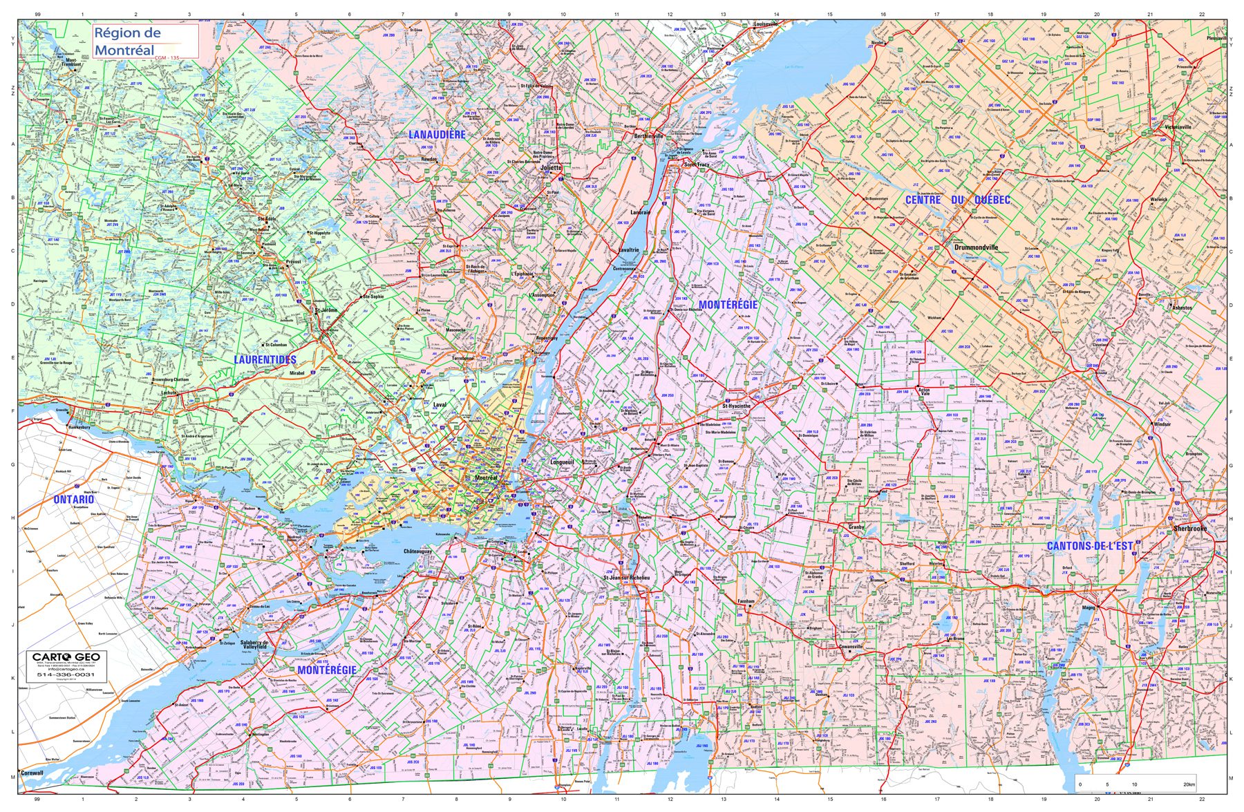
Montreal Region Wall Map – CartoGeo is a large regional map to give you an excellent overview of the Montreal region.

Description:

  • Covers Vaudreuil-Soulanges to Victoriaville from west to east
  • From Mont-Tremblant to the USA from north to south
  • Highly detailed shows roads and rows
  • Municipal boundaries
  • Demarcation of postal codes

Dimensions :

  • 69 x 42 po

Format:

  • Paper: cheaper but more fragile, Not recommended for schools and children. Best choice for framing or laminating.
  • Laminated: tear-resistant and waterproof. Possibility of writing and erasing on the card using permanent marker or non-permanent. The best choice for schools and children.
  • Mounting on rigid panel (lamination on wood or foamcore panel): please contact us to obtain an estimate.

Visit our Map Accessories page to maximize your experience with your new Montreal Island Wall Map – CartoGeo.

Additional information

Plastification

Paper, Plastic

Brand

Country

Language

English, French