Additional information
| Region | |
|---|---|
| Map Type | Road atlas |
| Brand |
29.95$
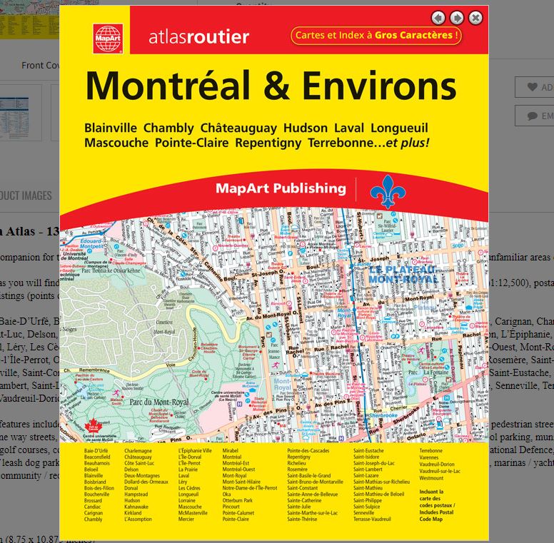
Montreal & Area Atlas
066770108834
It’s the definitive auto companion for travel in this area, whether you are a resident or short-term visitor. It’s got all the features to make even the unfamiliar areas easy to navigate.
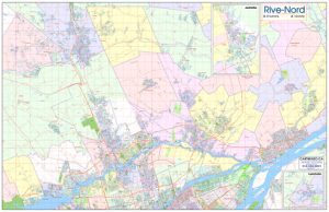
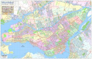
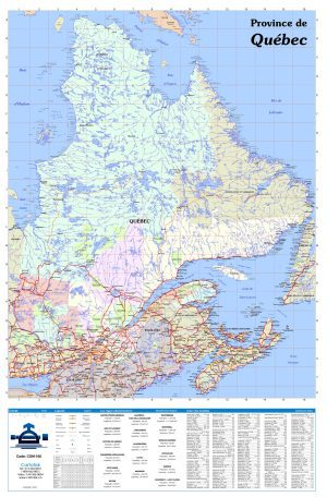
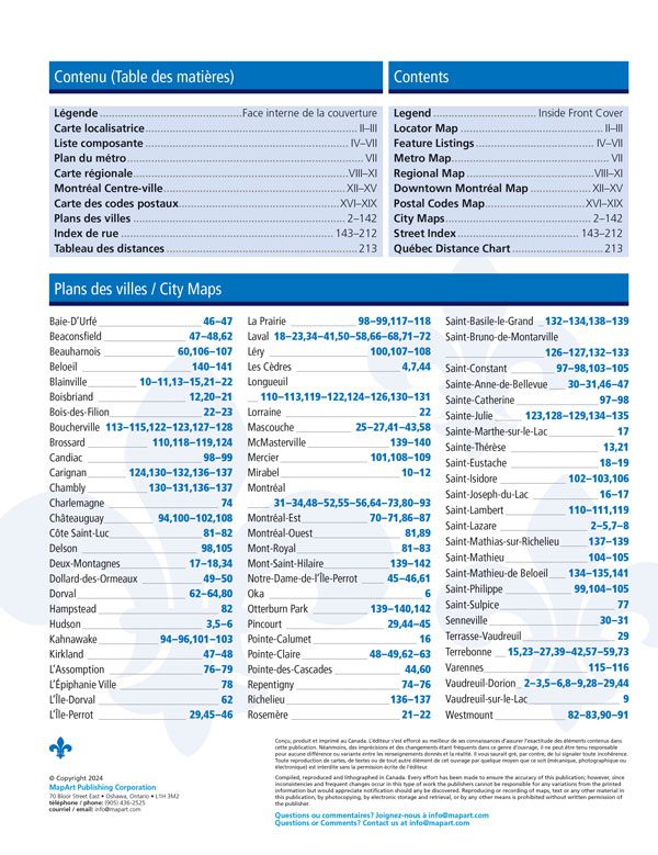
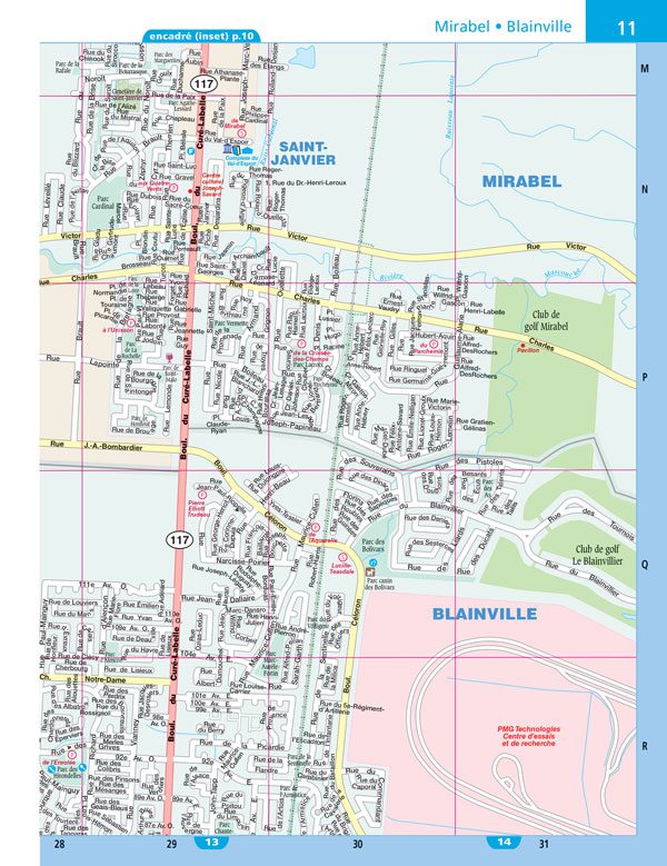
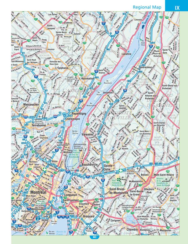
Inside this 232 page atlas you will find city maps (1:21,000), regional road maps (1:250,000), locator map, Metro map, downtown Montréal map )1:12,500), postal codes map, Québec distance chart, feature listings (points of interest, hospitals, golf clubs, post secondary schools, airports) and a street index.
City mapping includes Baie-D’Urfé, Beaconsfield, Beauharnois, Beloeil, Blainville, Boisbriand, Bois-des-Filion, Boucherville, Brossard, Candiac, Carignan, Chambly, Charlemagne, Châteauguay, Côte Saint-Luc, Delson, Deux-Montagnes, Dollard-des-Ormeaux, Dorval, Hampstead, Hudson, Kahnawake, Kirkland, L’Assomption, L’Épiphanie, L’Île-Dorval, L’Île-Perrot, La Prairie, Laval, Léry, Les Cèdres, Longueuil, Lorraine, Mascouche, McMasterville, Mercier, Mirabel, Montréal, Montréal-Est, Montréal-Ouest, Mont-Royal, Mont-Saint-Hilaire, Notre-Dame-de-l’Île-Perrot, Oka, Otterburn Park, Pincourt, Pointe-Calumet, Pointe-Claire, Pointe-des-Cascades, Repentigny, Richelieu, Rosemère, Saint-Basile-le-Grand, Saint-Bruno-de-Montarville, Saint-Constant, Sainte-Anne-de-Bellevue, Sainte-Catherine, Sainte-Julie, Sainte-Marthe-sur-le-Lac, Sainte-Thérèse, Saint-Eustache, Saint-Isidore, Saint-Joseph-du-Lac, Saint-Lambert, Saint-Lazare, Saint-Mathias-sur-Richelieu, Saint-Mathieu, Saint-Mathieu-de Beloeil, Saint-Philippe, Saint-Sulpice, Senneville, Terrasse-Vaudreuil, Terrebonne, Varennes, Vaudreuil-Dorion, Vaudreuil-sur-le-Lac and Westmount.
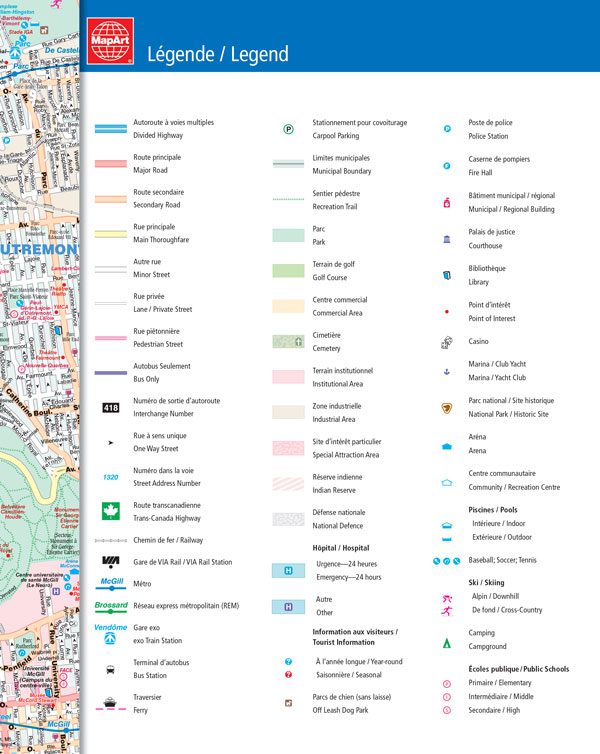
The detailed city maps features include divided highways, major roads, secondary roads, main thoroughfares, minor streets, lanes / private streets, pedestrian streets, bus only, interchange numbers, one way streets, street address numbers, Trans-Canada Highway, railways, VIA Rail stations, Métro, gare exo, ferries, carpool parking, municipal boundaries, recreation trails, parks, golf courses, commercial areas, cemeteries, institutional areas, industrial areas, special attraction areas, Indian Reserves, National Defence, hospitals, tourist information centres, off leash dog parks, police stations, fire halls, municipal / regional buildings, courthouses, libraries, points of interest, casinos, marinas / yacht clubs, national parks / historic sites, arenas, community / recreation centres, pools, baseball, soccer, tennis, skiing, campgrounds, public schools.
Wire-O bound
Dimensions: 22 x 28 cm (8.75 x 10.875 inches)
Edition: 2020
Proudly made in Canada!