Additional information
| Region | |
|---|---|
| Map Type | Paper, Road |
| Brand |

7.95$
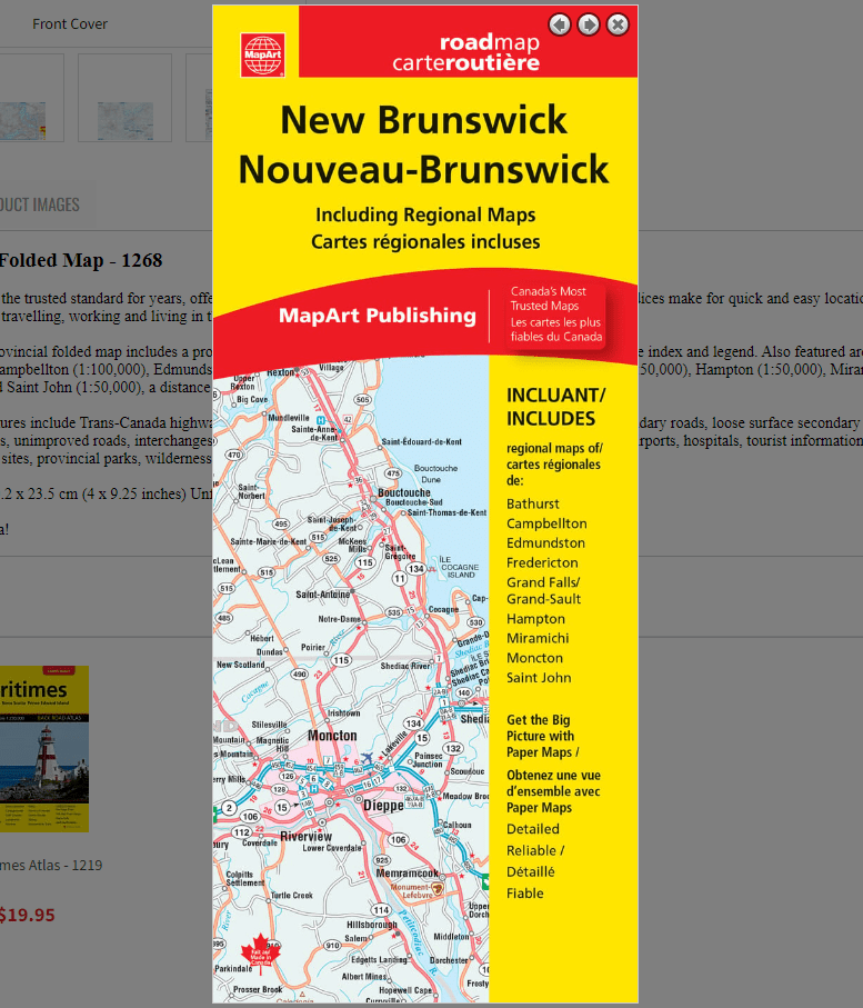
New Brunswick Folded Map
0-61158-01268-0
Folded maps have been the trusted standard for years, offering unbeatable accuracy and reliability at a great price. Detailed indices make for quick and easy location of destinations. It’s a must-have for anyone travelling, working and living in the province of New Brunswick.
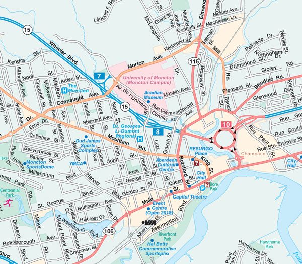
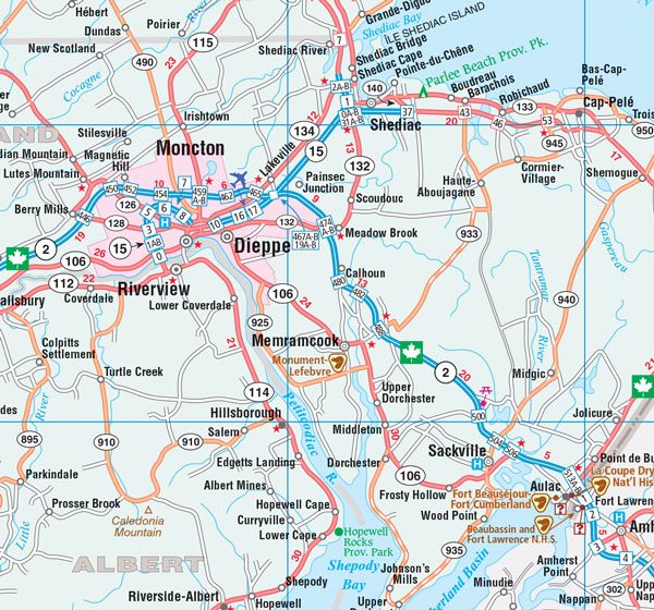
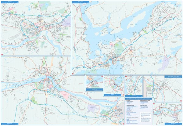
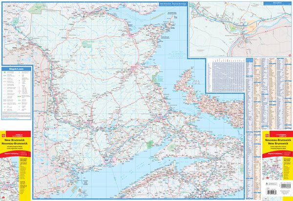
The New Brunswick Provincial folded map includes a provincial map of New Brunswick at 1:600,000 along with a place name index and legend. Also featured are municipal maps of Bathurst (1:100,000), Campbellton (1:100,000), Edmundston (1:50,000), Fredericton (1:46,300), Grand Falls / Grand-Sault (1:50,000), Hampton (1:50,000), Miramichi (1:100,000), Moncton (1:50,000) and Saint John (1:50,000), a distance chart and ferry information.
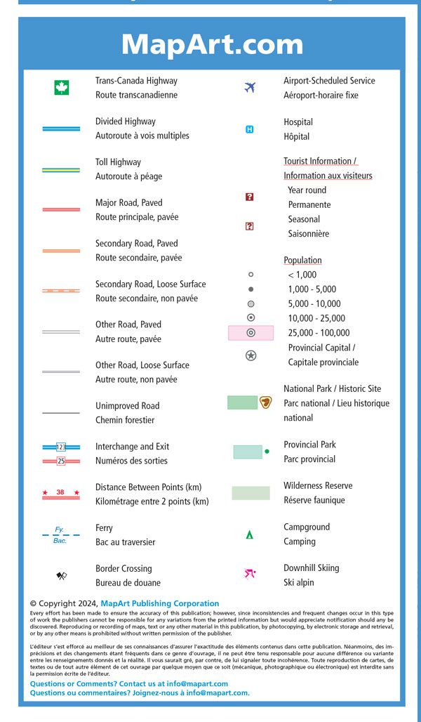
The provincial map features include Trans-Canada highway, divided highways, toll highways, paved major roads, paved secondary roads, loose surface secondary roads, paved and loose surface other roads, unimproved roads, interchanges and exits, distance between points (km), ferries, border crossings, airports, hospitals, tourist information centres, populations, national parks / historic sites, provincial parks, wilderness reserves, campgrounds and downhill skiing.
Dimensions:
Folded: 10.2 x 23.5 cm (4 x 9.25 inches)
Unfolded: 68.6 x 99.7 cm (27 x 39.25 inches)
Edition: 2024
Proudly made in Canada!
| Region | |
|---|---|
| Map Type | Paper, Road |
| Brand |