Additional information
| Region | |
|---|---|
| Map Type | Paper, Road |
| Brand |
7.95$
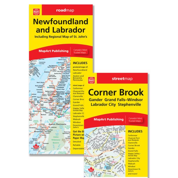
Newfoundland and Labrador / Corner Brook Folded Map
Folded maps have been the trusted standard for years, offering unbeatable accuracy and reliability at a great price. Detailed indices make for quick and easy location of destinations. It’s a must-have for anyone travelling, working and living in Newfoundland and Labrador.
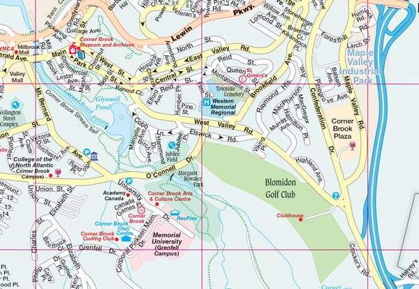
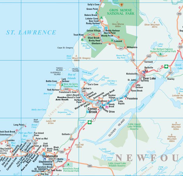
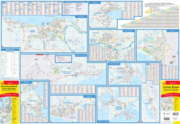
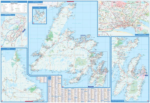
The folded map of Newfoundland and Labrador /Cornerbrook includes provincial maps of Newfoundland (1:984,500) and Labrador (1:3,000,000), an inset map of Avalon and Bonavista peninsulas (1:550,000) and community index. Detailed city maps at 1:25,000 of Carbonear, Channel – Port aux Basques, Clarenville, Corner Brook, Gander, Happy Valley – Goose Bay, Labrador City / Wabush, Stephenville, Windsor and their corresponding street indexes is also included. Other features are a detailed downtown St. John’s map at 1:15,000, ferry information and an Atlantic Canada distance chart.
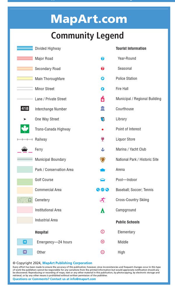
The detailed city mapping features include divided highways, major roads, secondary roads, main thoroughfares, minor streets, lanes / private streets, interchange numbers, one way streets, Trans-Canada Highway, railways, ferries, municipal boundaries, parks / conservation areas, golf courses, commercial areas, cemeteries, institutional areas, industrial areas, hospitals, tourist information centres, police stations, fire halls, municipal / regional buildings, courthouses, libraries, points of interest, liquor stores, marinas / yacht clubs, national parks / historic sites, arenas, pools, baseball, soccer, tennis, cross-country skiing, campgrounds, public schools.
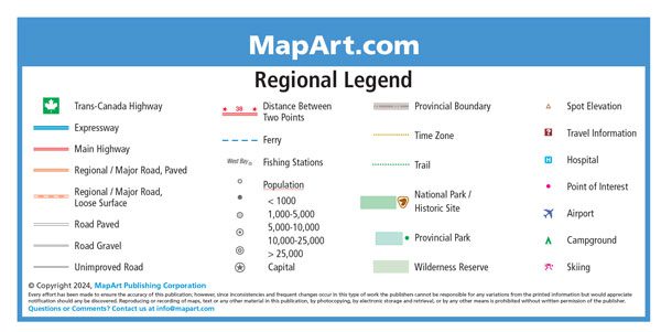
The regional map features include Trans-Canada highway , expressways, main highways, paved regional / major roads, loose surface regional / major roads, paved and gravel s, unimproved roads, distance between two points, ferries, fishing stations, populations, capitals, provincial boundaries, time zones, trails, national parks / historic sites, provincial parks, wilderness reserves, spot elevations, travel information centres, hospitals, points of interest, airports, campgrounds and skiing.
Dimensions: Folded: 10.2 x 23.5 cm (4 x 9.25 inches) Unfolded: 68.6 x 99.7 cm (27 x 39.25 inches)
Edition: 2024
Looking for a book for this region? Have a look here!
Proudly made in Canada!
9781554863013
061158013014
| Region | |
|---|---|
| Map Type | Paper, Road |
| Brand |