North America Wall Map – Political

39.95$54.95$

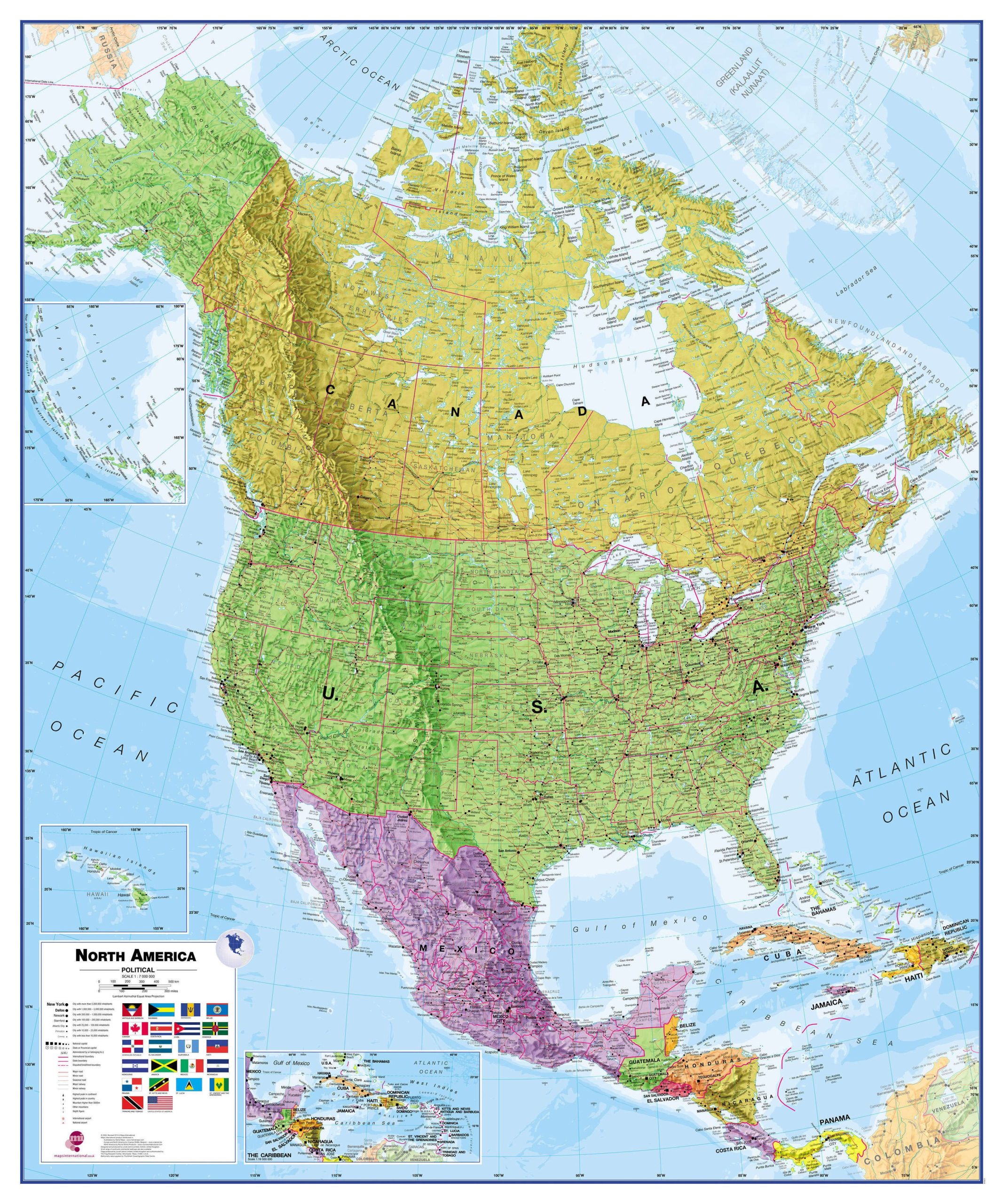
North America Wall Map – Political clearly covers a huge expanse of land, stretching from Alaska and Canada through the United States down to Mexico, Central America and the Caribbean.

Description:
  • This political map of North America shows countries in different colors, international boundaries and major transportation networks.
  • The North America wall map also has a panel with the flags of the countries in North America.
  • Details include city populations, capital cities and all major towns and cities in North America.
  • The map’s shaded relief for land and sea makes it easier to see the mountain ranges. The shaded relief gives it life
Dimensions:
  • 47 1/4 x 39 1/2 in
  • 120 cm X 99 cm
Format:
  • Paper: cheaper but more fragile, Not recommended for schools and children. Best choice for framing or laminating.
  • Laminated: tear-resistant and waterproof. Possibility of writing and erasing on the card using permanent marker or not. The best choice for schools and children.
    Mounting on rigid panel (lamination on wood or foamcore panel): please contact us to obtain an estimate.

Visit our Map Accessories page to maximize your experience with your new map.

Additional information

Brand

Language

English

Plastification

Paper, Plastic

Country

, , , , , , , , , , , , ,