Additional information
| Plastification | Paper, Plastic |
|---|---|
| Brand | |
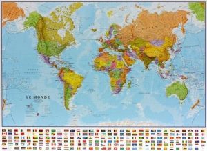
| Language | English, French |
| Region |
Price range: 29.95$ through 44.95$
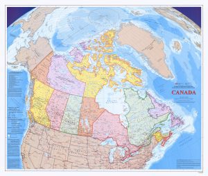
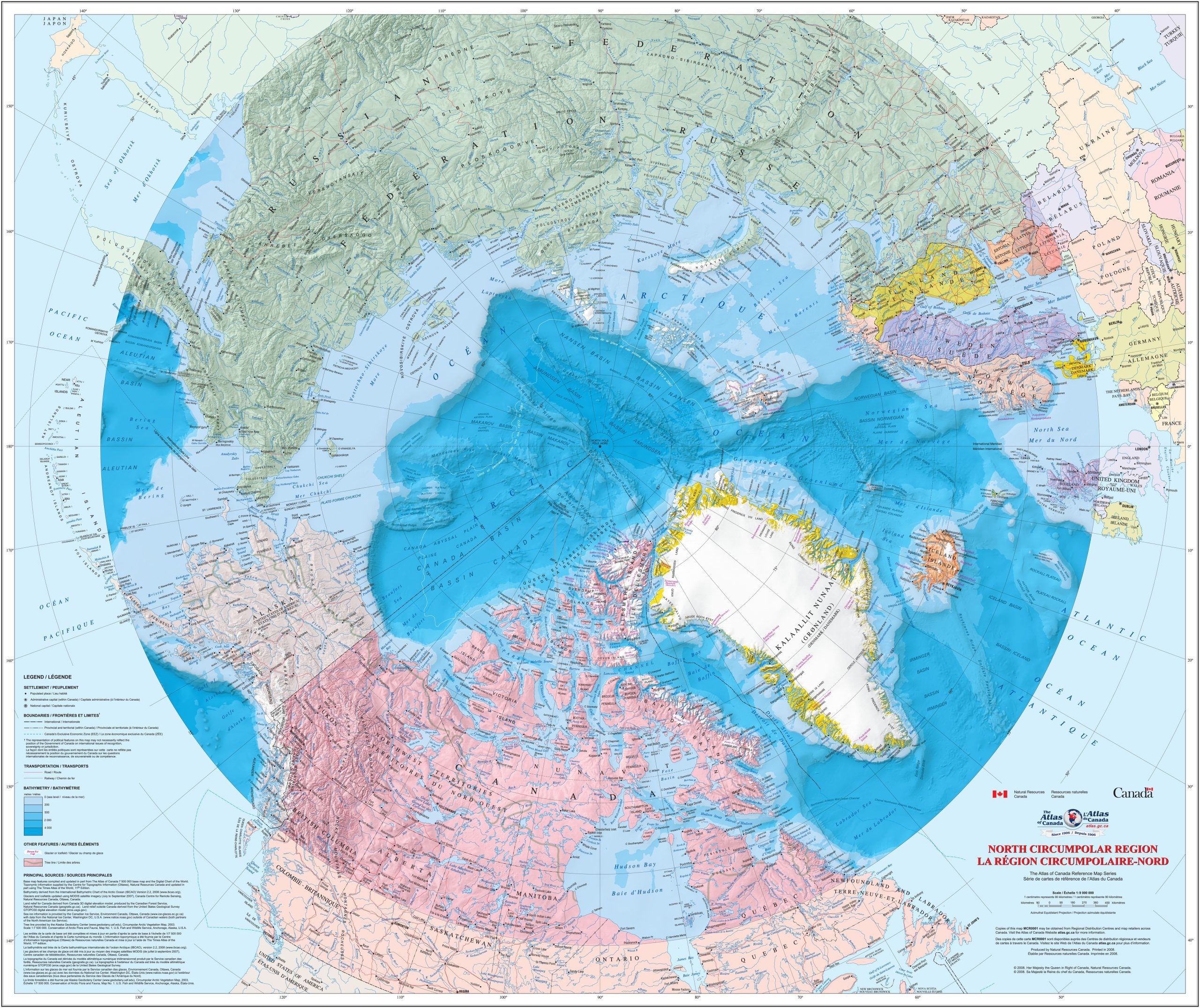
This North Circumpolar Region – Wall Map (MCR0001) is the latest publication in the Atlas of Canada Reference Map Series. This bilingual map at a scale of 1:9 000 000 shows the geography of the northern circumpolar region, north of approximately 55 degrees latitude. The map uses the azimuthal equidistant projection. All international boundaries, as well as the Canadian provincial and territorial boundaries and Canada’s 200 nautical mile offshore exclusive economic zone are displayed on the map. National capital cities, other cities, towns, villages and hamlets along with some seasonally populated places are also shown. The map identifies a number of significant northern features, including the median sea ice extent from September 1981 to 2010, the tree line, undersea relief, land relief, the Magnetic North Pole, glaciers, ice fields and coastal ice shelves. Many of the physiographic and hydrographic features are also labelled.
Description:
Dimensions :
Format:
Visit our Map Accessories page to maximize your experience with your new North Circumpolar Region – Wall Map.
| Plastification | Paper, Plastic |
|---|---|
| Brand | |
| Language | English, French |
| Region |