Additional information
| Country | |
|---|---|
| Region | |
| Map Type |
19.95$
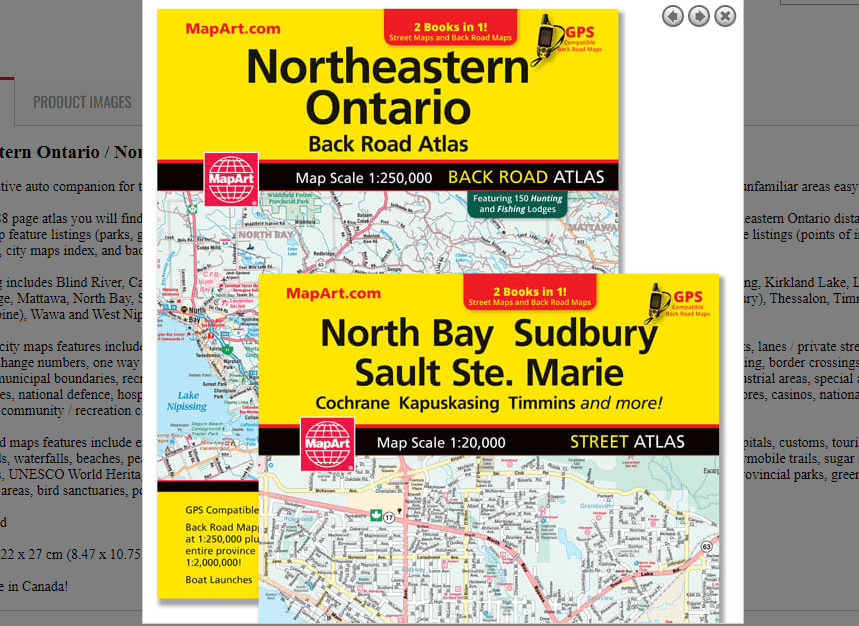
Northeastern Ontario / North Bay, Sudbury, Sault Ste. Marie Atlas
0-61158-01166-9
It’s the definitive auto companion for travel in this area, whether you are a resident or short-term visitor. It’s got all the features to make even the unfamiliar areas easy to navigate.
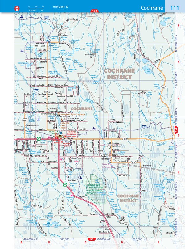
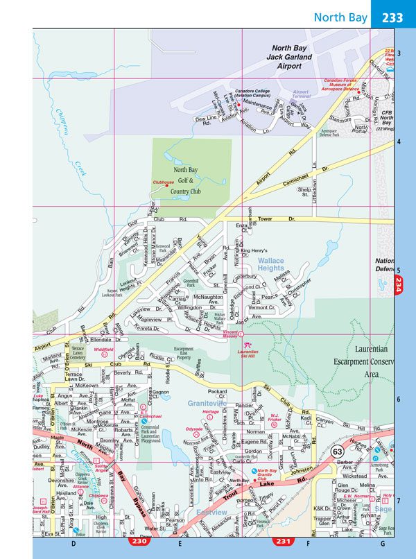
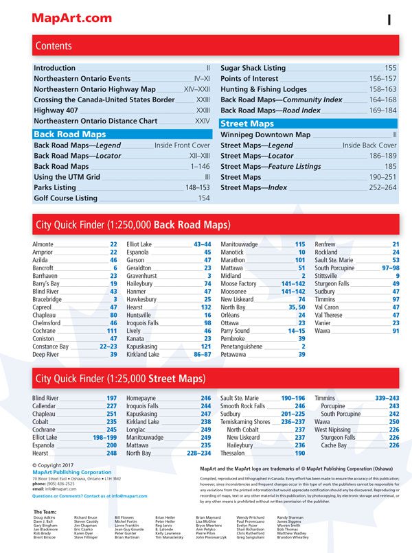
Inside this 288 page atlas you will find city maps (1:20,000), back road maps (1:250,000), locator maps, northeastern Ontario highway map, northeastern Ontario distance chart, backroad map feature listings (parks, golf, sugar shacks, points of interest, hunting and fishing lodges), Winnipeg downtown map, city map feature listings (points of interest, hospitals, golf courses), city maps index, and back road maps community and road indexes.
City mapping includes Blind River, Callendar, Chapleau, Cobalt, Cochrane, Elliot Lake, Espanola, Hearst, Hornepayne, Iroquois Falls, Kapuskasing, Kirkland Lake, Longlac, Manitouwadge, Mattawa, North Bay, Sault Ste. Marie, Smooth Rock Falls, Sudbury, Temiskaming Shores (North Cobalt, New Liskeard, Haileybury), Thessalon, Timmins (Porcupine, South Porcupine), Wawa and West Nipissing (Sturgeon Falls, Cache Bay)
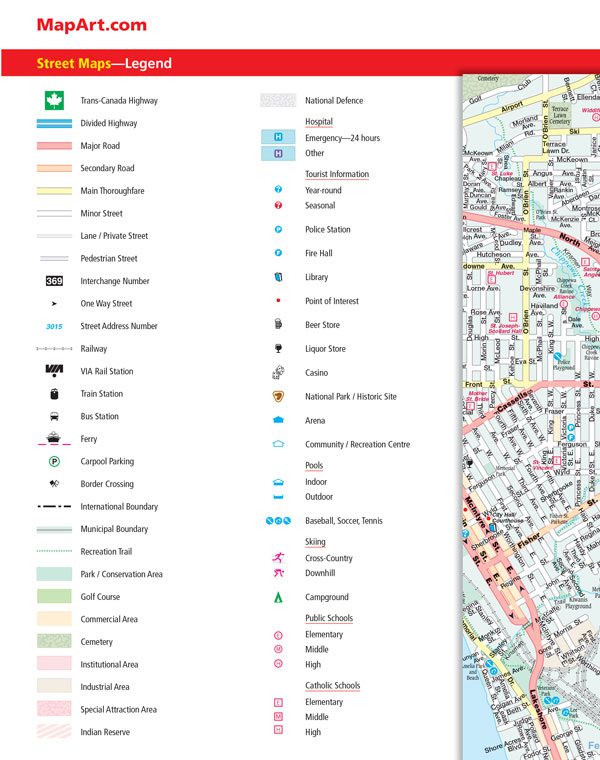
The detailed city maps features include Trans-Canada highway, divided highways, major roads, secondary roads, main thoroughfares, minor streets, lanes / private streets, pedestrian streets, interchange numbers, one way streets, street address numbers, railways, VIA Rail stations, train stations, bus stations, ferries, carpool parking, border crossings, international boundaries, municipal boundaries, recreation trails, parks / conservation areas, golf courses, commercial areas, cemeteries, institutional areas, industrial areas, special attraction areas, Indian reserves, national defence, hospitals, tourist information centres, police stations, fire halls, libraries, points of interest, beer stores, liquor stores, casinos, national parks / historic sites, arenas, community / recreation centres, pools, baseball, soccer, tennis, skiing, campgrounds, public and catholic schools
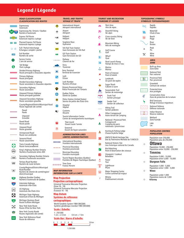
The back road maps features include expressways to seasonal roads, airports, train stations, ferries, locks, lock numbers, OPP, Québec Police, hospitals, customs, tourist information centres, rapids, waterfalls, beaches, peaks, mines, rest areas, skiing, golf, mountain biking, wharfs, boat launches, marinas, points of interest, snowmobile trails, sugar shacks, campgrounds, UNESCO World Heritage sites, National Historic sites, bird watching, viewpoints/looksouts, lighthouses, wineries, National and Provincial parks, greenbelts, conservation areas, bird sanctuaries, populations and more.
Wire-O bound
Dimensions: 22 x 27 cm (8.47 x 10.75 inches)
Edition: 2017
Proudly made in Canada!