Additional information
| Region | |
|---|---|
| Map Type | Paper, Road atlas |
| Brand |
7.95$
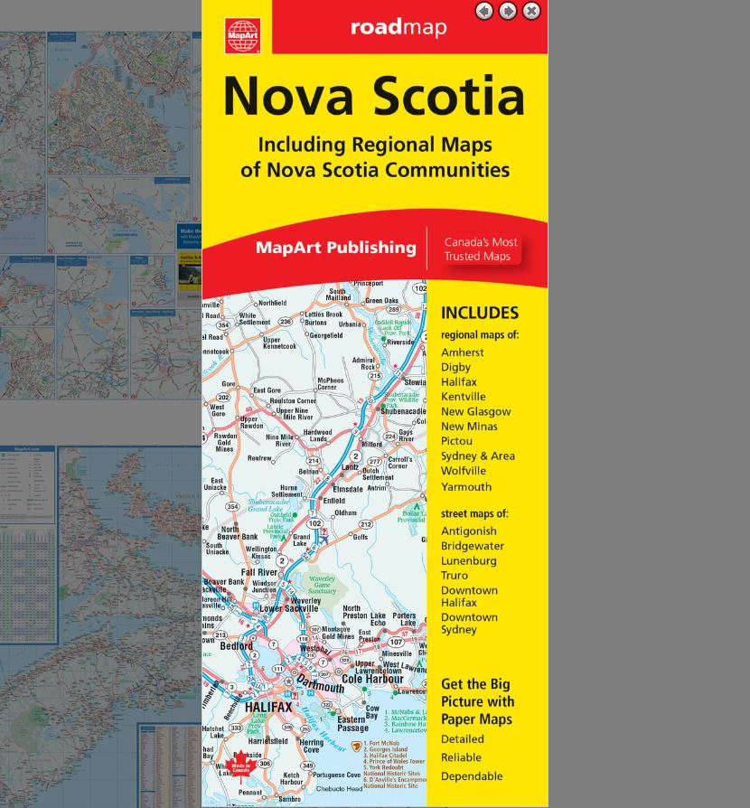
Nova Scotia Folded Map
9781554862313
Folded maps have been the trusted standard for years, offering unbeatable accuracy and reliability at a great price. Detailed indices make for quick and easy location of destinations. It’s a must-have for anyone travelling, working and living in Nova Scotia.
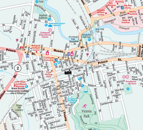
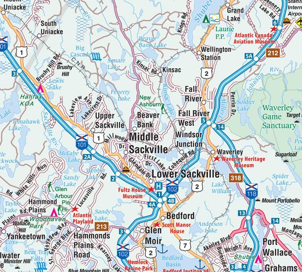
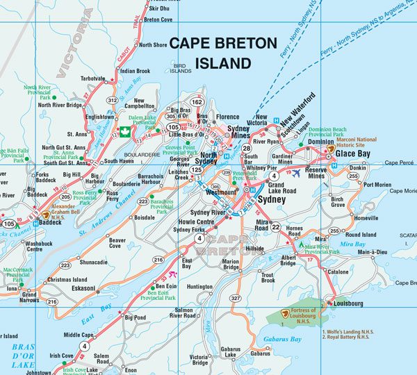
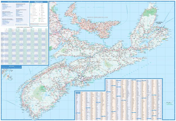
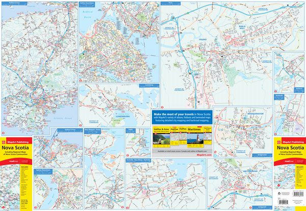
The Nova Scotia provincial folded map features a provincial map at a scale of 1:600,000 along with a legend and community index, regional maps at 1:250,000 of Halifax & Area, Sydney & Area, detailed city maps at 1:25,000 of Halifax downtown, Sydney downtown, Antigonish, Bridgewater, Lunenburg and Truro, regional maps of Amherst, Digby, Kentville, New Glasgow, New Minas, Pictou, Wolfville and Yarmouth, an Atlantic Canada distance chart and Nova Scotia ferry information.
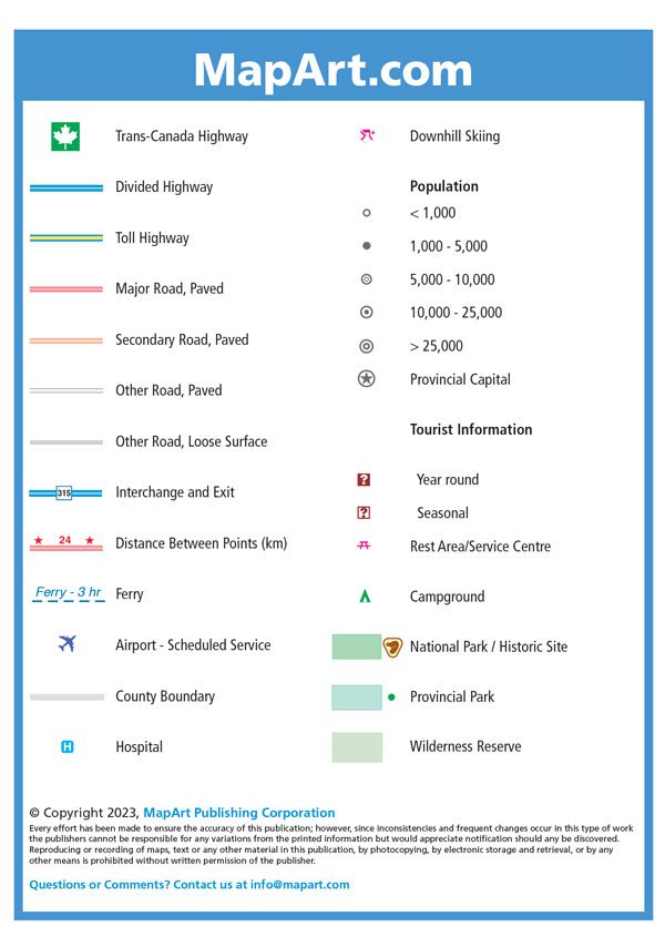
The detailed provincial map features include Trans-Canada highway, divided highways, toll highways, paved major roads, paved secondary roads, paved and loose surface other roads, interchanges and exits, distance between points (km), ferries, airports, county boundaries, hospitals, downhill skiing, populations, provincial capital, tourist information centres, rest areas/service centres, campgrounds, national parks / historic sites, provincial parks and wilderness reserves.
Dimensions:
Folded: 10.2 x 23.5 cm (4 x 9.25 inches)
Unfolded: 68.6 x 99.7 cm (27 x 39.25 inches)
Edition: 2023
Proudly made in Canada!
| Region | |
|---|---|
| Map Type | Paper, Road atlas |
| Brand |