Additional information
| Region | |
|---|---|
| Map Type | Paper, Road |
| Brand |
6.95$
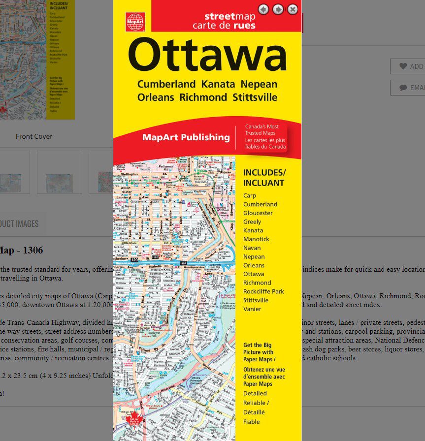
Ottawa Folded Map
061158013069
Folded maps have been the trusted standard for years, offering unbeatable accuracy and reliability at a great price. Detailed indices make for quick and easy location of destinations. It’s a must-have for anyone travelling in Ottawa.
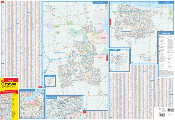
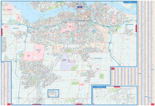
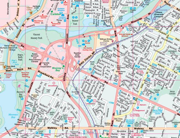
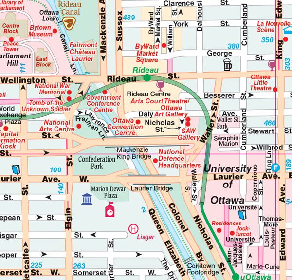
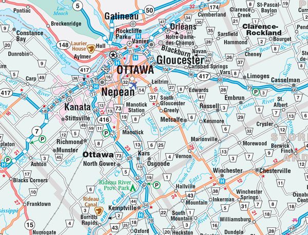
This folded map includes detailed city maps of Ottawa (Carp, Cumberland, Gloucester, Greely, Kanata, Manotick, Navan, Nepean, Orleans, Ottawa, Richmond, Rockcliffe Park, Stittsville, Vanier) at 1:35,000, downtown Ottawa at 1:20,000, a regional map of the Ottawa area at 1:900,000, a map legend and detailed street index.
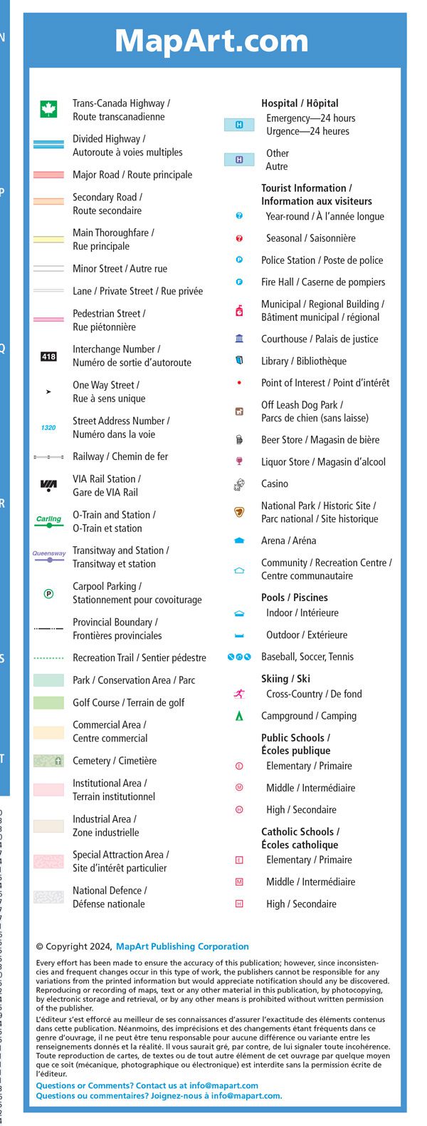
City map features include Trans-Canada Highway, divided highways, major roads, secondary roads, main thoroughfares, minor streets, lanes / private streets, pedestrian streets, interchange numbers, one way streets, street address numbers, railways, VIA Rail stations, O-Train and stations, Transitway and stations, carpool parking, provincial boundaries, recreation trails, parks / conservation areas, golf courses, commercial areas, cemeteries, institutional areas, industrial areas, special attraction areas, National Defence, hospitals, tourist information centres, police stations, fire halls, municipal / regional buildings, courthouses, libraries, points of interest, off leash dog parks, beer stores, liquor stores, casinos, national parks / historic sites, arenas, community / recreation centres, pools, baseball, soccer, tennis, skiing, campgrounds, public and catholic schools.
Dimensions:
Folded: 10.2 x 23.5 cm (4 x 9.25 inches)
Unfolded: 68.6 x 99.7 cm (27 x 39.25 inches)
Edition: 2024
Proudly made in Canada!