Additional information
| Brand | |
|---|---|
| Language | French |
| Region | |
| Plastification | Paper, Plastic |
Price range: 59.95$ through 69.95$
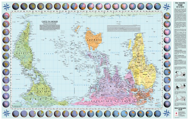
Peter’s upside down world centered on the Pacific. The world seen from another angle. Peters’ projection, upside down, centered on the Pacific Ocean. This surface-true Peters projection English world map shows countries in relation to their relative sizes. You are challenged as a spectator because North and South are displayed upside down and the map is centered on the Pacific Ocean.
The Peters projection is a cartographic projection which, unlike the Mercator projection, allows the actual surface area of the continents to be taken into account. Indeed, the Mercator projection, because of the distortions, makes the countries and continents of the temperate and especially polar zones appear larger: in the Mercator projection, Greenland appears as large as the African continent, whereas it is 14 to 15 times smaller.
The Peters projection is an equivalent projection: it preserves the areas, and therefore maintains the proportion between the areas on the map and the real areas. Thus, the ratios between the areas of the countries on the map correspond to the ratio of their real areas (Africa appears 14 to 15 times larger than Greenland). But locally, this projection does not preserve the angles, which results in the deformation of the continents unlike the Mercator map.
Visit our Map Accessories page to maximize your experience with your new map.
| Brand | |
|---|---|
| Language | French |
| Region | |
| Plastification | Paper, Plastic |