Additional information
| Region | |
|---|---|
| Map Type | Paper, Road |
| Brand |
7.95$
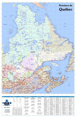
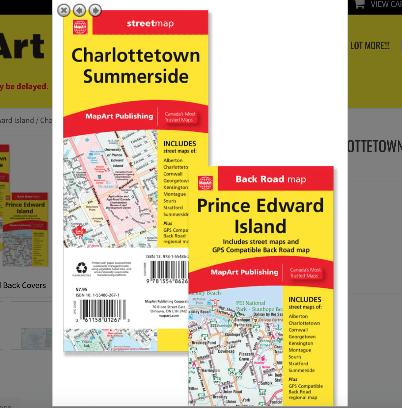
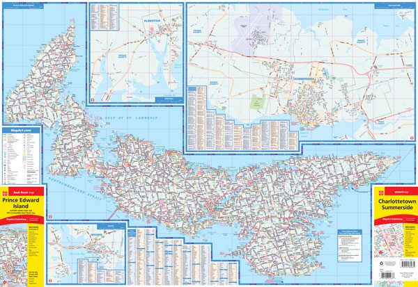
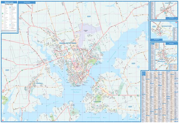
Prince Edward Island / Charlottetown Summerside Folded Map
Folded maps have been the trusted standard for years, offering unbeatable accuracy and reliability at a great price. Detailed indices make for quick and easy location of destinations. It’s a must-have for anyone travelling, working and living in Prince Edward Island.
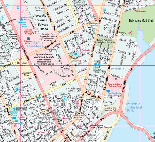
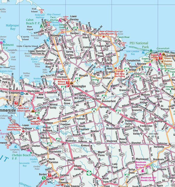
The folded map of Prince Edward Island / Charlottetown, Summerside includes detailed city mapping at 1:25,000 of Alberton, Charlottetown, Cornwall, Georgetown, Kensington, Montague, Souris, Stratford and Summerside, street indexes of each community, legend and a regional map of Prince Edward Island at 1:200,000 along with a community name index, legend, Prince Edward Island ferry information and bridge information.
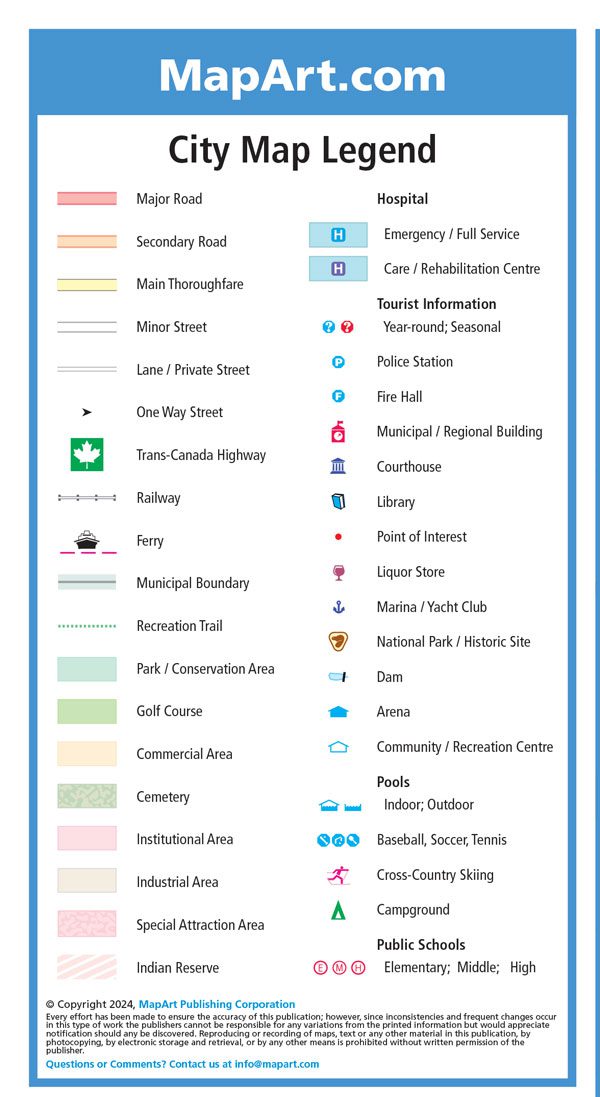
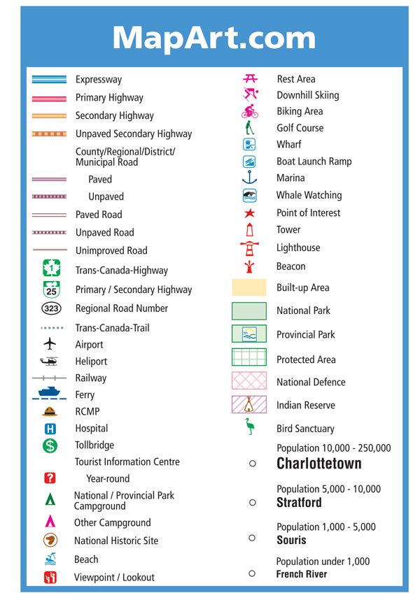
The detailed city map features include major roads, secondary roads, main thoroughfares, minor streets, lanes / private streets, one way streets, trans-canada highway, railways, bus stations, ferries, municipal boundaries, recreation trails, parks / conservation areas, golf courses, commercial areas, cemeteries, institutional areas, industrial areas, special attraction areas, Indian reserves, hospitals, tourist information centres, police stations, fire halls, libraries, points of interest, liquor stores, national parks / historic sites, dams, arenas, community / recreation centres, pools, baseball, soccer, tennis, cross-country skiing, campgrounds and public schools.
The detailed regional map features include expressways, primary highways, secondary paved and unpaved highways, paved and unpaved roads, unimproved roads, airports, railways, ferries, RCMP, hospitals, toll bridges, tourist information centres, national parks, provincial parks, campgrounds, National Historic sites, beaches, viewpoints/lookouts, rest areas, skiing, biking areas, golf courses, wharfs, boat launch ramps, marinas, whale watching, points of interest, towers, lighthouses, beacons, national parks, provincial parks, protected areas, National Defence, Indian reserves, bird sanctuaries, populations and more.
Edition: 2025
Proudly made in Canada!
061158012673
9781554862672
| Region | |
|---|---|
| Map Type | Paper, Road |
| Brand |