Additional information
| Region | |
|---|---|
| Map Type | Road atlas |
| Brand |
19.95$
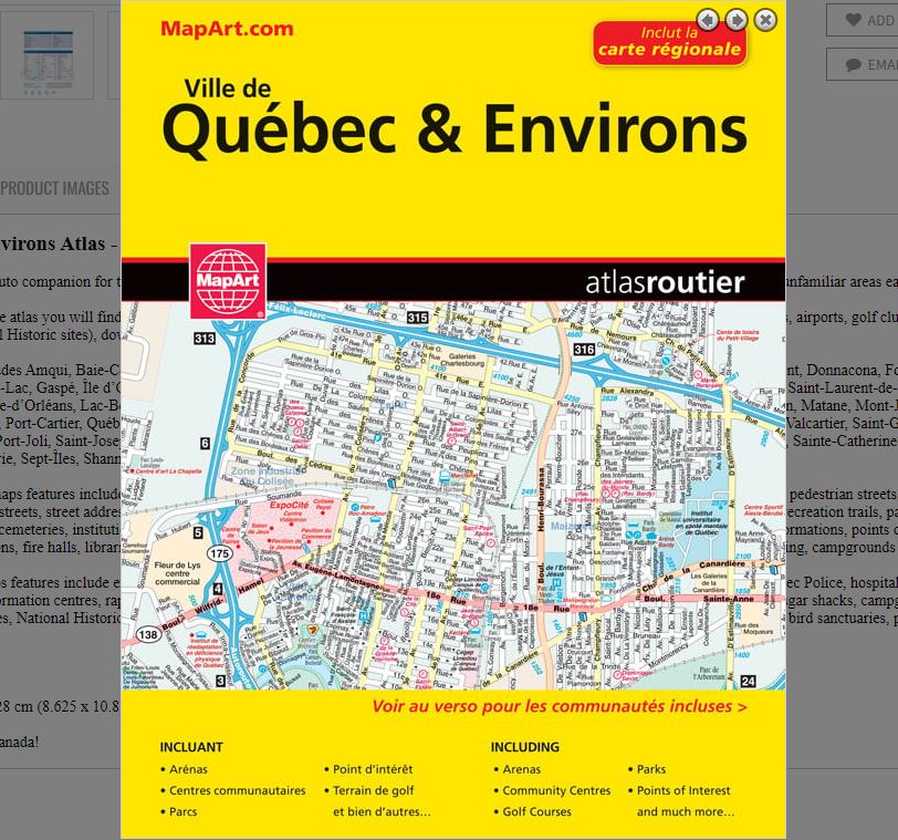
Québec & Environs Atlas
0-66770-20526-7
It’s the definitive auto companion for travel in this area, whether you are a resident or short-term visitor. It’s got all the features to make even the unfamiliar areas easy to navigate.
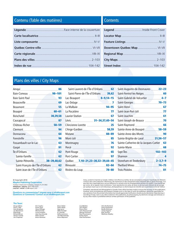
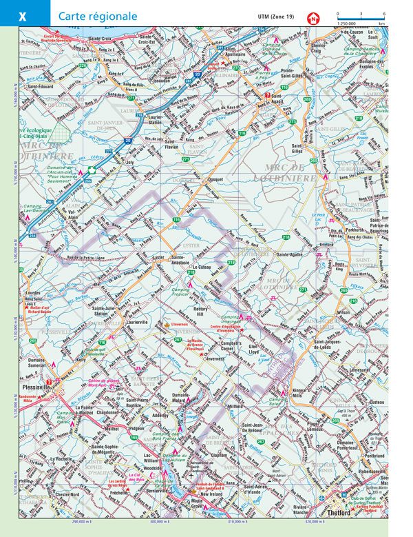
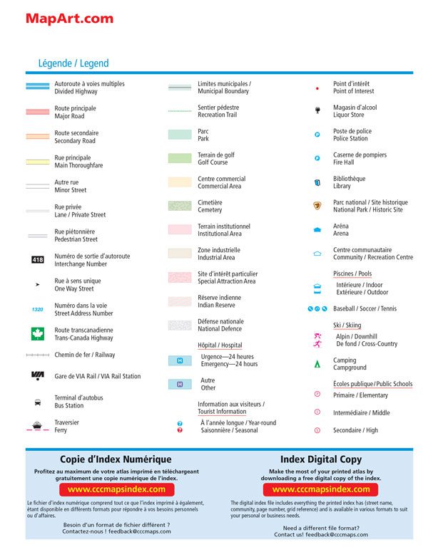
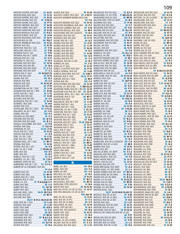
Inside this 152 page atlas you will find city maps (1:21,000), regional maps (1:250,000), locator maps, feature listings (points of interest, hospitals, airports, golf clubs, higher education, National Historic sites), downtown Québec City map and a street index.
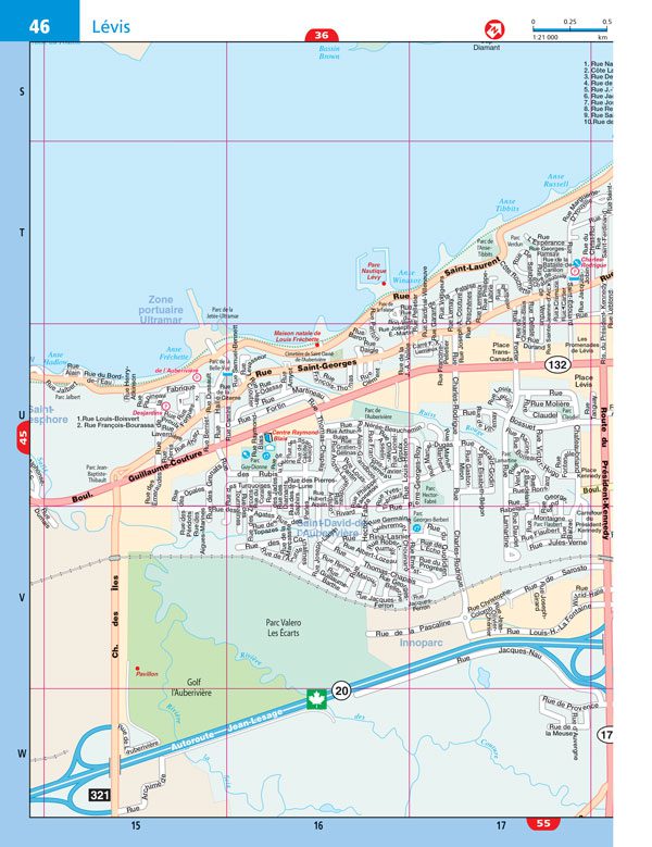
City mapping includes Amqui, Baie-Comeau, Baie-Saint-Paul, Beauceville, Beaumont, Beaupré, Boischatel, Causapscal, Château-Richer, Clermont, Donnacona, Forestville, Fossambault-sur-le-Lac, Gaspé, Île d’Orléans (Sainte-Famille, Sainte-Pétronille, Saint-François-de-l’Île-d’Orléans, Saint-Jean-de-l’Île-d’Orléans, Saint-Laurent-de-l’Île-d’Orléans, Saint-Pierre-de-l’Île-d’Orléans, Lac-Beauport, Lac-Delage, La Malbaie, La Pocatière, Laurier-Station, Lévis, L’Ancienne-Lorette, L’Ange-Gardien, Matane, Mont-Joli, Montmagny, Percé, Pont-Rouge, Port-Cartier, Québec, Rimouski, Rivière-du-Loup, Saint-Augustin-de-Desmaures, Saint-Ferréol-les-Neiges, Saint-Gabriel-de-Valcartier, Saint-Georges, Saint-Henri, Saint-Jean-Port-Joli, Saint-Joseph-de-Beauce, Saint-Raymond, Sainte-Anne-de Beaupré, Sainte-Anne-des-Monts, Sainte-Brigitte-de-Laval, Sainte-Catherine-de-la-Jacques-Cartier, Sainte-Marie, Sept-Îles, Shannon, Stoneham-et-Tewkesbury, Thetford Mines and Trois-Pistoles.
The detailed city maps features include divided highways, major roads, secondary roads, main thoroughfares, minor streets, lanes / private streets, pedestrian streets, interchange numbers, one way streets, street address numbers, Trans-Canada highway, railway, VIA Rail stations, bus stations, ferries, municipal boundaries, recreation trails, parks, golf courses, commercial areas, cemeteries, institutional areas, industrial areas, special attraction areas, Indian reserves, National Defence, hospitals, tourist informations, points of interest, liquor stores, police stations, fire halls, libraries, national parks / historic sites, arenas, community / recreation centres, pools, baseball, soccer, tennis, skiing, campgrounds and public schools.
The back road maps features include expressways to seasonal roads, scenic routes, airports, train stations, ferries, locks, lock numbers, OPP, Québec Police, hospitals, customs, service centres, tourist information centres, rapids, waterfalls, beaches, peaks, rest areas, skiing, golf, wharfs, boat launches, marinas, points of interest, sugar shacks, campgrounds, UNESCO World Heritage sites, National Historic sites, bird watching, viewpoints/looksouts, lighthouses, National and Provincial parks, conservation areas, bird sanctuaries, populations and more.
Wire-O bound
Dimensions: 22 x 28 cm (8.625 x 10.875 inches)
Edition: 2018
Proudly made in Canada!
| Region | |
|---|---|
| Map Type | Road atlas |
| Brand |