Additional information
| Region | |
|---|---|
| Map Type | Paper, Road |
| Brand |
5.95$
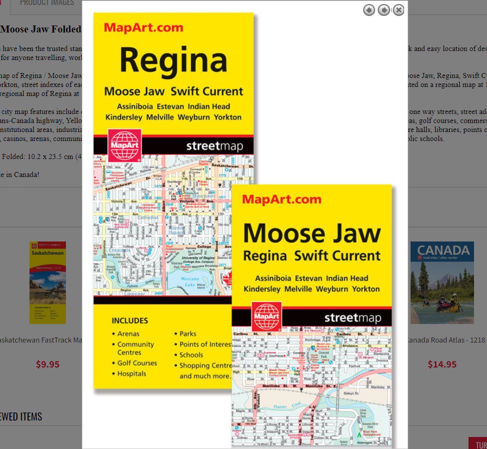
Regina / Moose Jaw Folded Map
061158011683
Folded maps have been the trusted standard for years, offering unbeatable accuracy and reliability at a great price. Detailed indices make for quick and easy location of destinations. It’s a must-have for anyone travelling, working and living in the province of Saskatchewan.
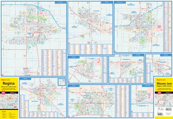
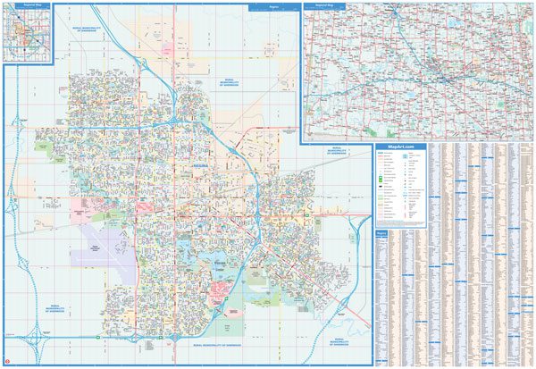
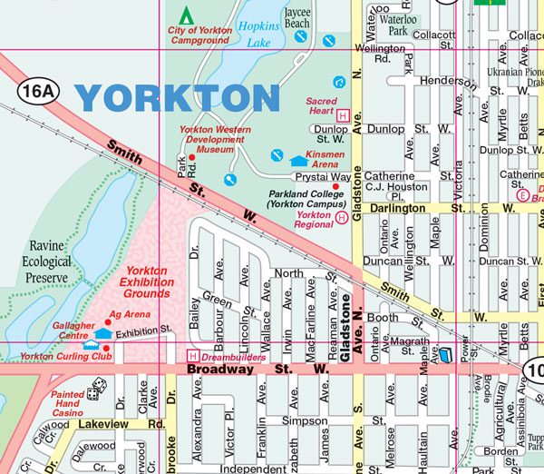
The folded map of Regina / Moose Jaw includes detailed city mapping at 1:25,000 of Assiniboia, Estevan, Indian Head, Kindersley, Melville, Moose Jaw, Regina, Swift Current, Weyburn, Yorkton, street indexes of each community, legend and the southern portion of Saskatchewan from Saskatoon to the Canada is represented on a regional map at 1:1,500,000, and another regional map of Regina at 1:250,000 is also included.
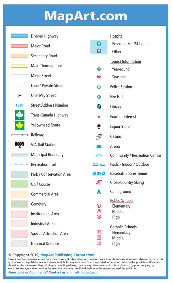
The detailed city map features include divided highways, major roads, secondary roads, main thoroughfares, minor streets, lanes / private streets, one way streets, street address numbers, Trans-Canada highway, Yellowhead Route, railways, VIA Rail stations, municipal boundaries, recreation trails, parks / conservation areas, golf courses, commercial areas, cemeteries, institutional areas, industrial areas, special attraction areas, National Defence, hospitals, tourist information centres, police stations, fire halls, libraries, points of interest, liquor stores, casinos, arenas, community / recreation centres, pools, baseball, soccer, tennis, cross-country skiing, campgrounds, public and catholic schools.
Dimensions:
Folded: 10.2 x 23.5 cm (4 x 9.25 inches)
Unfolded: 68.6 x 99.7 cm (27 x 39.25 inches)
Edition: 2019
Proudly made in Canada!
| Region | |
|---|---|
| Map Type | Paper, Road |
| Brand |