Additional information
| Brand | |
|---|---|
| Country | |
| Plastification | Paper, Plastic |
| Language | English, French |
Price range: 30.95$ through 45.95$
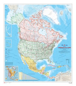
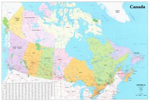
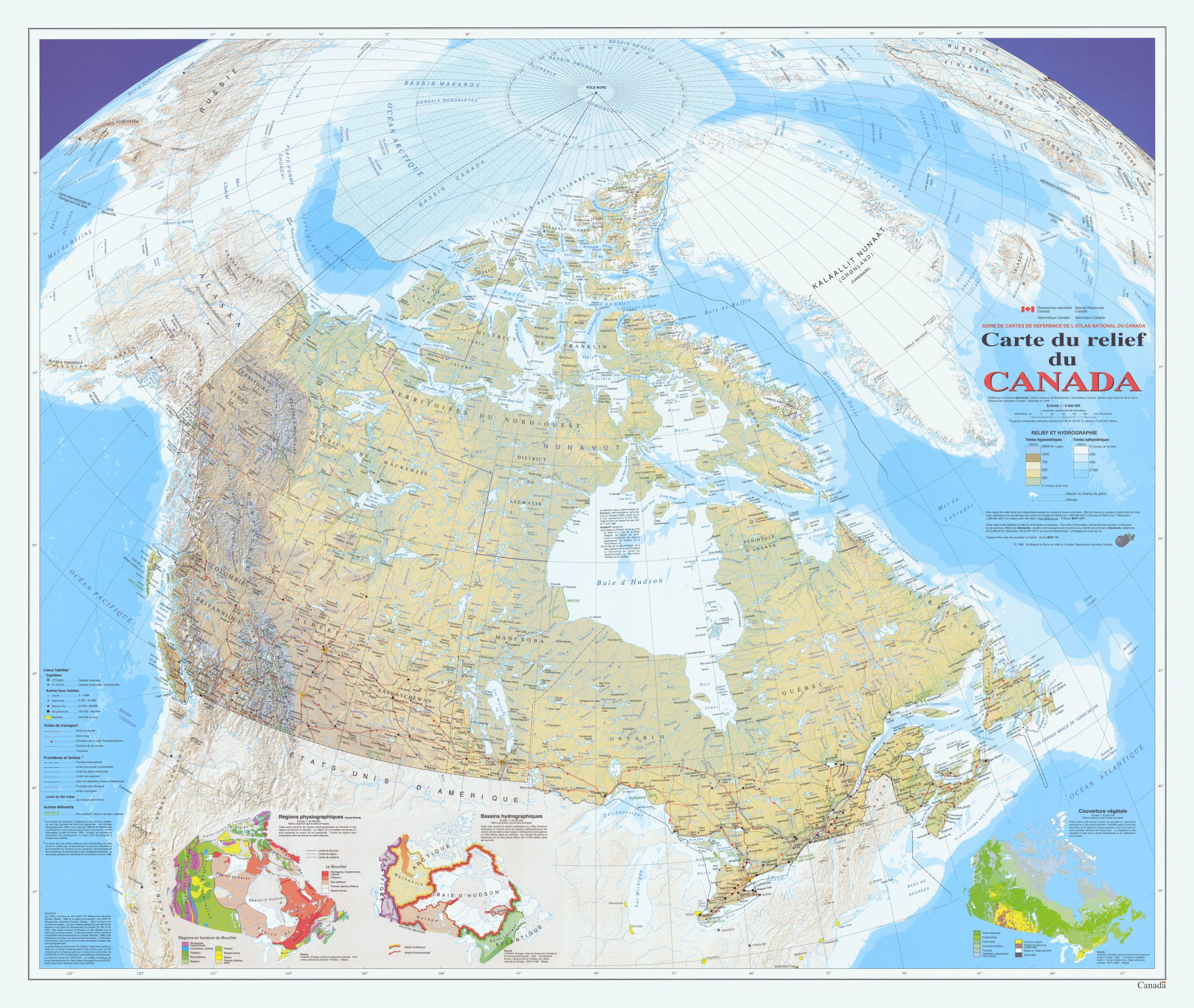
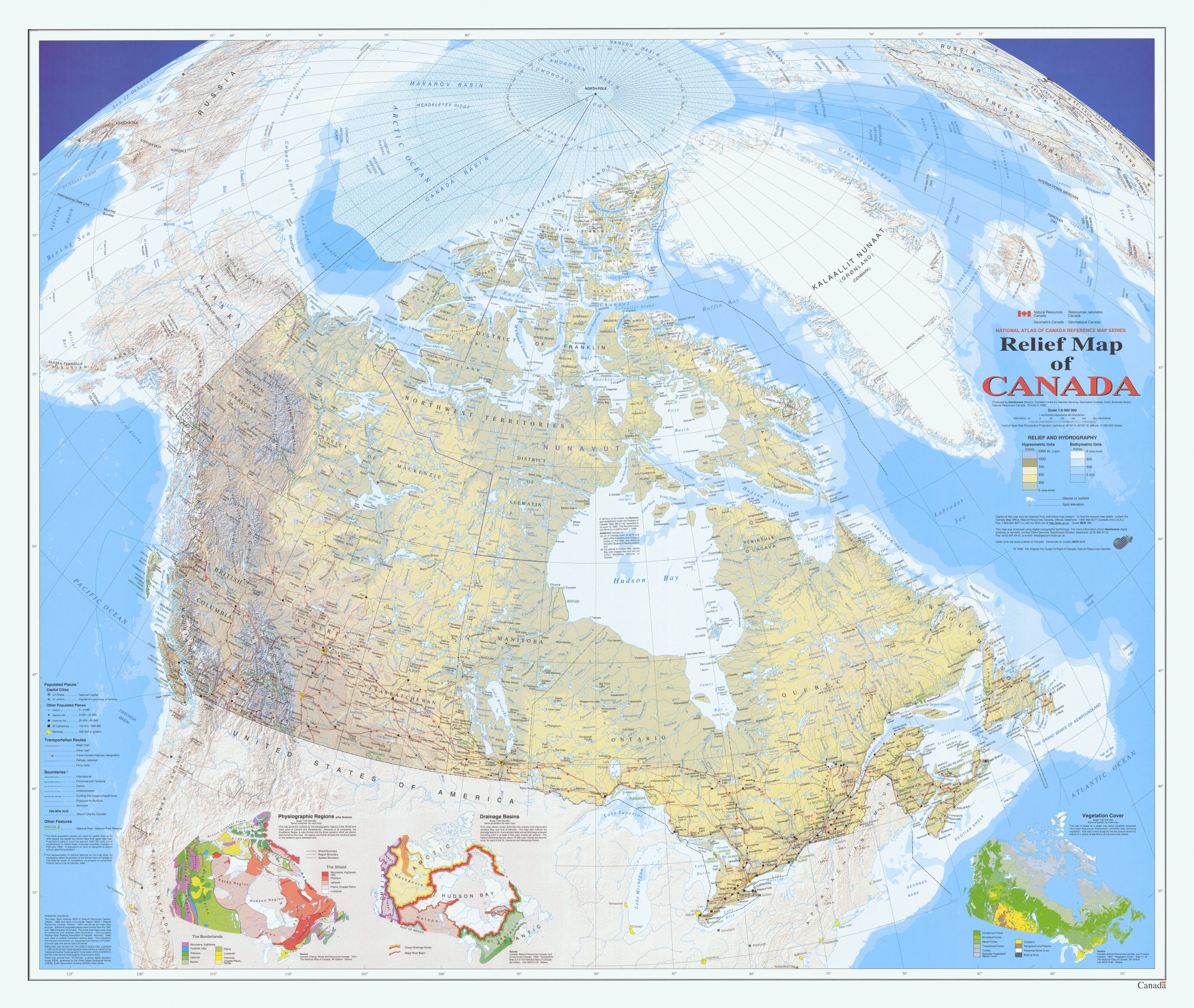
Relief Map of Canada (MCR0101), is a map showing Canada with a very-detailed digital shaded relief.
Ocean contours are shown using bathymetric tints. Major physical features including mountain ranges, peaks, and spot elevations are identified. The map also shows the extent and name for all of Canada’s national parks. An extensive set of populated places is shown, using six population size classes. Transportation data is extensive, but relatively muted: for example, roads are only in two classes. All official Canadian, provincial, and surrounding international boundaries are shown, including the proposed boundary for the new territory of Nunavut (which came into existence in 1999), The offshore boundary delineating Canada’s exclusive 200-mile fishing and economic zone is also shown. There are three small maps of Canada shown on this map sheet, all at scale 1: 35 000 000. One shows the major physiographic regions; the second shows major drainage basins, and the third map shows classes of vegetation cover. There is very limited data shown for foreign areas, but shaded relief is shown for all of these areas. All data on the map is current to the mid to late 1990’s.
Description:
Dimensions :
Format:
Visit our Map Accessories page to maximize your experience with your new Relief Map of Canada (MCR0101).
| Brand | |
|---|---|
| Country | |
| Plastification | Paper, Plastic |
| Language | English, French |