Additional information
| Region | |
|---|---|
| Map Type | Paper, Road |
| Brand |
6.95$
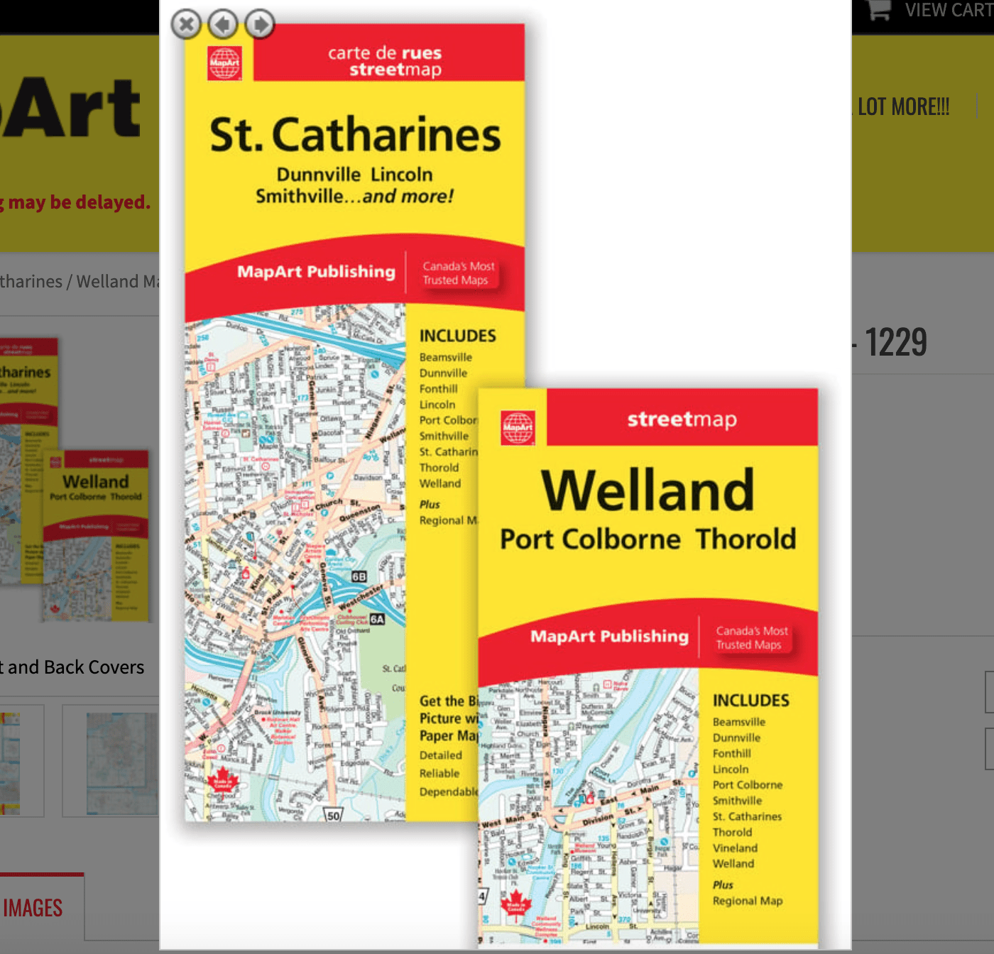
St. Catharines / Welland Folded Map
061158012291
Folded maps have been the trusted standard for years, offering unbeatable accuracy and reliability at a great price. Detailed indices make for quick and easy location of destinations.
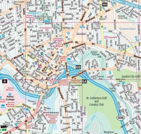
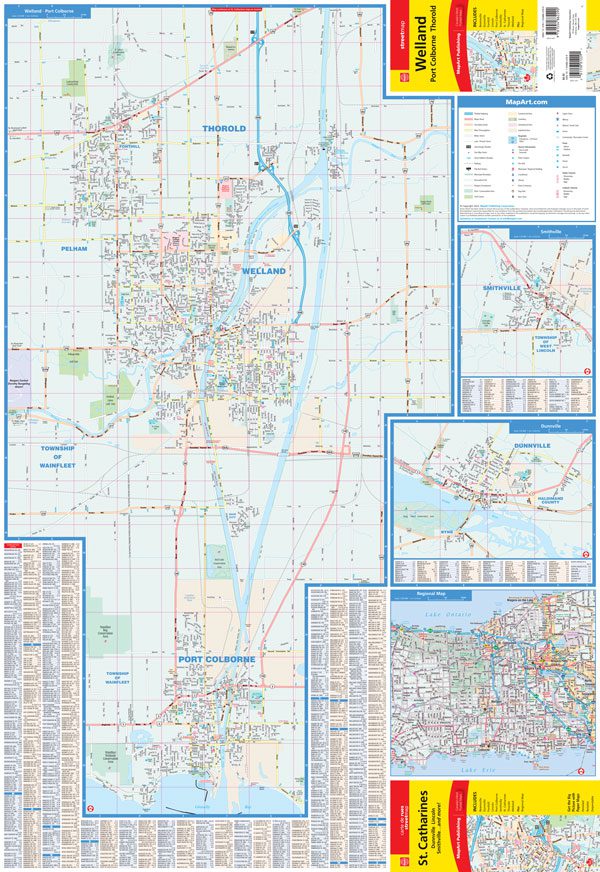
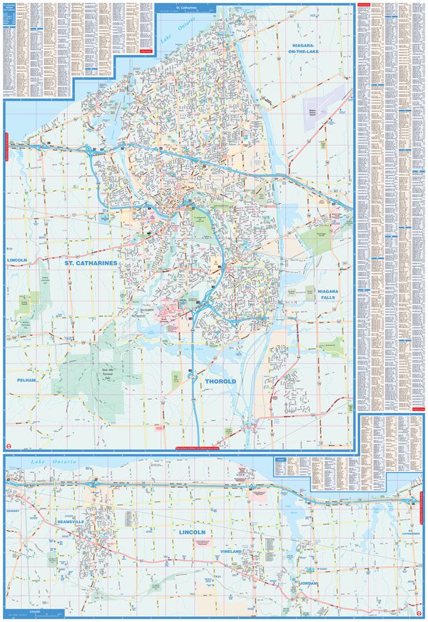
The folded map of St. Catharines includes detailed city mapping at 1:25,000/1:27,000 of Dunnville, Lincoln, Pelham, Port Colborne, Smithville, St. Catharines, Thorold and Welland. A city map legend, city indexes and a regional map at 1:250,000 is also included.
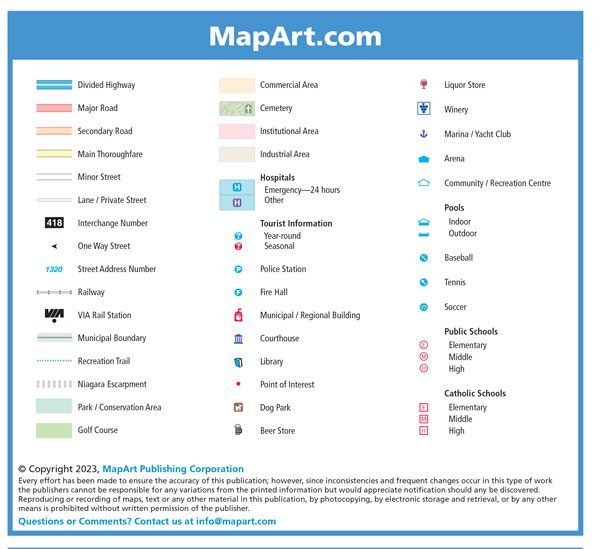
City map features include divided highways, major roads, secondary roads, main thoroughfares, minor streets, lanes / private streets, interchange numbers, one way streets, street address numbers, railways, VIA Rail stations, bus stations, municipal boundaries, recreation trails, niagara escarpments, parks / conservation areas, golf courses, commercial areas, cemeteries, institutional areas, industrial areas, hospitals, tourist information centres, police stations, fire halls, libraries, points of interest, beer stores, liquor stores, wineries, arenas, community / recreation centres, pools, baseball, tennis, soccer, public and catholic schools.
Dimensions:
Folded: 10.2 x 23.5 cm (4 x 9.25 inches)
Unfolded: 68.6 x 99.7 cm (27 x 39.25 inches)
Edition: 2023
Proudly made in Canada!