Additional information
| Region | |
|---|---|
| Map Type | Paper, Road |
| Brand |
5.95$
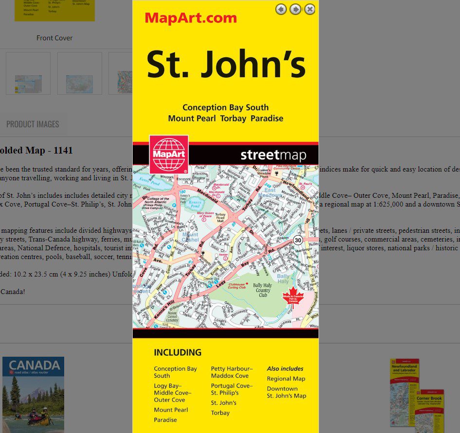
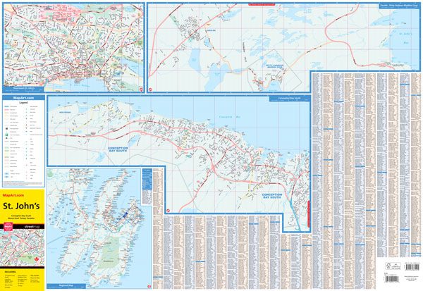
St. John’s Folded Map
061158011416
Folded maps have been the trusted standard for years, offering unbeatable accuracy and reliability at a great price. Detailed indices make for quick and easy location of destinations. It’s a must-have for anyone travelling, working and living in St. John’s, Newfoundland.
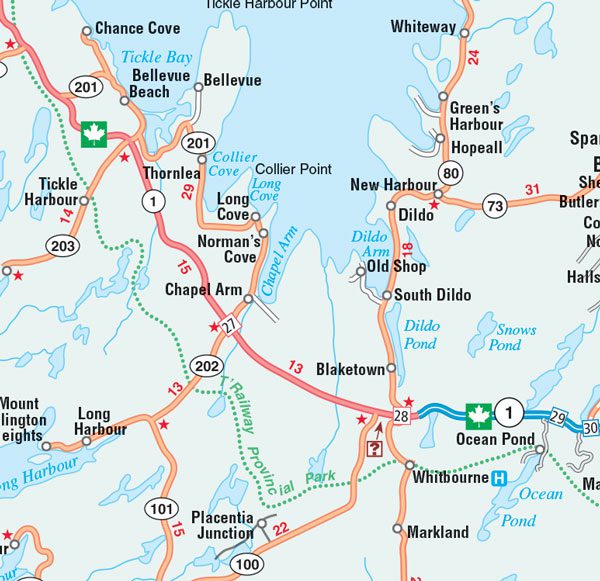
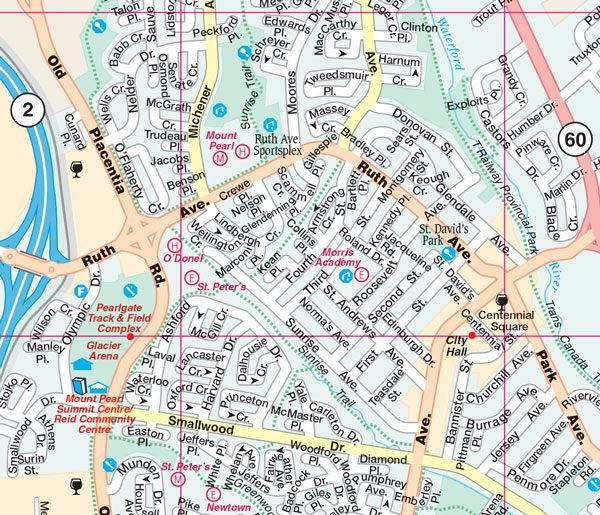
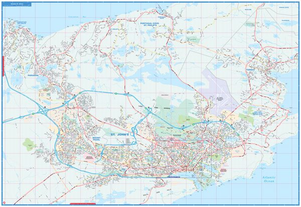
The folded map of St. John’s includes includes detailed city mapping at 1:25,000 of Conception Bay South, Logy Bay– Middle Cove– Outer Cove, Mount Pearl, Paradise, Petty Harbour–Maddox Cove, Portugal Cove–St. Philip’s, St. John’s, Torbay. Includes street indexes of each community, legend, a regional map at 1:625,000 and a downtown St. John’s map at 1:15,000.
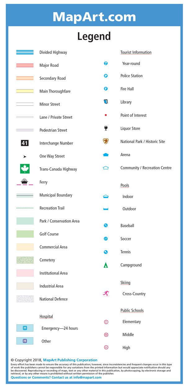
The detailed city mapping features include divided highways, major roads, secondary roads, main thoroughfares, minor streets, lanes / private streets, pedestrian streets, interchange numbers, one way streets, Trans-Canada highway, ferries, municipal boundaries, recreation trails, parks / conservation areas, golf courses, commercial areas, cemeteries, institutional areas, industrial areas, National Defence, hospitals, tourist information centres, police stations, fire halls, libraries, points of interest, liquor stores, national parks / historic sites, arenas, community / recreation centres, pools, baseball, soccer, tennis, campgrounds, skiing and public schools.
Dimensions:
Folded: 10.2 x 23.5 cm (4 x 9.25 inches)
Unfolded: 68.6 x 99.7 cm (27 x 39.25 inches)
Edition: 2018
Proudly made in Canada!
| Region | |
|---|---|
| Map Type | Paper, Road |
| Brand |