Additional information
| Plastification | Paper, Plastic |
|---|---|
| Brand | |
| Region | |
| Language | English, French |

Price range: 29.95$ through 44.99$
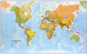
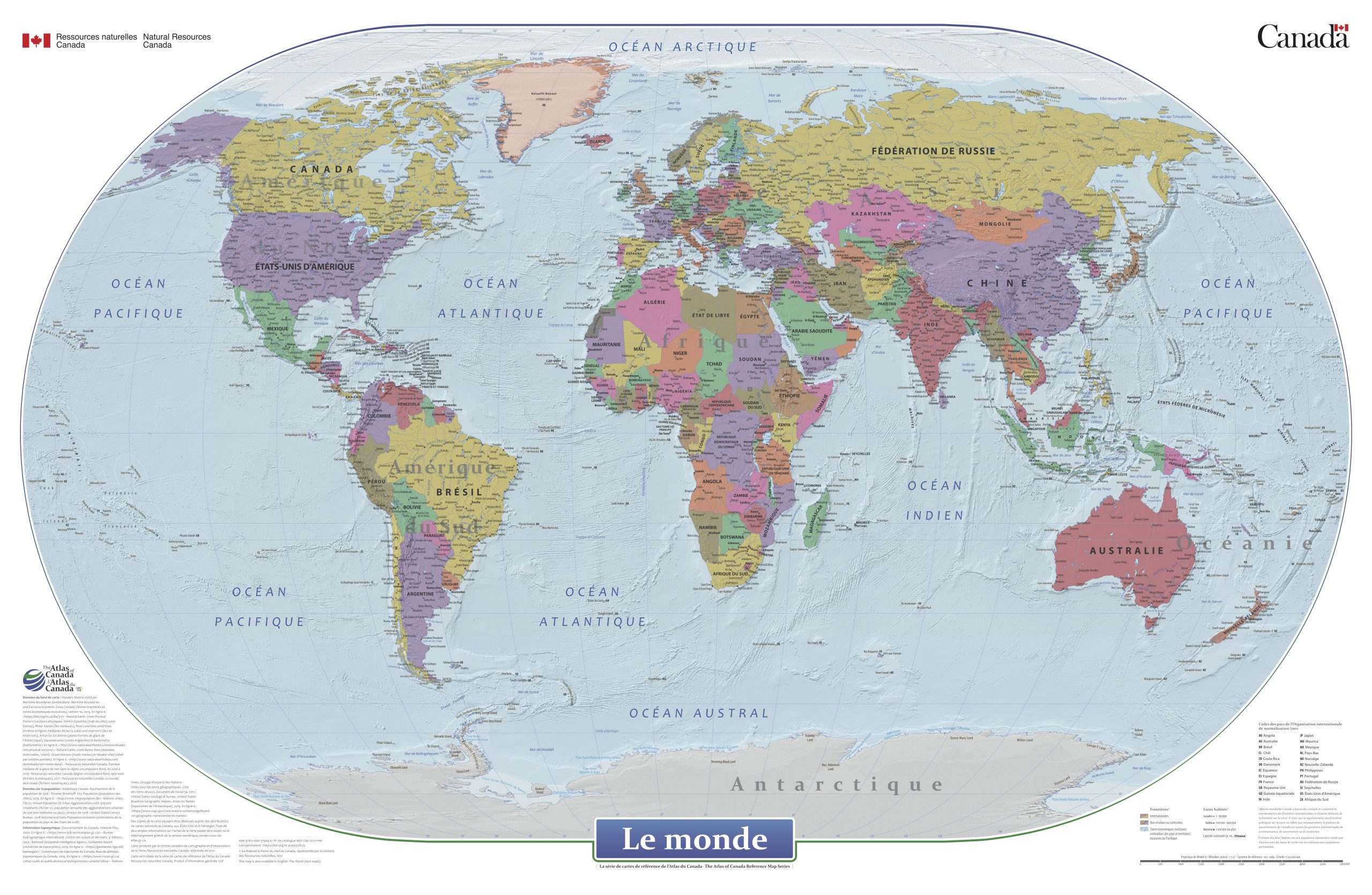
The World (MCR0046) – Wall Map from the Atlas of Canada’s.
The World is a general reference political map focused on the names and international boundaries of sovereign and non-sovereign countries. The information is portrayed using the Winkel II projection at a scale of 1:29 000 000. The dataset includes international boundaries, populated places, and labelled major hydrographic and physical features.
In the geodatabase the representation of political boundaries do not necessarily reflect the position of the Government of Canada on all international issues of recognition, sovereignty or jurisdiction; some of the populated places have seasonal populations, while others are research or military bases with no permanent populations; and, there are no attribute information in the geodatabase for the labelled hydrographic and physical features.
Description:
Dimensions :
Format:
Visit our Map Accessories page to maximize your experience with your new The World (MCR0046) – Wall Map.
| Plastification | Paper, Plastic |
|---|---|
| Brand | |
| Region | |
| Language | English, French |