USA Wall Map – Political

59.95$

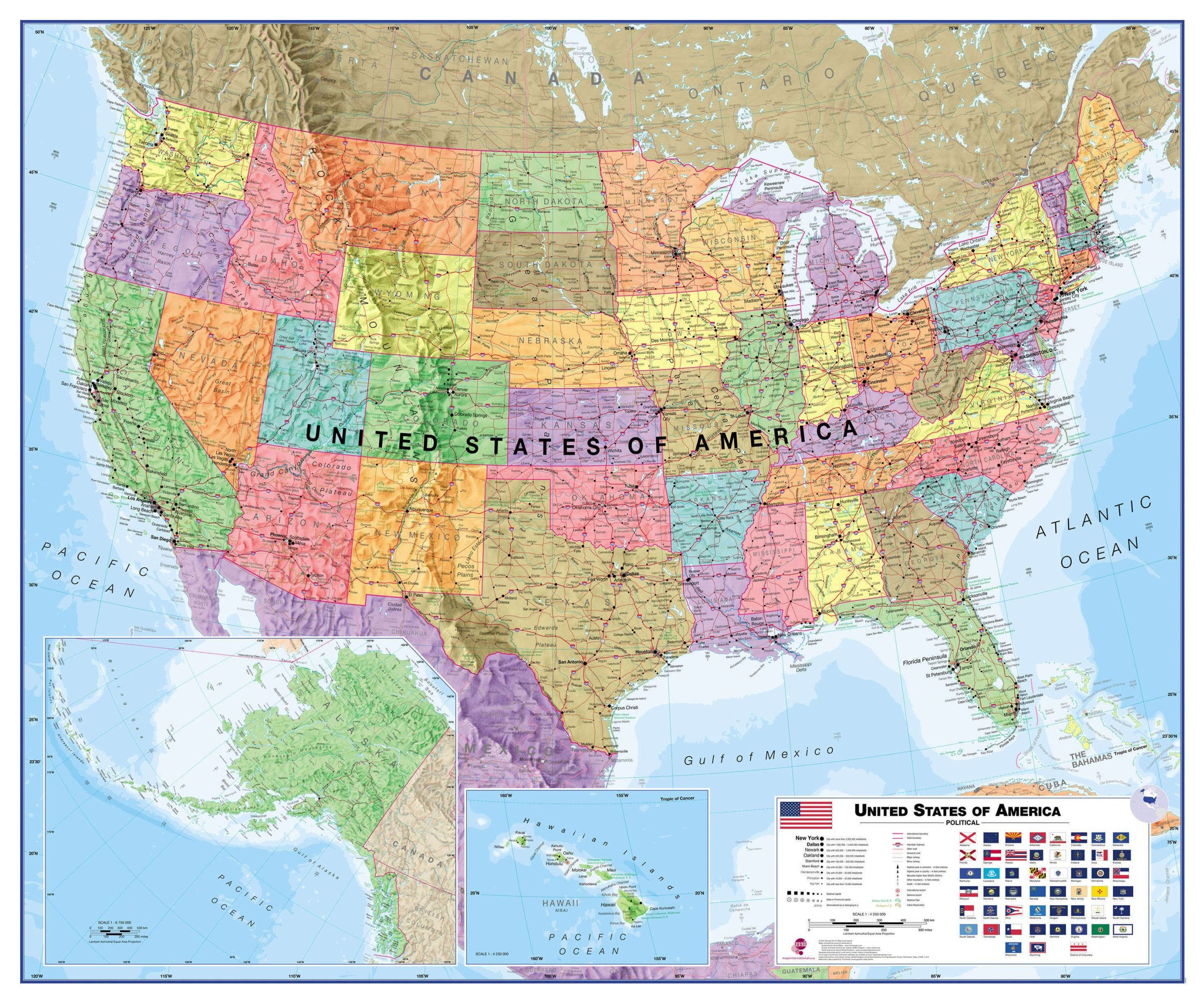
USA Wall Map – Political. Including Hawaii and Alaska. Laminated.

  • This USA map clearly shows all cities and major roads, as well as the states and their boundaries.
  • It also features the state flags.
  • The map is politically up-to-date with cartographic changes.
  • The map’s shaded relief for land and sea makes it easier to see the mountain ranges. The shaded relief gives it life
Dimensions:
  • 47 1/4 x 39 1/2 po
  • 120 cm X 99 cm
Format:
  • Laminated: tear-resistant and waterproof. Possibility of writing and erasing on the card using permanent marker or not. The best choice for schools and children.
    Mounting on rigid panel (lamination on wood or foamcore panel): please contact us to obtain an estimate.

Visit our Map Accessories page to maximize your experience with your new map.

Additional information

Brand

Language

English

Country