Additional information
| Region | |
|---|---|
| Map Type | Paper, Road |
| Brand |
5.95$
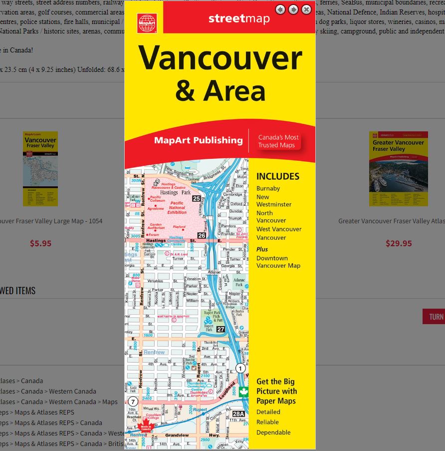
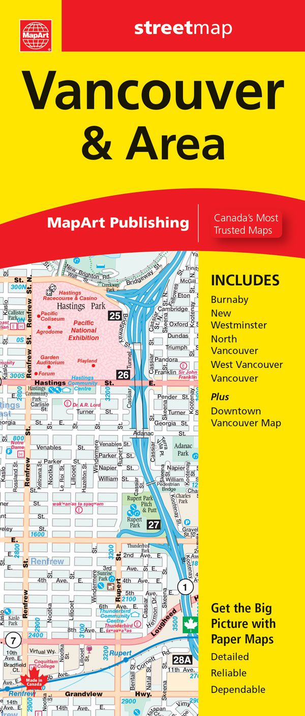
Vancouver and Area Folded Map
061158011843
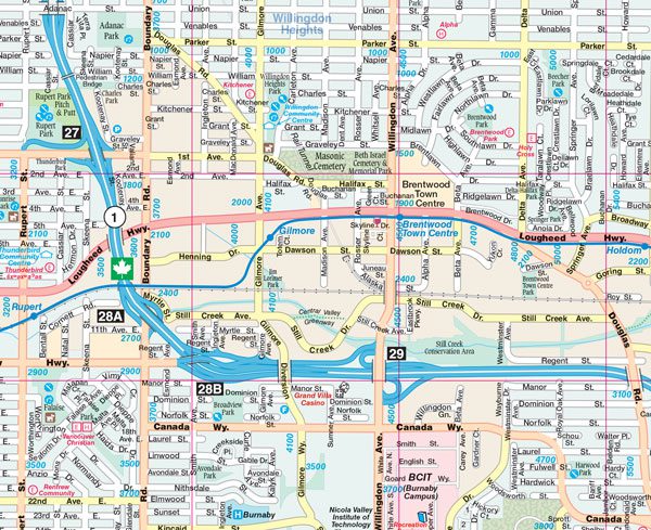
Folded maps have been the trusted standard for years, offering unbeatable accuracy and reliability at a great price. Detailed indices make for quick and easy location of destinations. It’s a must-have for anyone travelling in Vancouver and surrounding area.
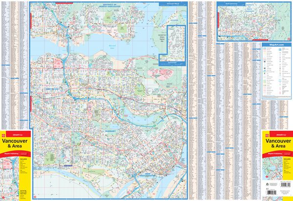
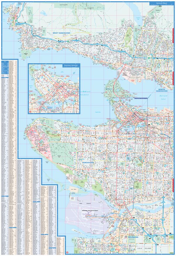
The Vancouver and Area folded map includes detailed city mapping at 1:25,000 of Vancouver, North Vancouver, Burnaby, New Westminster, West Vancouver, a portion of Richmond and a downtown Vancouver inset at 1:19,000.
City map features include divided highways, major roads, secondary roads, main thoroughfares, minor streets, lanes / private streets, pedestrian streets, bus only streets, interchange numbers, one way streets, street address numbers, railways, VIA Rail Stations, SkyTrain Stations, West Coast Express Stations, ferries, SeaBus, municipal boundaries, recreation trails, parks / conservation areas, golf courses, commercial areas, cemeteries, institutional areas, industrial areas, special attraction areas, National Defence, Indian Reserves, hospitals, tourist information centres, police stations, fire halls, municipal / regional buildings, courthouses, libraries, points of interest, off leash dog parks, liquor stores, wineries, casinos, marinas / yacht clubs, National Parks / historic sites, arenas, community / recreation centres, pools, baseball, soccer, tennis, cross-country skiing, campground, public and independent schools.
Dimensions:
Folded: 10.2 x 23.5 cm (4 x 9.25 inches)
Unfolded: 68.6 x 99.7 cm (27 x 39.25 inches)
Proudly made in Canada!
| Region | |
|---|---|
| Map Type | Paper, Road |
| Brand |