Additional information
| Region | |
|---|---|
| Map Type | Paper, Road |
| Brand |
5.95$
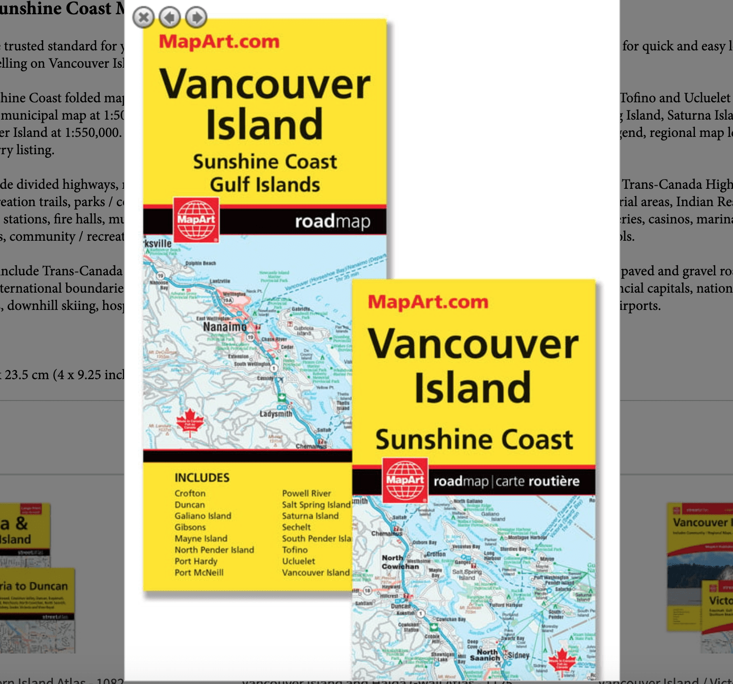
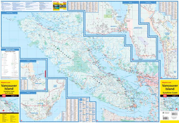
Vancouver Island Sunshine Coast Map
061158011768
Folded maps have been the trusted standard for years, offering unbeatable accuracy and reliability at a great price. Detailed indices make for quick and easy location of destinations. It’s a must-have for anyone travelling on Vancouver Island.
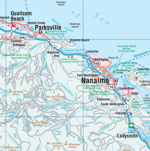
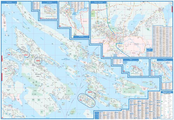
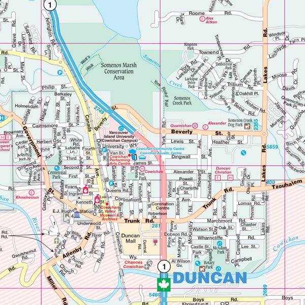
The Vancouver Island Sunshine Coast folded map includes detailed city mapping of Crofton, Duncan, Port Hardy, Powell River, Sechelt, Tofino and Ucluelet at 1:25,000, Gibsons and Port McNeill at 1:30,000, a municipal map at 1:50,000 of the Gulf Islands (Galiano Island, Mayne Island, North Pender Island, Salt Spring Island, Saturna Island, South Pender Island)and a regional map of Vancouver Island at 1:550,000. Also included on this folded map is detailed city indexing of each city map, city map legend, regional map legend, regional map community index and a ferry listing.
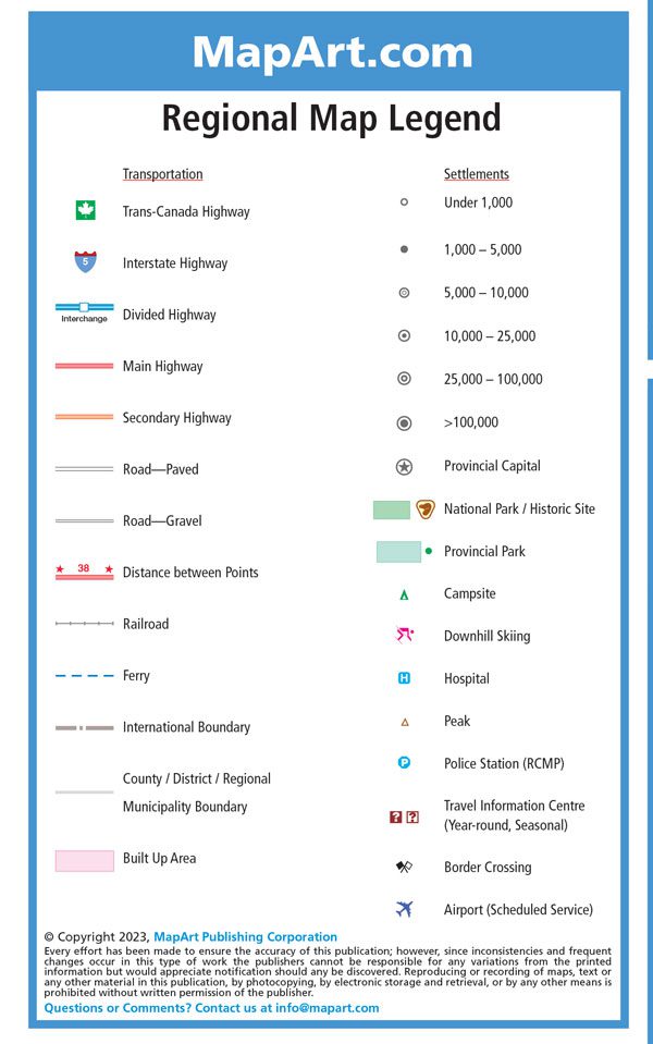
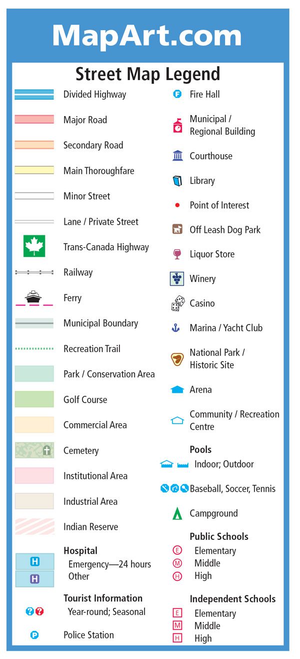
The city map features include divided highways, major roads, secondary roads, main thoroughfares, minor streets, lanes / private streets, Trans-Canada Highway, railways, ferries, municipal boundaries, recreation trails, parks / conservation areas, golf courses, commercial areas, cemeteries, institutional areas, industrial areas, Indian Reserves, hospitals, tourist information centres, police stations, fire halls, municipal / regional buildings, courthouses, libraries, points of interest, liquor stores, wineries, casinos, marinas / yacht clubs, national parks / historic sites, arenas, community / recreation centres, pools, baseball, soccer, tennis, campgrounds, public and independent schools.
The regional map features include Trans-Canada Highway , Interstate highways, divided highways, main highways, secondary highways, paved and gravel roads, distances between points, railroads, ferries, international boundaries, county / district / regional municipality boundaries, built up areas, settlements, provincial capitals, national parks / historic sites, provincial parks, campsites, downhill skiing, hospitals, peaks, police stations (RCMP), travel information centres, border crossings and airports.
Proudly made in Canada!
Edition: 2023
Dimensions:
Folded: 10.2 x 23.5 cm (4 x 9.25 inches)
Unfolded: 68.6 x 99.7 cm (27 x 39.25 inches)
| Region | |
|---|---|
| Map Type | Paper, Road |
| Brand |