Additional information
| Region | |
|---|---|
| Map Type | Road atlas |
| Brand |
19.95$
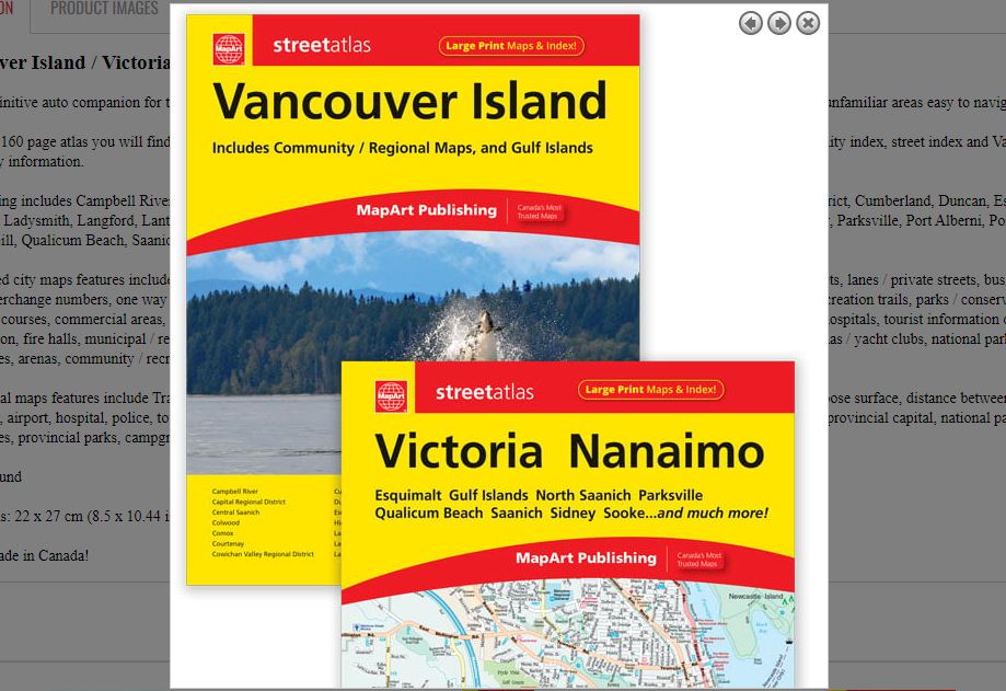
Vancouver Island / Victoria, Nanaimo Atlas
061158012116
It’s the definitive auto companion for travel in this area, whether you are a resident or short-term visitor. It’s got all the features to make even the unfamiliar areas easy to navigate.
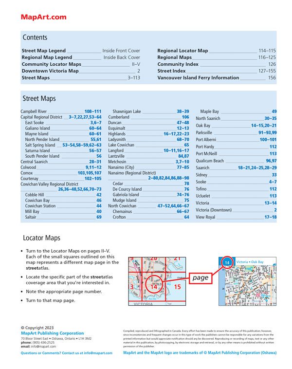
Inside this 160 page atlas you will find city maps (1:23,000), regional maps (1:475,000), locator maps, legends, downtown Victoria map, community index, street index and Vancouver Island ferry information.
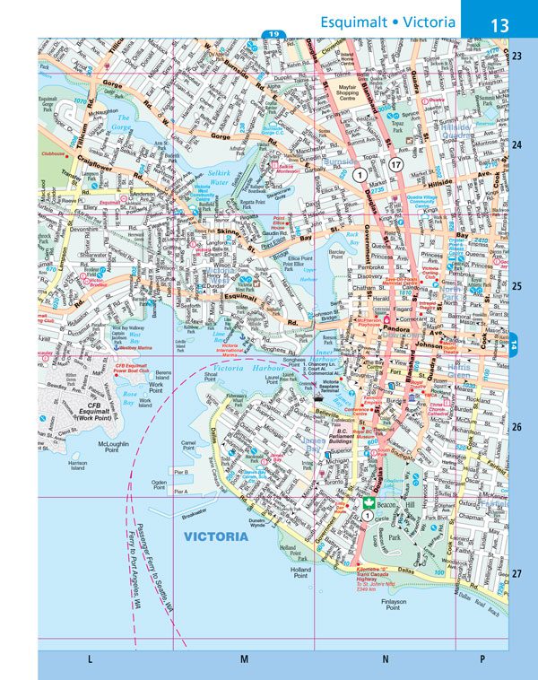
City mapping includes Campbell River, Capital Regional District, Central Saanich, Colwood, Comox, Courtenay, Cowichan Valley Regional District, Cumberland, Duncan, Esquimalt, Highlands, Ladysmith, Langford, Lantzville, Metchosin, Nanaimo (City), Nanaimo (Regional District), North Cowichan, North Saanich, Oak Bay, Parksville, Port Alberni, Port Hardy, Port McNeill, Qualicum Beach, Saanich, Sidney, Sooke, Tofino, Ucluelet, Victoria and View Royal.
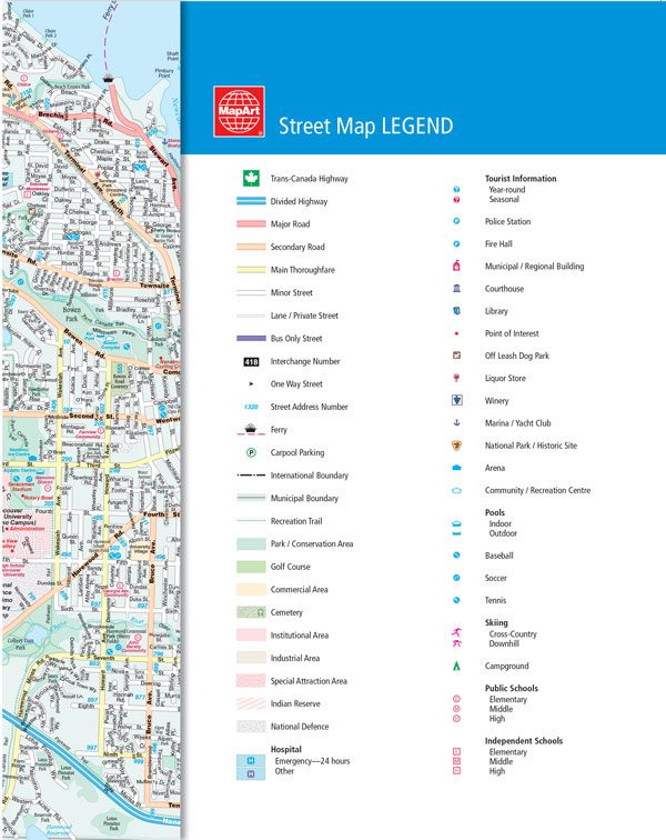
The detailed city maps features include Trans-Canada Highway, divided highways, major roads, secondary roads, main thoroughfares, minor streets, lanes / private streets, bus only streets, interchange numbers, one way streets, street address numbers, ferries, carpool parking, international boundaries, municipal boundaries, recreation trails, parks / conservation areas, golf courses, commercial areas, cemeteries, institutional areas, industrial areas, special attraction areas, Indian Reserves, national defence, hospitals, tourist information centres, police station, fire halls, municipal / regional buildings, courthouses, libraries, points of interest, off leash dog parks, liquor stores, wineries, marinas / yacht clubs, national parks / historic sites, arenas, community / recreation centres, pools, baseball, soccer, tennis, skiing, campgrounds, and public and independent schools.
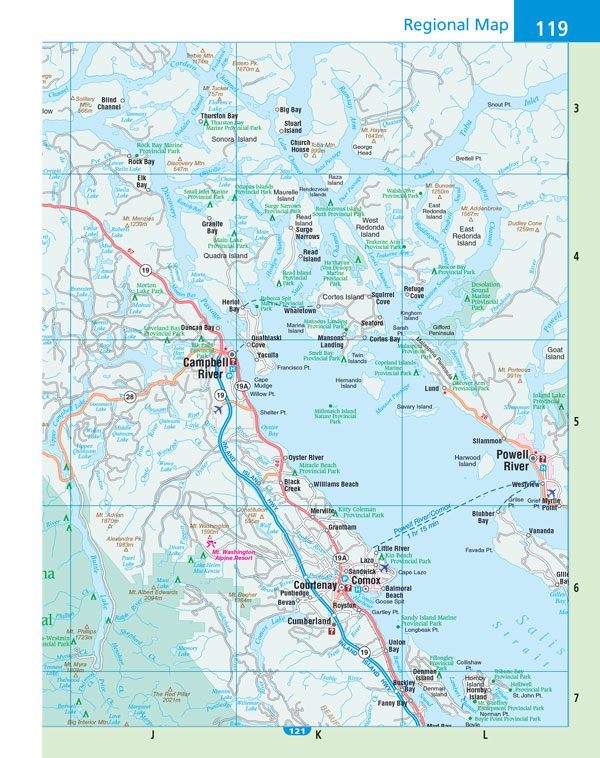
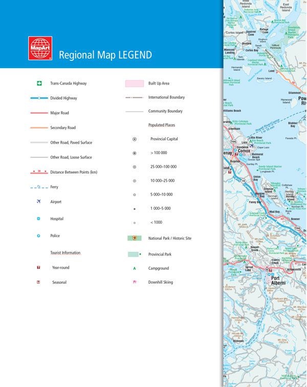
The regional maps features include Trans-Canada highway, divided highway, major road, secondary road, other road, paved surface, other road, loose surface, distance between points (km), ferry, airport, hospital, police, tourist information centres, built up area, international boundaries, community boundaries, populated places, provincial capital, national parks / historic sites, provincial parks, campgrounds and downhill skiing and more.
Wire-O bound
Dimensions: 22 x 27 cm (8.5 x 10.44 inches)
Edition: 2023
Proudly made in Canada!
2 weekds delay when ordered
Out of stock
| Region | |
|---|---|
| Map Type | Road atlas |
| Brand |