Additional information
| Region | |
|---|---|
| Map Type | Road atlas |
| Brand |

9.95$
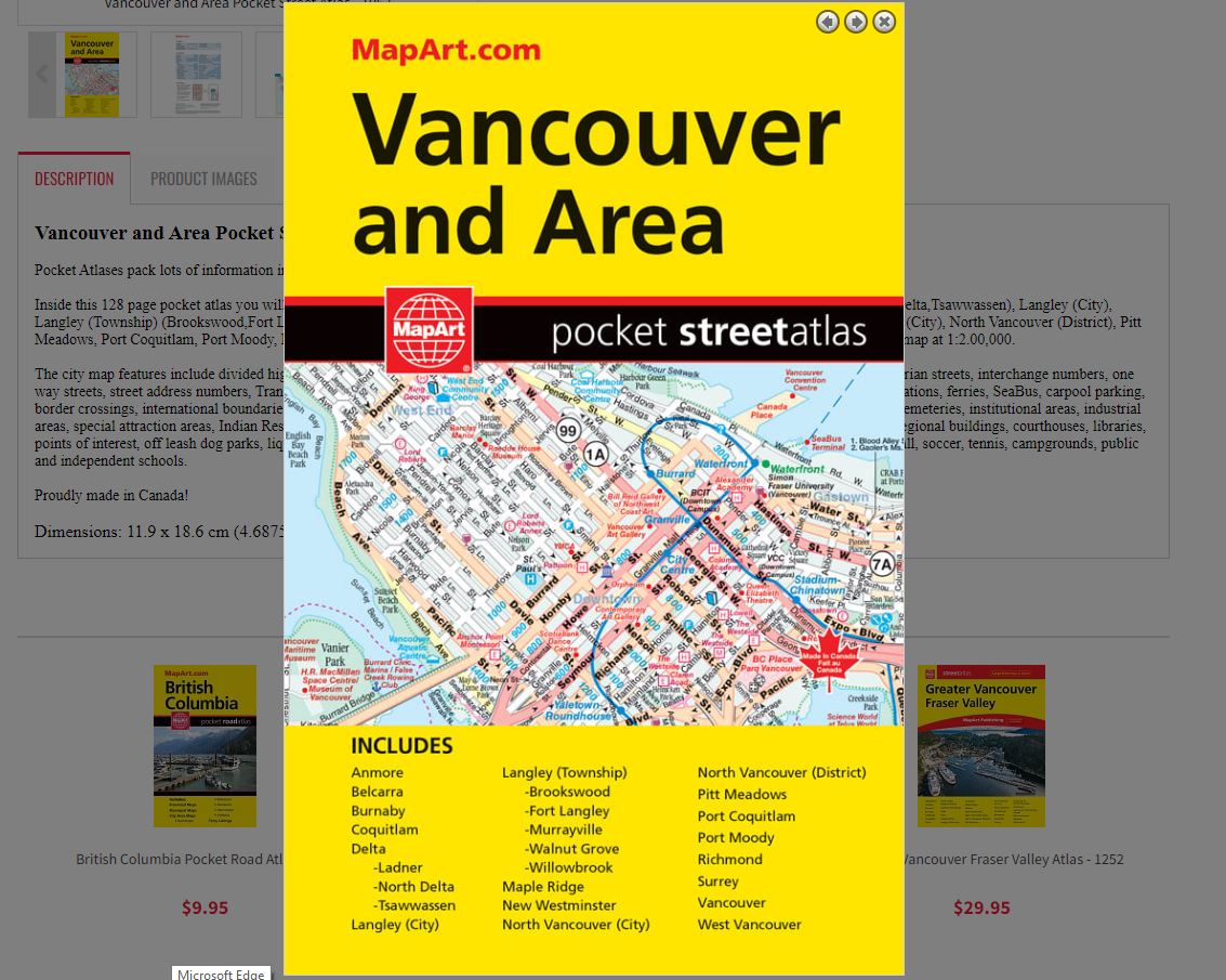
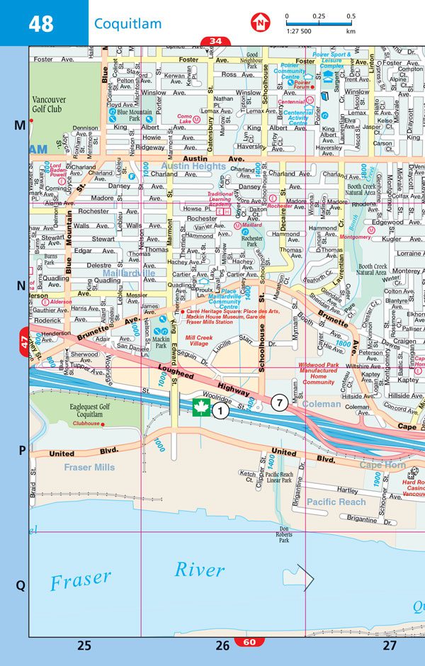
Vancouver and Area Pocket Street Atlas
Pocket Atlases pack lots of information in a handy size that easily fits into a purse or pocket.
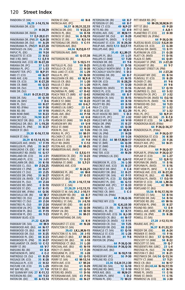
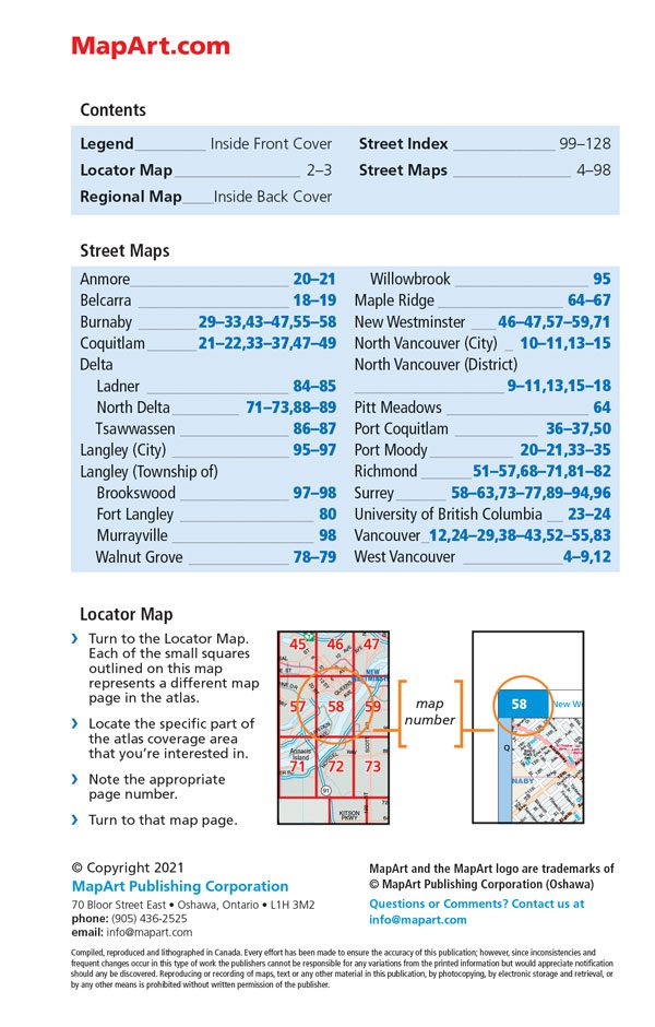
Inside this 128 page pocket atlas you will find detailed street maps at 1:27,500: Anmore, Belcarra, Burnaby, Coquitlam, Delta (Ladner, North Delta,Tsawwassen), Langley (City), Langley (Township) (Brookswood,Fort Langley, Murrayville, Walnut Grove, Willowbrook), Maple Ridge, New Westminster, North Vancouver (City), North Vancouver (District), Pitt Meadows, Port Coquitlam, Port Moody, Richmond, Surrey, Vancouver, West Vancouver. Also includes a street index, map legend and regional map at 1:2.00,000.
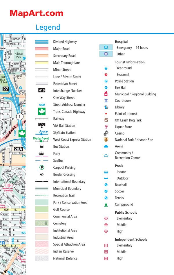
The city map features include divided highways, major roads, secondary roads, main thoroughfares, minor streets, lanes / private streets, pedestrian streets, interchange numbers, one way streets, street address numbers, Trans-Canada Highway, railways, VIA Rail stations, SkyTrain stations, West Coast Express stations, bus stations, ferries, SeaBus, carpool parking, border crossings, international boundaries, municipal boundaries, recreation trails, parks / conservation areas, golf courses, commercial areas, cemeteries, institutional areas, industrial areas, special attraction areas, Indian Reserves, National Defence, hospitals, tourist information centres, police stations, fire halls, municipal / regional buildings, courthouses, libraries, points of interest, off leash dog parks, liquor stores, casinos, national parks / historic sites, arenas, community / recreation centres, pools, baseball, soccer, tennis, campgrounds, public and independent schools.
Proudly made in Canada!
In english only.
Dimensions: 11.9 x 18.6 cm (4.6875 x 7.3125 inches)
| Region | |
|---|---|
| Map Type | Road atlas |
| Brand |