Additional information
| Region | |
|---|---|
| Map Type | Road atlas |
| Brand |
8.95$
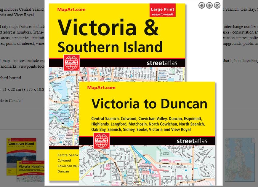
Victoria & Southern Island Atlas
061158010822
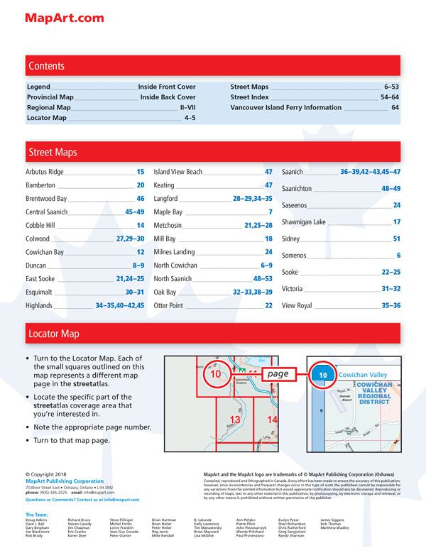
It’s the definitive auto companion for travel in this area, whether you are a resident or short-term visitor. It’s got all the features to make even the unfamiliar areas easy to navigate.
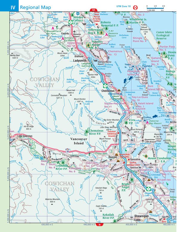
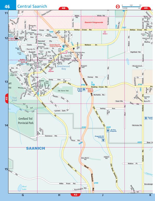
Inside this 72 page atlas you will find city maps (1:20,000), regional maps (1:200,000), British Columbia provincial map, locator map, legend, street index and Vancouver Island ferry information.
City mapping includes Central Saanich, Colwood, Cowichan Valley, Duncan, Esquimalt, Highlands, Langford, Metchosin, North Cowichan, North Saanich, Oak Bay, Saanich, Sidney, Sooke, Victoria and View Royal.
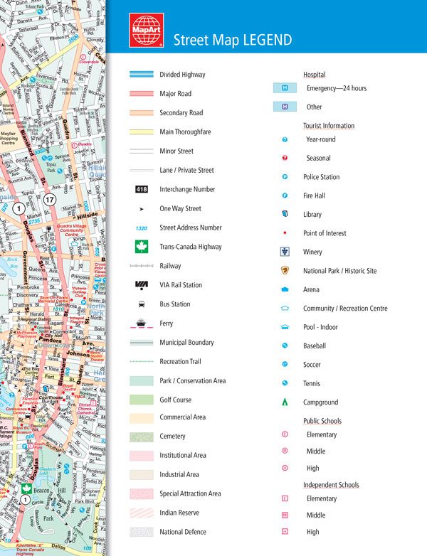
The detailed city maps features include divided highways, major roads, secondary roads, main thoroughfares, minor streets, lanes / private streets, interchange numbers, one way streets, street address numbers, Trans-Canada highway, railways, VIA Rail stations, bus stations, ferries, municipal boundaries, recreation trails, parks / conservation areas, golf courses, commercial areas, cemeteries, institutional areas, industrial areas, special attraction areas, Indian reserves, national defence, hospitals, tourist information centres, police stations, fire halls, libraries, points of interest, wineries, national parks / historic sites, arenas, community / recreation centres, pools, baseball, soccer, tennis, campgrounds, public and independent schools.
The regional maps features include expressways to seasonal roads, airports, ferries, hospitals, tourist information centres, rest areas, skiing, golf, wharfs, boat launches, marinas, points of interest, landmarks, viewpoints/lookouts and much more!
Saddlestitched bound
Dimensions: 21 x 28 cm (8.375 x 10.875 inches)
In english only.
Proudly made in Canada!
| Region | |
|---|---|
| Map Type | Road atlas |
| Brand |