Additional information
| Region | |
|---|---|
| Map Type | Marine, Waterproof |
| Brand |
15.95$
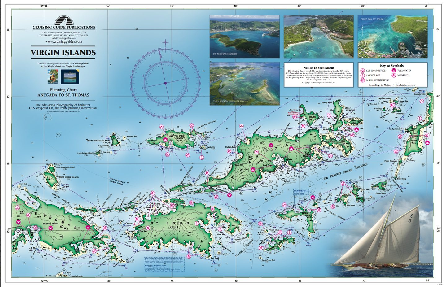
Virgin Islands – The Cruising Guide Nautical Chart
Printed on both sides, this new chart covers the United States and the British Virgin Islands, from St. Thomas to Anegada, with anchorage and mooring locations, as well as GPS coordinates, sailing routes, and distances between waypoints.
This waterproof chart is ideal for the cockpit and attractive enough to hang on the wall once it’s inside. Designed for use with The Cruising Guide, this planning chart is an exact copy of the one included with the guide, except for its waterproof design.
See other products from The Cruising Guide here.
23″ x 17″
Folded
| Region | |
|---|---|
| Map Type | Marine, Waterproof |
| Brand |