Additional information
| Region | |
|---|---|
| Map Type | Paper, Road |
| Brand |
5.95$
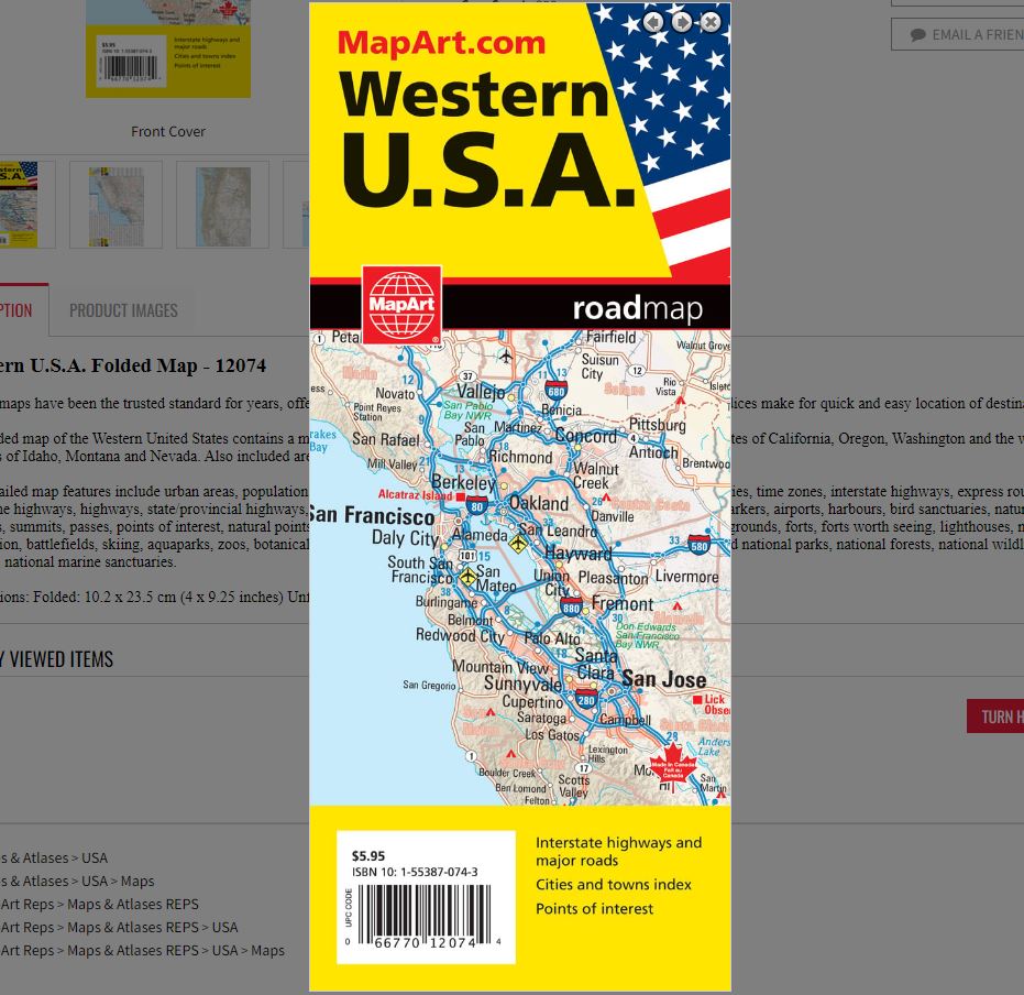
Western U.S.A. Folded Map
066770120744
Folded maps have been the trusted standard for years, offering unbeatable accuracy and reliability at a great price. Detailed indices make for quick and easy location of destinations.
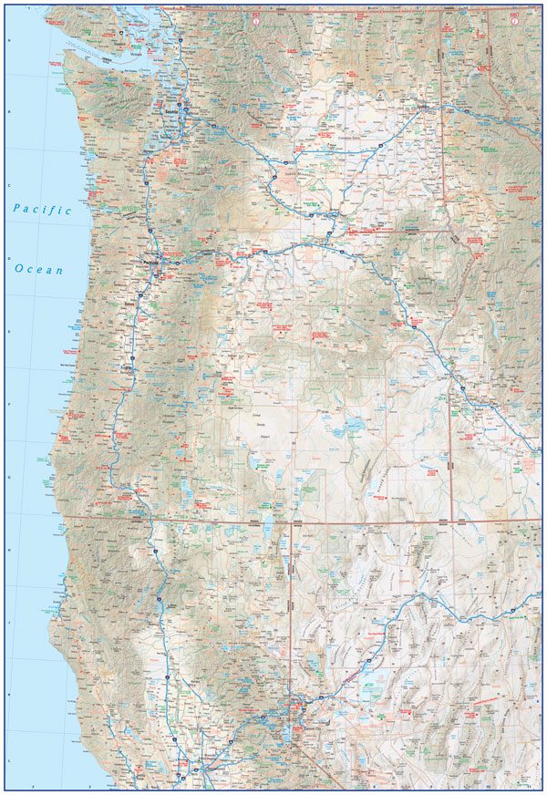
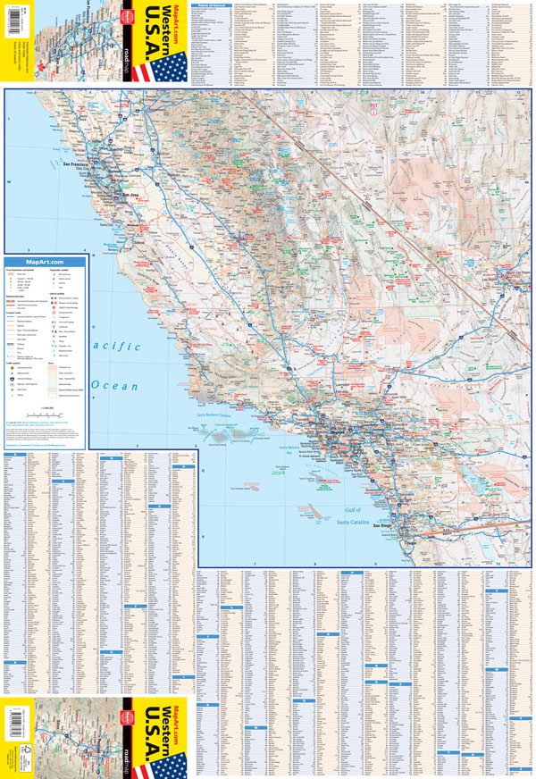
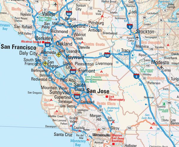
The folded map of the Western United States contains a map of the Western USA at a scale of 1:2,000,000 and includes the states of California, Oregon, Washington and the western portions of Idaho, Montana and Nevada. Also included are a map legend, points of interest listing and a place name index.
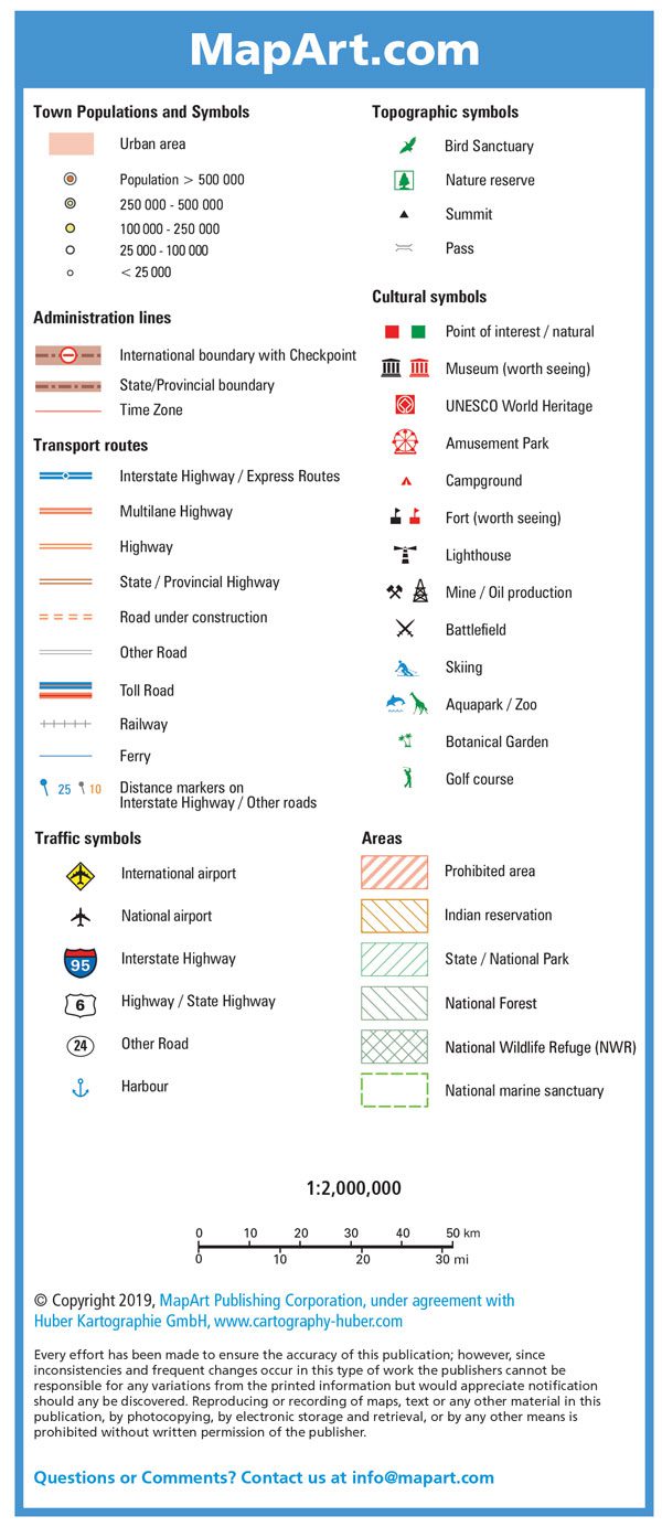
The detailed map features include urban areas, populations, international boundaries and checkpoints, state/provincial boundaries, time zones, interstate highways, express routes, multilane highways, highways, state/provincial highways, roads under construction, other roads, railways, ferries, distances markers, airports, harbours, bird sanctuaries, nature reserves, summits, passes, points of interest, natural points of interest, UNESCO world heritage sites, amusement parks, campgrounds, forts, forts worth seeing, lighthouses, mines/oil production, battlefields, skiing, aquaparks, zoos, botanical gardens, golf courses, prohibited areas, Indian reservations, state and national parks, national forests, national wildlife refuges, national marine sanctuaries.
Dimensions:
Folded: 10.2 x 23.5 cm (4 x 9.25 inches)
Unfolded: 68.6 x 99.7 cm (27 x 39.25 inches)