World wall map political – french

19.95$59.95$

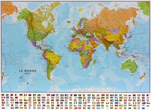
This World wall map political – french is our best seller. The #1 choice for schools and homes.

World wall map political – french comes in 3 different sizes, in French, paper or laminated, with flags. This map is an educational resource or a stylish item on your wall.

Map details:

  • The political world wall map features each country in a different color, with international borders clearly marked.
  • The world wall map highlights all major cities and the capitals are clearly marked.
  • The map’s shaded relief for land and sea makes it easier to see the mountain ranges. The shaded relief gives it life.
  • The strip of flags along the base of the map and the population facts and figures make this map very interactive.

Format:

  • Paper: cheaper but more fragile, Not recommended for schools and children. Best choice for framing or laminating.
  • Laminated: tear-resistant and waterproof. Possibility of writing and erasing on the card using permanent marker or not. The best choice for schools and children.
    Mounting on rigid panel (lamination on wood or foamcore panel): please contact us to obtain an estimate.

Dimensions:

  • Small: 24 x 18 in
  • Medium: 36 x 24 in
  • Large: 48 x 36 in

Additional information

Country

Dimension

1-Small, 2-Medium, 3-Large

Language

French

Plastification

Paper, Plastic

Brand