Additional information
| Map Type | Paper, Road |
|---|---|
| Region |
5.95$
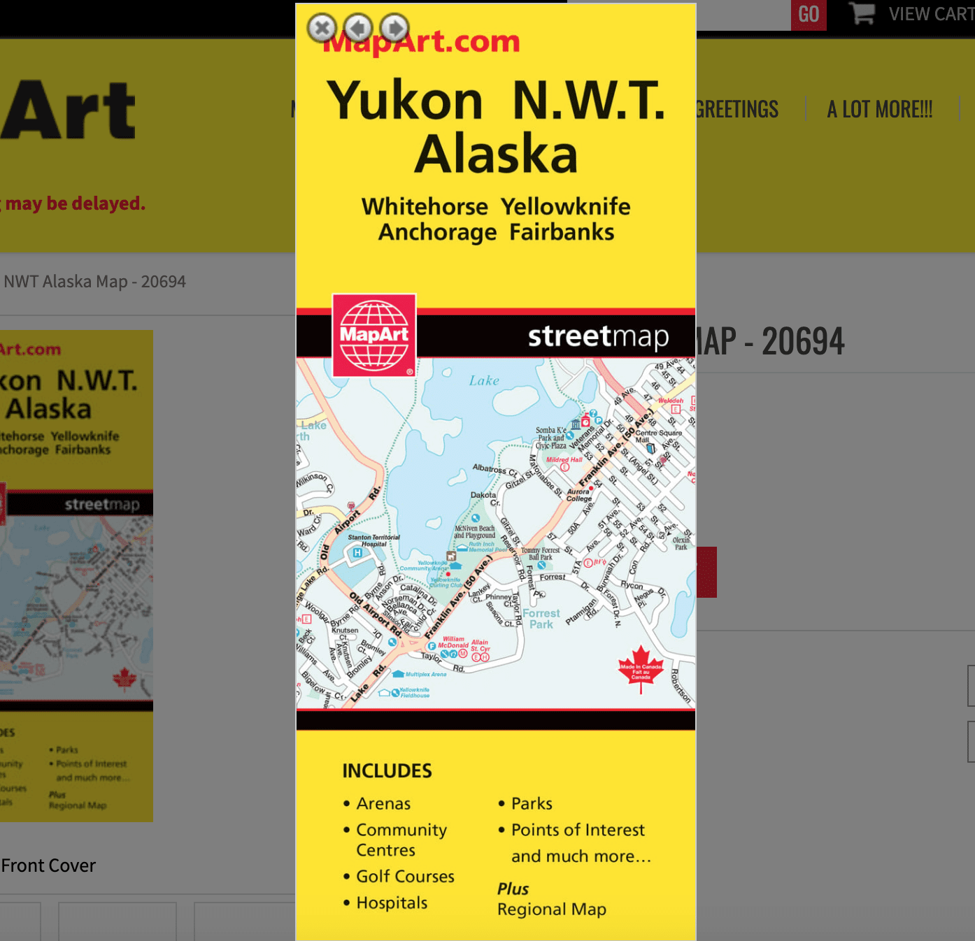
Yukon NWT Alaska Folded Map
Folded maps have been the trusted standard for years, offering unbeatable accuracy and reliability at a great price. Detailed indices make for quick and easy location of destinations. It’s a must-have for anyone travelling, working and living in this area of northern Canada.
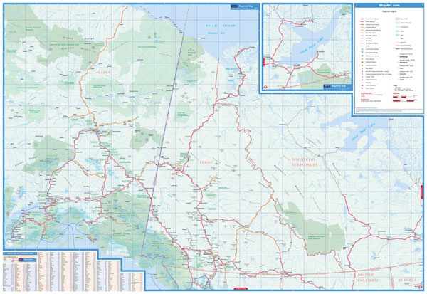
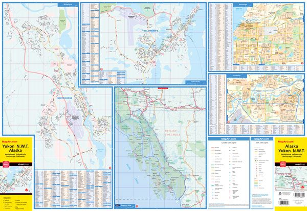
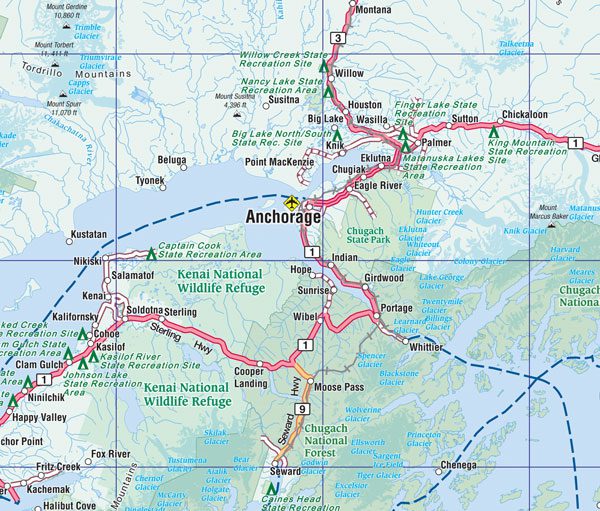
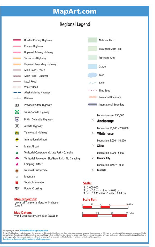
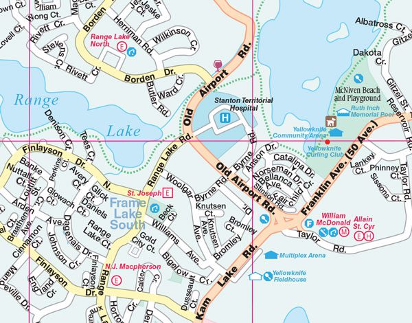
The folded map of Yukon NWT Alaska includes detailed city mapping, at 1:25,000 of Whitehorse and Yellowknife, detailed city mapping of Anchorage and Fairbanks, Alaska at 1:35,000, indexes of each city, map legend, a regional map at 1: 2,000,000 along with a community index and legend.
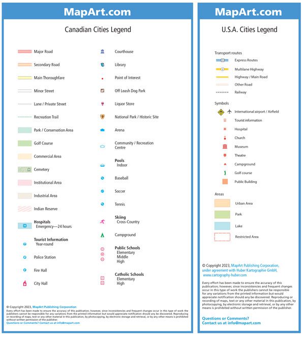
The detailed city map features include major roads, secondary roads, main thoroughfares, minor streets, lanes / private streets, recreation trails, parks / conservation areas, golf courses, commercial areas, cemeteries, institutional areas, industrial areas, Indian reserves, hospitals, tourist information centres, police stations, fire halls, city halls, courthouses, libraries, points of interest, off leash dog parks, national parks / historic sites, arenas, community / recreation centres, pools, baseball, soccer, tennis, skiing, campgrounds, public and catholic schools.
The regional map features include paved and unpaved primary highways, paved and unpaved secondary highways, paved and unpaved main roads, local roads, winter roads, Alaska Marine highway, railway, airports, camping, National Historic sites, mountains, tourist information centres, border crossings, national parks, provincial/state parks, protected areas, glaciers, time zones, boundaries, populations and more.
Edition: 2023
Proudly made in Canada!
| Map Type | Paper, Road |
|---|---|
| Region |