Additional information
| Brand |
|---|


35.95$
Miller Atlas – Reliefs
This splendidly illuminated “Northern Indian Ocean with Arabia and India” belongs to a “Nautical Atlas of the World,” a collection of maps produced in Lisbon before 1520 by the finest Portuguese cartographers. While incorporating the most recent “discoveries” of the time with somewhat limited accuracy, these maps were intended more to glorify the conquests and glory of the Portuguese empire than to be of practical use to navigators.
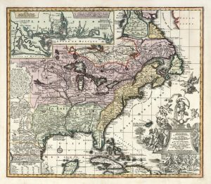
Each of Reliefs’ annual collections includes a series of antique geographical maps published in poster format. With a map on the front and its story on the back, the “Nostalgic Geography” collection corresponds to the section of the same name found in the magazine’s opening pages. These cartographic treasures, from all corners of the world, are printed on high-quality paper. The “Nostalgic Geography” maps are presented in an elegant slipcase.
Details:
Here for historical maps.
| Brand |
|---|